Reading Civil War Maps

In this lesson, students will explore the Battle of Secessionville through a documentary film and then analyze two historical maps to understand the battle's location, troop positions, and the strategic importance of Fort Lamar.  Following discussions and map analysis, students will create their own maps of their local area.

Duration
1-2 hours
Lesson Type
Traditional Lesson

Lesson Created By: MegGaillard

Lesson Partners: South Carolina Department of Natural Resources

Collections

Essential Question

How did the use of maps during the Civil War, like those depicting Fort Lamar and the Charleston Harbor, influence military strategies and tactics?

Grade(s):

  • 4
  • 8

Subject(s):

Other Instructional Materials or Notes:

Materials: 

  • “Civil War Map Analysis” Worksheet (questions may be adapted to better suit individual grades or classes) 
  • “Civil War Maps” Handout (optional – students may study the historical maps online.) 
  • Art Supplies (pencils, pens, paper, graph paper, markers, rulers, etc.) 

Lesson Progression

Lesson

  1. Give a brief overview of Fort Lamar and the Battle of Secessionville. Reference the historical background information linked in the resources tab. Show your students the short documentary film The Challenge. You can also show the short documentary films The Confrontation, The Battle, and The Swamp Angel.
  2. Review necessary map skills, depending on grade level and prior class experience with studying maps. Review map vocabulary as necessary.
  3. Introduce the two maps your students will be using for this lesson:
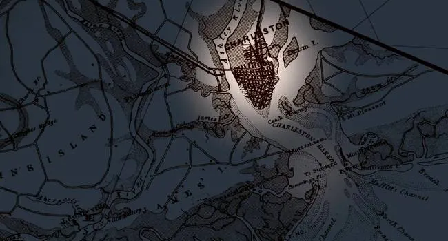
    1. Map 1 - “Map of the Defenses of Charleston City and Harbor”, (linked in resources tab)
    2. Map 2 - “Map of Charleston Harbor with Morris Island and James, Broad, Folly, and Cole’s Islds.: showing the position of the Union and Rebel forts and batteries & November and December 1863”, (linked in resources tab)
  4. Distribute the “Civil War Map Analysis Worksheet.” (linked in resources tab)
  5. Have your students look at Map 1, “Map of the Defenses of Charleston City and Harbor”.
  6. As a class, discuss the contents of this map. Have your students contribute questions and observations, using the questions on the worksheet to guide conversation. Areas for discussion include:
    1. What do you immediately notice when looking at this map?
    2. Can you locate important map elements, such as the map’s legend, title, date, scale, coordinates, symbols, etc.?
    3. What do the red and blue markings mean?
    4. What was the map’s intended / original purpose? How was this map useful in the Civil War and to whom?
    5. How easy or difficult is it to read this map?
    6. Can you locate places mentioned in the documentary, such as Fort Lamar / Secessionville, the Swamp Angel, Fort Wagner, Fort Johnson, Fort Sumter, and Grimball’s plantation? Discuss the locations of these places in relation to each other. Does looking at a map provide a clearer view of the events depicted in the Fort Lamar documentary?
    7. How might this map be useful to historians and archaeologists today?
  7. Next, have your students look at Map 2, “Map of Charleston Harbor with Morris Island and James, Broad, Folly, and Cole’s Islands”.
  8. As a class, discuss the contents of this map. As with Map 1, have your students contribute observations and questions for discussion.
    1. Compare this map to the previous map. How are they similar? How are they different?
    2. What information does Map 2 convey that Map 1 does not?
    3. Can you identify key map elements, such as the map’s legend, title, author, date, scale, symbols, etc.?
    4. How did the mapmaker for Map 2 use color differently than the mapmaker for Map 1?
    5. What was this map’s intended / original purpose? How was it useful and to whom?
    6. Can you find the same locations you found with Map 1 on Map 2?
  9. Discuss with your students the necessity of accurate maps in the Civil War. How was having an accurate map important for certain weapons or military operations, such as the Swamp Angel?
  10. Find a detailed view of Charleston on a modern map, like Google Earth. Ask your class to compare how Charleston and its surrounding areas have changed since Map 1 and 2 were created in the 1860s. Zoom in on the locations your students identified on the historical maps (i.e., Fort Lamar, the Swamp Angel, Fort Wagner, etc.). Explore questions such as: Do these structures still exist? How has their surrounding area changed? Charleston has grown a lot since the Civil War. Should we be worried about losing or damaging these historical sites because of residential or business development?
  11. After your students have completed the worksheet, tell them that they will now be creating a map of their own. Distribute art supplies. Have your students create a map of their local neighborhood, town, community, or area. It is up to the students to determine what characteristics / information they want to represent on their maps. They can create a general reference map or a thematic map. Whatever their decision, a map must contain symbols, a title, a map key, and a scale. When creating their maps, students may use the historical maps used in this lesson as references. 

Teacher Notes

It is recommended that students complete this activity in the computer lab, so students can move around the maps and observe details on their own. Alternatively, this lesson can be completed in the classroom by displaying the maps on the board.

differentiation: For struggling students, create a map scavenger hunt specifically for Map 1 ("Map of the Defenses of Charleston City and Harbor"). Provide a list of simplified questions or tasks that guide them to locate key features on the map, such as "Find the red star that marks Fort Sumter" or "Circle all of the blue symbols that represent Union forts."

extension: Challenge advanced students to research a specific aspect of the Battle of Secessionville beyond what was covered in class. This could be the role of a particular military unit, the engineering behind the Swamp Angel mortar, or the experiences of soldiers from a specific background (e.g., Black regiments, Irish immigrants).

Civil War Map Analysis Worksheet

Print a copy for each student. Use to assess student learning outcomes.

View Resource

Historical Background Info

Reference for whole group discussion during lesson.

View Resource

Assessments

Use the Civil War Map Analysis Worksheet (linked in resources tab) to assess student understanding.

More in this Series

Heritage Trust

Archaeo-Tech: Atlatl Physics

Lesson

Grades

  • 4
  • 6
  • 8
Archaeo-Tech: Atlatl Physics

Students learn about the atlatl, a prehistoric throwing tool that uses leverage, then build and test replicas to measure the increase in throwing distance compared to throwing by hand. They discuss...

Archaeo-Tech: Documenting an Archaeological Site

Lesson

Grades

  • 6
  • 7
Archaeo-Tech: Documenting an Archaeological Site

Students become archaeologists for a day, creating scaled drawings of a mock excavation unit to document its features and artifacts. Through this activity, they explore the importance of accurate...

Archaeo-Tech: Geophysics

Lesson

Grades

  • 4
  • 6
  • 8
  • 9
  • 10
  • 11
  • 12
Archaeo-Tech: Geophysics

Students design a mock archaeological site and simulate a survey using punch holes to represent shovel test pits. They then discuss the limitations of this method and explore how geophysics offers a...

Archaeo-Tech: Introducing Experimental Archaeology

Lesson

Grades

  • 3
  • 6
Archaeo-Tech: Introducing Experimental Archaeology

Students brainstorm examples of artifacts archaeologists might find in prehistoric South Carolina and then analyze photos of real artifacts to understand how archaeologists use them to learn about...

Archaeo-Tech: LIDAR

Lesson

Grades

  • 8
Archaeo-Tech: LIDAR

Students build a miniature landscape in a sandbox and use tools to measure elevations at various points. By converting these measurements and coloring a graph, they create a 2D elevation model similar...

Archaeo-Tech: Mollusk ID & Coloring Activity

Lesson

Grades

  • 3
  • 6
Archaeo-Tech: Mollusk ID & Coloring Activity

Students learn about mollusks, their characteristics and habitats, and how their shells provide clues to the diet of ancient hunter-gatherers who lived on the South Carolina coast thousands of years...

Archaeo-Tech: Radiocarbon Dating

Lesson

Grades

  • 9
  • 10
  • 11
  • 12
Archaeo-Tech: Radiocarbon Dating

Students explore the concept of radioactive decay and half-life through a penny-flipping activity, then learn how this principle is used in radiocarbon dating to estimate the age of ancient organic...

Archaeo-Tech: The Barrier Island

Lesson

Grades

  • 3
  • 5
  • 6
  • 8
Archaeo-Tech: The Barrier Island

Students build model beaches and use waves to simulate coastal erosion, observing how it disturbs and destroys archaeological sites. They then explore engineering solutions to reduce erosion and...

Civil War Medicine - Fact or Fiction?

Lesson

Grades

  • 8
Civil War Medicine - Fact or Fiction?

Leveraging a KWL chart, this lesson activates students' prior knowledge of Civil War medicine before delving into the history of Fort Lamar. Through analysis of primary and fictional sources, students...

Civil War Uniforms & Equipment

Lesson

Grades

  • 4
  • 5
  • 6
  • 7
  • 8
Civil War Uniforms & Equipment

Students delve into Fort Lamar's history and the Civil War through a documentary. Analyzing photographs and recreating a soldier's belongings, they explore how artifacts offer unique insights into the...

Fort Frederick Timeline

Lesson

Grades

  • 4
  • 6
  • 8
Fort Frederick Timeline

In this lesson, students will explore the rich history of Fort Frederick Heritage Preserve by examining a documentary film, creating a visual timeline of key events, and reflecting on the significance...

Fort Lamar: Ordnance- Historical Photograph Analysis

Lesson

Grades

  • 8
  • 11
Fort Lamar: Ordnance- Historical Photograph Analysis

In this lesson, students will analyze historical photographs of Fort Lamar and the Battle of Secessionville to understand the role of artillery during the Civil War. By comparing visuals with a...

Frosted Fort: Tabby Construction

Lesson

Grades

  • 4
  • 6
  • 8
Frosted Fort: Tabby Construction

Students will learn about Fort Frederick's history, built by the British with a unique tabby material, and then engage in a hands-on activity to explore the challenges and importance of this...

Heritage Tourism: Explore Local Culture

Lesson

Grades

  • 6
  • 7
  • 8
Heritage Tourism: Explore Local Culture

This lesson explores heritage tourism, how it can preserve historical sites like Fort Frederick, and challenges students to brainstorm creative ways to promote such locations for future generations...

Historical Letter Analysis

Lesson

Grades

  • 8
Historical Letter Analysis

This lesson explores Fort Lamar and the Civil War's early years, then analyzes soldier letters from the Battle of Secessionville to highlight the value of primary documents in understanding personal...

Robert Smalls

Lesson

Grades

  • 8
Robert Smalls

This lesson delves into the story of Robert Smalls, a pivotal figure in the Civil War, and explores the changing role of African Americans during the conflict. Students will analyze Smalls' actions...

Salt Marsh Ecosystem

Lesson

Grades

  • 5
  • 6
  • 7
  • 8
Salt Marsh Ecosystem

This lesson will explore the Civil War battle of Secessionville and its connection to the unique ecosystem of the Carolina coast's salt marshes. Students will analyze the importance of these marshes...

Planter at the Gate

Civil War Medicine - Fact or Fiction?

Lesson

Grades

  • 8
Civil War Medicine - Fact or Fiction?

Leveraging a KWL chart, this lesson activates students' prior knowledge of Civil War medicine before delving into the history of Fort Lamar. Through analysis of primary and fictional sources, students...

Civil War Uniforms & Equipment

Lesson

Grades

  • 4
  • 5
  • 6
  • 7
  • 8
Civil War Uniforms & Equipment

Students delve into Fort Lamar's history and the Civil War through a documentary. Analyzing photographs and recreating a soldier's belongings, they explore how artifacts offer unique insights into the...

Fort Lamar: Ordnance- Historical Photograph Analysis

Lesson

Grades

  • 8
  • 11
Fort Lamar: Ordnance- Historical Photograph Analysis

In this lesson, students will analyze historical photographs of Fort Lamar and the Battle of Secessionville to understand the role of artillery during the Civil War. By comparing visuals with a...

Historical Letter Analysis

Lesson

Grades

  • 8
Historical Letter Analysis

This lesson explores Fort Lamar and the Civil War's early years, then analyzes soldier letters from the Battle of Secessionville to highlight the value of primary documents in understanding personal...

Robert Smalls

Lesson

Grades

  • 8
Robert Smalls

This lesson delves into the story of Robert Smalls, a pivotal figure in the Civil War, and explores the changing role of African Americans during the conflict. Students will analyze Smalls' actions...

Salt Marsh Ecosystem

Lesson

Grades

  • 5
  • 6
  • 7
  • 8
Salt Marsh Ecosystem

This lesson will explore the Civil War battle of Secessionville and its connection to the unique ecosystem of the Carolina coast's salt marshes. Students will analyze the importance of these marshes...

The Swamp Angel
   - Episode 13 The Planter at the Gate, Part 1 1

Video

Grades

  • 6
  • 7
  • 8
  • 9
  • 10
  • 11
  • 12
The Planter at the Gate, Part 1
Episode 1
An inland planter from Edgefield fears the loss of his way of life as a plantation master. In due time, Thomas Lamar will stand directly in the Union Army’s path to Charleston.
The Battle of Secessionville - Part 1
   - Episode 10 The Planter at the Gate, Part 2 2

Video

Grades

  • 6
  • 7
  • 8
  • 9
  • 10
  • 11
  • 12
The Planter at the Gate, Part 2
Episode 2
Thomas Lamar farms cotton on the family land granted by the King of England. Thomas’ brother, Charles, makes a bold move to reopen the African slave trade in defiance of a federal ban. Talk of...
The Swamp Angel
   - Episode 13 The Planter at the Gate, Part 3 3

Video

Grades

  • 6
  • 7
  • 8
  • 9
  • 10
  • 11
  • 12
The Planter at the Gate, Part 3
Episode 3
South Carolina secedes to join the Confederate States of America. Fort Sumter becomes the flash point for war.
 The Planter at the Gate, Part 4 4

Video

Grades

  • 6
  • 7
  • 8
  • 9
  • 10
  • 11
  • 12
The Planter at the Gate, Part 4
Episode 4
President Lincoln blockades Southern ports. The Union takes Port Royal Sound. The coastal planters flee leaving tens of thousands of enslaved people free.
The Swamp Angel
   - Episode 13 The Planter at the Gate, Part 5 5

Video

Grades

  • 6
  • 7
  • 8
  • 9
  • 10
  • 11
  • 12
The Planter at the Gate, Part 5
Episode 5
Robert E. Lee redevelops his strategy for defending the South. Sea island plantation owners feel abandoned. The stage is set for Robert Smalls.
 The Planter at the Gate, Part 6 6

Video

Grades

  • 6
  • 7
  • 8
  • 9
  • 10
  • 11
  • 12
The Planter at the Gate, Part 6
Episode 6
In a daring move, Robert Smalls and his crew commandeer the steamship, The Planter, sail past Fort Sumter and deliver the ship and key intelligence to the Union.
 The Planter at the Gate, Part 7 7

Video

Grades

  • 6
  • 7
  • 8
  • 9
  • 10
  • 11
  • 12
The Planter at the Gate, Part 7
Episode 7
There are two avenues into Charleston for the Union Army. Driven by information from Smalls, the Union goes for the back door - right through James Island and Thomas Lamar.
The Swamp Angel
   - Episode 13 The Planter at the Gate, Part 8 8

Video

Grades

  • 6
  • 7
  • 8
  • 9
  • 10
  • 11
  • 12
The Planter at the Gate, Part 8
Episode 8
June 16, 1862. The battle begins in the pre-dawn hours. The Union miscalculates the fierce defense rendered by Confederate cannon fire and becomes mired in Mother Nature’s secret weapon.
The Swamp Angel
   - Episode 13 The Planter at the Gate, Part 9 9

Video

Grades

  • 6
  • 7
  • 8
  • 9
  • 10
  • 11
  • 12
The Planter at the Gate, Part 9
Episode 9
Hundreds are left dead on the field of battle as the Union is repelled. Thomas Lamar is declared a hero but suffers the consequences of the bloody encounter.
 The Battle of Secessionville 10

Video

Grades

  • 4
  • 8
The Battle of Secessionville
Episode 10
The Challenge The Union Army decides the time is right to move into position on James Island and capture Charleston Harbor. Citadel professor Dr. Kyle Sinisi guides us through the military maneuvers...
The Swamp Angel
   - Episode 13 The Battle of Secessionville 11

Video

Grades

  • 4
  • 8
The Battle of Secessionville
Episode 11
The Confrontation Confederate forces at the Tower Battery push back against the Union's advancement toward their position. Citadel professor Dr. Kyle Sinisi guides us through the military maneuvers...
The Swamp Angel
   - Episode 13 The Battle of Secessionville 12

Video

Grades

  • 4
  • 8
The Battle of Secessionville
Episode 12
The Battle Confederate and Union forces clash in a short, bloody fight. Citadel professor Dr. Kyle Sinisi guides us through the military maneuvers that climaxed on June 16, 1862.
 The Swamp Angel 13

Video

Grades

  • 4
  • 8
The Swamp Angel
Episode 13
Charleston Museum curator, Grahame Long, recounts the story of the war's most renowned Parrott gun and its deadly ordnance: Greek Fire.
The Swamp Angel
   - Episode 13  The Pluff Mud Advantage 14

Video

Grades

  • 4
  • 8
The Pluff Mud Advantage
Episode 14
Home field advantage is key, especially in battle. College of Charleston's Dr. Scott Harris is very familiar with the muck that changed the odds in the Battle of Secessionville.