Archaeo-Tech: Documenting an Archaeological Site

Students become archaeologists for a day, creating scaled drawings of a mock excavation unit to document its features and artifacts. Through this activity, they explore the importance of accurate documentation in archaeology and the benefits of new technologies like photogrammetry.
Lesson Created By: MegGaillard
Lesson Partners: South Carolina Department of Natural Resources
Essential Question
How can archaeologists use careful documentation techniques, including traditional methods like scaled drawings and modern technologies like photogrammetry, to accurately record and interpret the past based on the material remains left behind?
Grade(s):
- 6
- 7
Subject(s):
Recommended Technology:
Other Instructional Materials or Notes:
Materials
• Multiple different colored sheets of craft paper
• Markers
• Pencils
• Small, ordinary household objects or cut out images of historic / prehistoric artifacts
• Graph Paper
• Measuring tapes or folding rulers
• Compass
• Digital Cameras (Optional)
Lesson Progression
Before class, prepare the mock excavation unit your students will be documenting. Refer to the image in the resources tab.
a. The mock excavation unit should be measured in square meters. For larger classrooms, it is recommended that the mock unit be multiple square meters, subdivided into 1 square meter sections (such as a 2 x 3 block) so students can document different sections of the unit in teams. However, a single 1 x 1-meter unit will also suffice for this activity.
b. Orient the unit in your classroom so one side is facing north, south, east, and west. Tape the corners down so the unit does not move during the activity. Assign each 1 x 1-meter quadrant an identification number.
c. Use different colored craft paper to indicate features / different soil colors. Place artifacts around the unit. You can use ordinary household objects, or you can use cutout images of prehistoric or historic artifacts. Tape the objects / images down so they are not accidentally moved during the activity.
d. Optional: Orient your mock unit to a datum point and assign coordinates to each 1 x 1-meter sub-unit.Begin the lesson by asking your students to discuss how scientists collect data. What tools might a scientist use to document and analyze their findings? Students might imagine a biologist, a chemist, or a geologist. Ask your students to brainstorm what tools an archaeologist might use to collect information and document their findings. Explain that an archaeologist is a scientist who studies the material remains of past human activity.
After explaining what an archaeologist is and what they do, tell your students that they will be documenting a mock archaeological excavation unit. Students will use graph paper, pencils, a measuring tape or folding ruler, and a compass to create a scaled drawing of the excavation unit. The compass will be used to find the north, south, east, and west sides of the unit.
a. For larger classrooms and / or a mock excavation unit divided into multiple 1 x 1- meter subsections, divide your class into groups and assign each group a 1 x 1-meter unit to document. Students can then compile their drawings at the end of the lesson to have a scaled drawing of the entire excavation unit.
b. Student should record soil color, the shape and color of all features, and the location of artifacts. Students should also label their drawing with the unit number and coordinates of each corner (if applicable) and include a scale and a compass rose.Discuss the activity with your students. Have your students compare their scaled drawings.
Ask your students what if they took a photograph of the excavation unit instead of making a scaled drawing? What information does a photograph capture that a scaled drawing does not and vice versa? How much faster is taking a photograph compared to making an accurate scaled drawing?
a. If digital cameras are available, students can photograph their mock units and print the image(s) on a sheet of paper to compare with their drawings.Show your students the Archaeo-Tech: Photogrammetry video (linked in the resources tab).
After watching the video, discuss the benefits of photogrammetry compared to scaled drawings and traditional photographs. What information does photogrammetry yield that scaled drawings and traditional photographs do not? What are some possible downsides to photogrammetry? Reference background information linked in the resources tab.
- Discuss the importance of accurately documenting an archaeological site and how technology, like photogrammetry, can help with this. Why is context important for archaeologists? Stress that when context is lost, information is lost.
Teacher Notes
differentiation: Pre-labeled Graph Paper: Provide students with graph paper that has a pre-drawn 1 x 1 meter grid with labeled axes (North, South, East, West). Color-Coded Legend: Create a simple legend that associates specific colors with different soil types in the mock excavation unit. This will help struggling students translate what they see to their drawings. Artifact Reference Sheet: Provide a reference sheet with pictures and descriptions of the artifacts in the excavation unit. This can help struggling students identify and record the artifacts accurately.
extension: students can independently research the use of photogrammetry in archaeology / heritage preservation and report their findings to the class in a small presentation or short paper.
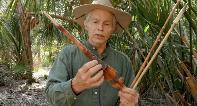
Photogrammetry Video
Archaeologists have taken photographs and made detailed drawings of their archaeological excavations for generations. A new technology called photogrammetry now provides archaeologists with a variety of additional benefits in documenting archaeology sites.
View ResourceStandards
- 6.MGSR Measurement, Geometry, and Spatial Reasoning
- 7.MGSR Measurement, Geometry, and Spatial Reasoning
- 7.5.1.PR Identify select North American physical systems and human characteristics of places.
- 7.5.6.AG Gather evidence and construct a map or model to investigate a significant contemporary cultural, economic, or political issue facing North America at the local, regional, or global scale.
- I Inquiry-Based Literacy Standards
- I.3 Construct knowledge, applying disciplinary concepts and tools, to build deeper understanding of the world through exploration, collaboration, and analysis.
- I.3.2 Examine historical, social, cultural, or political context to broaden inquiry.
- I.3.3 Gather information from a variety of primary and secondary sources and evaluate sources for perspective, validity, and bias.
- I.3.4 Organize and categorize important information, revise ideas, and report relevant findings.
- I.3 Construct knowledge, applying disciplinary concepts and tools, to build deeper understanding of the world through exploration, collaboration, and analysis.
- I Inquiry-Based Literacy Standards
- I.3 Construct knowledge, applying disciplinary concepts and tools, to build deeper understanding of the world through exploration, collaboration, and analysis.
- I.3.2 Examine historical, social, cultural, or political context to broaden inquiry.
- I.3.3 Gather information from a variety of primary and secondary sources and evaluate sources for perspective, validity, and bias.
- I.3.4 Organize and categorize important information, revise ideas, and report relevant findings.
- I.3 Construct knowledge, applying disciplinary concepts and tools, to build deeper understanding of the world through exploration, collaboration, and analysis.
Assessments
Collect student drawings. This is the primary assessment tool. Evaluate the accuracy of their drawings based on:
Representation of size and shape: Does the drawing accurately reflect the dimensions of the unit and the relative size of features and artifacts?
Detail and labeling: Did students include details like soil color variations, feature shapes, and artifact locations? Are these elements labeled correctly?
North orientation: Did students correctly identify and label the north direction using a compass rose?
Scale and legend (if applicable): Did students include a scale and a legend to explain the meaning of symbols used for different soil types?