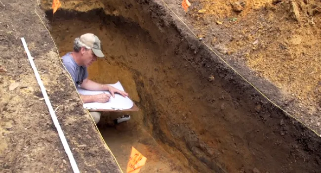
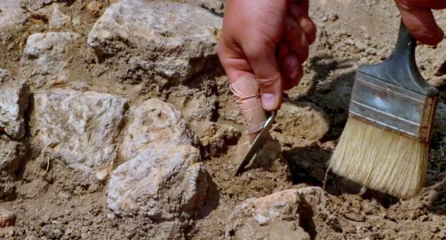
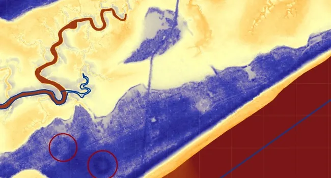
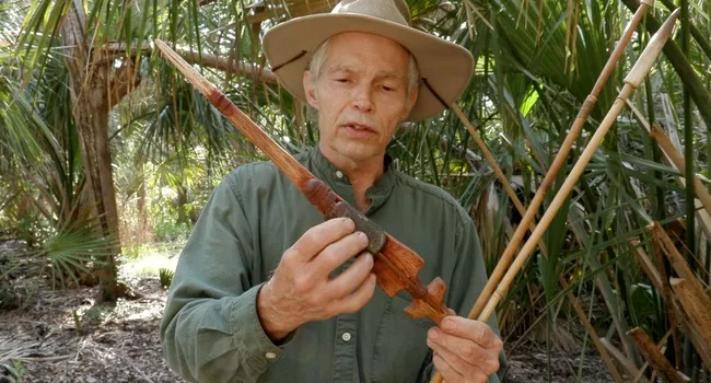
Photogrammetry | Archaeo-Tech | SCDNR

Kaltura

Archaeologists preserve an excavation in three dimensions using a new photographic technique.

More in this Series

Archaeo-Tech

Archaeo-Tech: Atlatl Physics

Lesson

Grades

  • 4
  • 6
  • 8
Archaeo-Tech: Atlatl Physics

Students learn about the atlatl, a prehistoric throwing tool that uses leverage, then build and test replicas to measure the increase in throwing distance compared to throwing by hand. They discuss...

Archaeo-Tech: Behind the Pottery- Studying Colonoware

Lesson

Grades

  • 3
  • 4
  • 6
  • 8
  • 9
  • 10
  • 11
  • 12
Archaeo-Tech: Behind the Pottery- Studying Colonoware

Pottery is one of the most common types of artifacts found in the archaeological record. Students will learn how and why archaeologists study pottery and explore how pottery, along with other objects...

Archaeo-Tech: Documenting an Archaeological Site

Lesson

Grades

  • 6
  • 7
Archaeo-Tech: Documenting an Archaeological Site

Students become archaeologists for a day, creating scaled drawings of a mock excavation unit to document its features and artifacts. Through this activity, they explore the importance of accurate...

Archaeo-Tech: Geophysics

Lesson

Grades

  • 4
  • 6
  • 8
  • 9
  • 10
  • 11
  • 12
Archaeo-Tech: Geophysics

Students design a mock archaeological site and simulate a survey using punch holes to represent shovel test pits. They then discuss the limitations of this method and explore how geophysics offers a...

Archaeo-Tech: Introducing Critical Cartography

Lesson

Grades

  • 6
  • 7
  • 8
  • 9
  • 10
  • 11
  • 12
Archaeo-Tech: Introducing Critical Cartography

This lesson plan is intended to introduce students to critical cartography, a subfield of geography that recognizes maps as inherently political objects subject to bias and hidden meaning. In this...

Archaeo-Tech: Introducing Experimental Archaeology

Lesson

Grades

  • 3
  • 6
Archaeo-Tech: Introducing Experimental Archaeology

Students brainstorm examples of artifacts archaeologists might find in prehistoric South Carolina and then analyze photos of real artifacts to understand how archaeologists use them to learn about...

Archaeo-Tech: LIDAR

Lesson

Grades

  • 8
Archaeo-Tech: LIDAR

Students build a miniature landscape in a sandbox and use tools to measure elevations at various points. By converting these measurements and coloring a graph, they create a 2D elevation model similar...

Archaeo-Tech: Mollusk ID & Coloring Activity

Lesson

Grades

  • 3
  • 6
Archaeo-Tech: Mollusk ID & Coloring Activity

Students learn about mollusks, their characteristics and habitats, and how their shells provide clues to the diet of ancient hunter-gatherers who lived on the South Carolina coast thousands of years...

Archaeo-Tech: Radiocarbon Dating

Lesson

Grades

  • 9
  • 10
  • 11
  • 12
Archaeo-Tech: Radiocarbon Dating

Students explore the concept of radioactive decay and half-life through a penny-flipping activity, then learn how this principle is used in radiocarbon dating to estimate the age of ancient organic...

Archaeo-Tech: Telling Time with Stone Tools

Lesson

Grades

  • 6
  • 7
  • 8
  • 9
  • 10
  • 11
  • 12
Archaeo-Tech: Telling Time with Stone Tools

This lesson plan explores how archaeologists study and classify projectile points (commonly referred to as arrowheads) into different “types” to learn about past people and cultures. After learning...

Archaeo-Tech: The Barrier Island

Lesson

Grades

  • 3
  • 5
  • 6
  • 8
Archaeo-Tech: The Barrier Island

Students build model beaches and use waves to simulate coastal erosion, observing how it disturbs and destroys archaeological sites. They then explore engineering solutions to reduce erosion and...

Archaeo-Tech: Tracing the Roots of Rice

Lesson

Grades

  • 5
  • 6
  • 7
  • 8
  • 9
  • 10
  • 11
  • 12
Archaeo-Tech: Tracing the Roots of Rice

Rice is the most consumed grain in the world, feeding more than 3 billion people every day. Students will learn about rice’s diversity and trace its history from its domestication in China 12,000...

Photogrammetry | Archaeo-Tech  | SCDNR Geophysics | Archaeo-Tech | SCDNR

Video

Grades

  • 6
  • 7
  • 8
  • 9
  • 10
  • 11
  • 12
Geophysics | Archaeo-Tech | SCDNR
Archaeologists survey an early Spanish settlement on Parris Island using ground penetrating radar, magnetometry and resistivity.
Photogrammetry | Archaeo-Tech  | SCDNR Radiocarbon Dating  | Archaeo-Tech  | SCDNR

Video

Grades

  • 6
  • 7
  • 8
  • 9
  • 10
  • 11
  • 12
Radiocarbon Dating | Archaeo-Tech | SCDNR
Scientists at the University of Georgia’s Center for Applied Isotope Study use an accelerator mass spectrometer to count Carbon-14 isotopes to determine the age of ancient material.