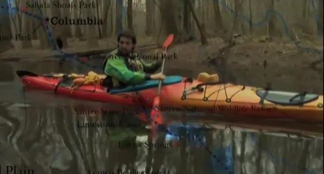
Ian Sanchez left the Santee Lake area and paddled toward the Upper Cooper River passing by Mepkin Abbey and through the Chicken Creek. Read his summary of the trip below:
Ian's Journal
In this webisode, as we left the Santee Lakes area we paddled the historic Upper Cooper River passing by Mepkin Abbey and through Chicken Creek. As we neared the Charleston area the landscape became industrial and I have to admit after three weeks on the river it felt very good to pass the old navy yards of North Charleston and see the Cooper River Bridge in the distance. On Sunday we stopped at the South Carolina Aquarium, meeting the Charleston Kids with Cameras group to discuss historic Charleston Harbor. The next morning we went around the peninsula and up the Ashley River to end our trip at beautiful Magnolia Gardens. We took a tour of the grounds with the middle schoolers from Haute Gap, sharing a great time with them on the river to end our Web of Water adventure.
Scavenger Hunt
Find the answers to these questions in Webisode 5: Coast!
1. What early colonist is responsible for building and developing the Native American deerskin trade? What important seeds did he plant from Madagascar?
2. What do you call mammals and birds that can generate their own heat and stay active year-round?
About the Landform – The Coastal Zone
The Coastal Zone, sometimes referred to as the tidewater area, extends from the coast inland about ten miles and covers approximately 1.2 million acres. Elevations range from sea level to 25 feet and local topographic relief is usually less than five feet. The water height and salinity of streams in the area are influenced by the daily cycles of the tides and most stream valleys widen into estuaries before they reach the ocean. Coastal beaches are fairly wide and slope gently. Parallel ridges of sand adjoin the coast. Beaches are interrupted by many inlets, bays, and islands along with wide expanses of marshlands, particularly south of the Santee Delta.
The South Carolina Coastal Zone is usually divided into three distinct geographic regions based on different landforms produced by different geological processes. Each distinctive area can be easily identified on maps or on aerial photographs. The first area is a long, crescent shaped beach referred to as the Carolina Grand Strand or Myrtle Beach Grand Strand. The second area is primarily the Santee Delta, the largest cuspate delta on the east coast. The third geographic area is composed of the Sea Islands and extends from the Santee Delta to the Georgia border. Some of these islands are referred to as barrier islands because they serve to protect the mainland from waves, tides, and hurricanes coming in from the Atlantic Ocean. Beaches of any kind protect inland areas by absorbing wave energy even though they may become eroded in the process. Formed through time by the steady transport of sand by water and wind, sand dunes serve as reservoirs of sand to replenish beaches during erosive events caused by storms.
South Carolina is fortunate to have an extensive 200-mile coastal area as one of its state boundaries. Including all of the bays, sounds, inlets, beaches, deltas, and marshes, the coastline is more than 3,000 miles long. Furthermore, the coast is within easy driving distance from all parts of the state. In comparing South Carolina with other states, only a few have the advantages of a coastal area, and none have one that is as diverse, intriguing, and delightful to explore as our Carolina coast.
Discussion Questions
- What types of technology did African-Americans bring to the colony of South Carolina that helped our agricultural development? Why were they important in our history?
- What fort sits at the convergence of the Cooper and Ashley rivers? Why is it important in American history?
- The waters around Magnolia Gardens are dark brown in color? What causes this darker coloration?
- What Caribbean island was influential in the early development of the colony of Charleston and what are some of the connections between Charleston and the islands?
- What is an estuary? What types of animals live there?
ANSWERS:
1. African slaves were largely responsible for teaching South Carolinians how to cultivate rice. They showed colonists how to build the dikes, mortar and pestle systems, and how to use sweet grass baskets as rice fanners to separate the husks. From the 1600’s through the 1800’s, the African rice cultivation methods were used and became the cornerstone of the state’s economy. African slaves who labored on rice and cotton plantations made South Carolinian plantation owners very wealthy until after the Civil War and the abolition of slavery. Although slavery was ended in 1865, the plantation system continued in the form of sharecropping, trapping former slaves and their descendents in economic servitude in some cases, through the 1950’s. It is because of slaves and their agricultural knowledge and labor that South Carolina was ever able to prosper. In addition to impacting our economic and political history, slavery has shaped and influenced our cultural history through its legacy of African-American language and tradition.
Learn more about West African cultural heritage through Knowitall.org at GullahNet, or find lesson plans about slavery at Knowitall.org through the Teaching American History in South Carolina. In the Estuary Module of RiverVenture, look for an object relating to the City of Charleston to learn more about rice cultivation in the lowcountry. Read more about rice grown in South Carolina in the History of South Carolina Slide Collection at Knowitall.org.
2. Several Forts sit on the convergence...
- Castle Pickney: XYZ affair, War of 1812, Civil War
- Fort Sumter: Civil War
- Fort Moultrie: Revolution and every war up to WWII
- Fort Johnson: Revolution, Civil War
Look for the connection between the Cabbage Palmetto and Revolutionary War forts in the Estuary module of RiverVenture.org.
3. Tannic acid that is drawn from decaying trees and leaves help to create a nutrient- rich tea.
4. English colonists from Barbados were responsible for the first European settlement of South Carolina at Charleston in 1670. For the first 50 years in the existence of Charles Towne (Charleston), Barbadians had a great influence on the laws, culture, architecture, trade, and people of the new colony. Most notably, the colonists implemented the Barbadian plantation system in South Carolina.
5. The estuary is where fresh water from rivers meets salt water flowing into the ocean. In estuarine environments, you are likely to find sea turtles, oysters, shrimp, crabs, dolphins, shore birds, and many others, including millions of different kinds of plankton that help sustain the ocean and the planet. Find more examples of animals of the estuary at Knowitall.org in the Estuary module of RiverVenture!
Ian Sanchez left the Santee Lake area and paddled toward the Upper Cooper River passing by Mepkin Abbey and through the Chicken Creek. Read his summary of the trip below:
Ian's Journal
In this webisode, as we left the Santee Lakes area we paddled the historic Upper Cooper River passing by Mepkin Abbey and through Chicken Creek. As we neared the Charleston area the landscape became industrial and I have to admit after three weeks on the river it felt very good to pass the old navy yards of North Charleston and see the Cooper River Bridge in the distance. On Sunday we stopped at the South Carolina Aquarium, meeting the Charleston Kids with Cameras group to discuss historic Charleston Harbor. The next morning we went around the peninsula and up the Ashley River to end our trip at beautiful Magnolia Gardens. We took a tour of the grounds with the middle schoolers from Haute Gap, sharing a great time with them on the river to end our Web of Water adventure.
Scavenger Hunt
Find the answers to these questions in Webisode 5: Coast!
1. What early colonist is responsible for building and developing the Native American deerskin trade? What important seeds did he plant from Madagascar?
2. What do you call mammals and birds that can generate their own heat and stay active year-round?
About the Landform – The Coastal Zone
The Coastal Zone, sometimes referred to as the tidewater area, extends from the coast inland about ten miles and covers approximately 1.2 million acres. Elevations range from sea level to 25 feet and local topographic relief is usually less than five feet. The water height and salinity of streams in the area are influenced by the daily cycles of the tides and most stream valleys widen into estuaries before they reach the ocean. Coastal beaches are fairly wide and slope gently. Parallel ridges of sand adjoin the coast. Beaches are interrupted by many inlets, bays, and islands along with wide expanses of marshlands, particularly south of the Santee Delta.
The South Carolina Coastal Zone is usually divided into three distinct geographic regions based on different landforms produced by different geological processes. Each distinctive area can be easily identified on maps or on aerial photographs. The first area is a long, crescent shaped beach referred to as the Carolina Grand Strand or Myrtle Beach Grand Strand. The second area is primarily the Santee Delta, the largest cuspate delta on the east coast. The third geographic area is composed of the Sea Islands and extends from the Santee Delta to the Georgia border. Some of these islands are referred to as barrier islands because they serve to protect the mainland from waves, tides, and hurricanes coming in from the Atlantic Ocean. Beaches of any kind protect inland areas by absorbing wave energy even though they may become eroded in the process. Formed through time by the steady transport of sand by water and wind, sand dunes serve as reservoirs of sand to replenish beaches during erosive events caused by storms.
South Carolina is fortunate to have an extensive 200-mile coastal area as one of its state boundaries. Including all of the bays, sounds, inlets, beaches, deltas, and marshes, the coastline is more than 3,000 miles long. Furthermore, the coast is within easy driving distance from all parts of the state. In comparing South Carolina with other states, only a few have the advantages of a coastal area, and none have one that is as diverse, intriguing, and delightful to explore as our Carolina coast.
Discussion Questions
- What types of technology did African-Americans bring to the colony of South Carolina that helped our agricultural development? Why were they important in our history?
- What fort sits at the convergence of the Cooper and Ashley rivers? Why is it important in American history?
- The waters around Magnolia Gardens are dark brown in color? What causes this darker coloration?
- What Caribbean island was influential in the early development of the colony of Charleston and what are some of the connections between Charleston and the islands?
- What is an estuary? What types of animals live there?
ANSWERS:
1. African slaves were largely responsible for teaching South Carolinians how to cultivate rice. They showed colonists how to build the dikes, mortar and pestle systems, and how to use sweet grass baskets as rice fanners to separate the husks. From the 1600’s through the 1800’s, the African rice cultivation methods were used and became the cornerstone of the state’s economy. African slaves who labored on rice and cotton plantations made South Carolinian plantation owners very wealthy until after the Civil War and the abolition of slavery. Although slavery was ended in 1865, the plantation system continued in the form of sharecropping, trapping former slaves and their descendents in economic servitude in some cases, through the 1950’s. It is because of slaves and their agricultural knowledge and labor that South Carolina was ever able to prosper. In addition to impacting our economic and political history, slavery has shaped and influenced our cultural history through its legacy of African-American language and tradition.
Learn more about West African cultural heritage through Knowitall.org at GullahNet, or find lesson plans about slavery at Knowitall.org through the Teaching American History in South Carolina. In the Estuary Module of RiverVenture, look for an object relating to the City of Charleston to learn more about rice cultivation in the lowcountry. Read more about rice grown in South Carolina in the History of South Carolina Slide Collection at Knowitall.org.
2. Several Forts sit on the convergence...
- Castle Pickney: XYZ affair, War of 1812, Civil War
- Fort Sumter: Civil War
- Fort Moultrie: Revolution and every war up to WWII
- Fort Johnson: Revolution, Civil War
Look for the connection between the Cabbage Palmetto and Revolutionary War forts in the Estuary module of RiverVenture.org.
3. Tannic acid that is drawn from decaying trees and leaves help to create a nutrient- rich tea.
4. English colonists from Barbados were responsible for the first European settlement of South Carolina at Charleston in 1670. For the first 50 years in the existence of Charles Towne (Charleston), Barbadians had a great influence on the laws, culture, architecture, trade, and people of the new colony. Most notably, the colonists implemented the Barbadian plantation system in South Carolina.
5. The estuary is where fresh water from rivers meets salt water flowing into the ocean. In estuarine environments, you are likely to find sea turtles, oysters, shrimp, crabs, dolphins, shore birds, and many others, including millions of different kinds of plankton that help sustain the ocean and the planet. Find more examples of animals of the estuary at Knowitall.org in the Estuary module of RiverVenture!
Standards
- 7-LS2-4 Construct an argument supported by empirical evidence that changes to physical or biological components of an ecosystem affect populations.
- 6-ESS2-5. Analyze and interpret data to provide evidence for how the motions and complex interactions of air masses result in changes in weather conditions.