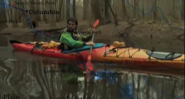
In this webisode, as Ian Sanchez traveled through the Piedmont, he noticed the river had changed since leaving the mountains. Read more of his summary below:
Ian's Journal
As I traveled through the Piedmont, I noticed the river had changed since leaving the mountains. I passed through rural farmland enjoying the sounds of animals and agriculture. It was a balance between the peacefulness of the river and the activity of population along its banks. All the lakes on the Upper Saluda are man-made. That meant carrying my kayak across many dams on the river beginning at Lake Greenwood State Park and ending at Lake Murray. Paddling the Piedmont, you can see man adapting the river to his needs all around you.
From the Piedmont we will head to the Sandhills and continue to observe how the earth shapes the waterways and the waterways shape the earth.
Scavenger Hunt
Find the answers to these questions in Webisode 2: Piedmont!
1. What is detritus?
2. What is a lake in the Piedmont that provides hydroelectric power?
3. How many lakes along the Saluda are man-made?
4. Who is Laurens County named after? What is the significance of that?
5. What was the town of Ninety-Six named after?
About the Landform – Piedmont
The word Piedmont is derived from a French word meaning "Foot of the Mountains." Although the South Carolina Piedmont certainly qualifies, it is only the northwestern portion that is technically at the foot of the mountains. The rest of the region stretches over 100 miles towards the southeast in a gradually sloping, mostly flat plain. The eastern boundary of the Piedmont region can be identified by drawing a line on the map from North Augusta on the Savannah River through Columbia and to the place where the Pee Dee River enters South Carolina.
The land surface is quite hilly in the higher elevations towards the northwest, but becomes more gently rolling at the lower elevations next to the Sandhills Region. Modern Piedmont rivers, usually wider and flowing more gently than Blue Ridge streams, are actively eroding into the Piedmont causing steep-walled valleys with locally high relief. Piedmont rivers often have dendritic (branching) drainage patterns and are usually full of suspended sediment transported from the mountains. Occasionally, this suspended sediment is temporarily deposited in wide flood plains which provide rich and very productive soil for agriculture. Between river valleys, the broad upland areas are essentially flat.
Occasionally, the relatively flat rolling topography is interrupted by deeply dissected stream valleys and a few scattered hills, called monadnocks. These are single mountains, typical of the Piedmont, left comparatively undisturbed by erosion. Monadnocks are usually surrounded by relatively flat ground and can therefore be seen from many miles away. Sometimes these hills are composed of harder rock which accounts for their greater resistance to erosion. In other cases, it seems to have been pure chance which has allowed them to escape erosion.
QUESTIONS:
- What are some of the ways that man has adapted the waterways to his needs?
- These rivers have always served as a mode of transportation and trade. What trade items have been popular along the Upper Saluda during its history? How did the trading of these goods effect the populations along the rivers?
- What is a canal? What are some of the uses of a canal?
- I was able to see a number or minerals along the waterway that had become apparent from erosion. What is a mineral?
- The Piedmont experienced a Gold rush in 1827 -- proving that ores are abundant near the Upper Saluda. What is an ore?
- We see a lot of red clay in the Piedmont. What valuable commodity was fashioned from this Red Clay that helped build our cities?
- We paddled near historic Laurens tracing the steps of American Revolutionaries. What revolutionary battles took place in the Piedmont, near the Upper Saluda?
ANSWERS:
1. Man has done much to shape the character of the river and adapt it to his needs. He uses the river and its resources for drinking water, agriculture, fishing, trading, travel, and power in the form of hydro- electric dams, as well as for recreation. Learn more about rivers and how we use them through Knowitall.org at RiverVenture.org.
2. Trade items that have been popular on the Upper Saluda have varied throughout history. First deerskins were traded between the Cherokee and settlers. Later cotton was transported down the river, and in more recent history, it has served as a mainstay of the textile industry. All of these have greatly affected the social and economic life of people living along the river. Learn more about trade along the three rivers at RiverVenture.org. Look for information about Congaree Town, Old Fort Congaree, the Cherokee Path, the Town of Granby, and the Saxa Gotha Township.
3. A canal is a man-made channel that connects two bodies of water. They are often used to allow boats to travel around geological obstacles. Learn more about canals, their structure, the canal era and its contribution to hydroelectricity in the Three Rivers module of RiverVenture.org.
4. A mineral is a naturally occurring substance formed through geological processes with specific physical and chemical properties. Examples of minerals include diamonds, quartz, topaz, and fluorite. A rock such as granitic gneiss, by comparison, is an aggregate of minerals and need not have a specific chemical composition. Learn more about rocks, minerals and geologic processes in the Carrick Creek module of RiverVenture.
5. An ore is a volume of rock containing components such as metals or minerals in a mode of occurrence that renders it valuable for mining. An ore must contain materials that are valuable in concentrations that can be profitably mined, transported, milled, and processed, or able to be extracted from waste rock. Examples of ore include crystallized gemstones, or metals like iron, gold, lead and copper, among others used as components in alloys. Ore deposits form from intense metamorphism and other processes involving water, heat and pressure. Find out more about natural resources and how they can be used in art through Knowitall.org at A Natural State.
6. Red clay was used to make brick, an important component in the growth and development of all early South Carolina cities and towns. Find out more about making bricks by reading about the brick kilns and the clay quarry along the three rivers at RiverVenture.org.
7. The Revolutionary War battles of Ninety-Six and Musgrove's Mills were fought near the Upper Saluda.