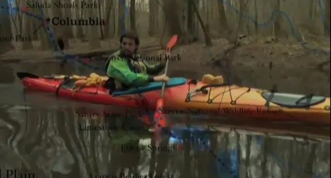
In this webisode, Ian Sanchez explores how the waterways of the Sandhills and Fall Line Zone connect landscapes, communities, and generations. As the Saluda widens below Lake Greenwood and joins other tributaries near Lake Murray, the journey highlights the relationships among natural habitats, local history, cultural voices, and environmental learning along South Carolina’s web of water. Read more of his summary below:
Ian's Journal
This thread of the web of water strings together friends and family as we pass through the Sandhills and Fall Line Zone. The heavy paddle through the undeveloped stretch of the Saluda below Lake Greenwood widened and joined with other tributaries at the mouth of Lake Murray. There I found a familiar sign on a spectacular peninsula saying: "Welcome! Take nothing but pictures, leave nothing but footprints" - Hodge Harmon. The ground crew met me there and we were treated to a fire side conversation with Mr. Harmon himself.
A paddle through Lake Murray brought us past tiny islands teeming with wildlife and finally to Dreher Island State Park. There we interviewed Chief Louie Chavis from the Beaver Creek tribe. The next day we learned a great deal from Karen Kustafik about the canals, fish ladder, power plants, and the exotic and native plants of Columbia's Riverfront Park. We were even treated to a geology lesson from a chance meeting with David Shelly, Education Coordinator from Congaree National Park.
We then traveled on to Saluda Shoals State Park where the entire 3rd grade class of Nursery Roads Middle School met us near the river's edge to learn about plants from the local rangers and the web of water.
Scavenger Hunt
Find the answers to these questions in Webisode 3: Sandhills!
1. What 3 rivers come together at a confluence in the Sandhills?
2. How does flooding contribute to a “dynamic system” between the rivers?
3. How does silt deposited along the Broad from upstream help the health of floodplain forests along the river?
4. How is it possible that the water in your body might have been drank by a dinosaur?
Discussion Questions
- Why is there a “Fall Line” in the middle of the state?
- Explain the difference between an exotic and native species? How do they affect one another?
- The fish ladder was built to help fish migrate up the river. What is migration?
- Who were the Catawba?
- Who was Robert Mills and what did he have to do with the canals in Columbia?
- What role did the river play in the development of the city of Columbia?
ANSWERS:
1. In the Sandhills region of South Carolina, the igneous and metamorphic rock of the hilly Piedmont meets the sandy soils and sedimentary rock of the lower regions in the middle of the state. Sedimentary rock erodes faster than metamorphic and igneous rock. Over millions of years this has left a shelf that crosses three states called the Fall Line or Fall Zone. Learn more about the context of the Fall Zone in the Three Rivers module of RiverVenture.org, or find out more about rocks and the rock cycle in the Carrick Creek module of RiverVenture.
2. Exotic species of plants and animals come from foreign lands. Native species are naturally occurring in a region. Plants and animals often compete for sunlight, food, or other resources. Often in places where exotic plants or animals have been introduced, they do not have natural predators, and so they choke out native species. These exotic species are often referred to as invasive. An example of an invasive animal species is the Green Porcelain Crab, introduced to the salt waters of Charleston Harbor. Some theories as to how the crab got there are 1) through the aquarium trade, or 2) on incoming ships importing seafood into South Carolina. Go to the Estuary at RiverVenture.org to learn more about the Green Porcelain Crab. An example of an invasive plant species is Kudzu, which you can learn more about in the Three Rivers module of RiverVenture.org.
3. Migration is the movement of organisms from one area to another. Many kinds of fish migrate in order to feed, reproduce, or to regulate their body temperatures. Pacific salmon are well-known for their migration patterns. As adults, these fish migrate from the sea back to the freshwater streams in which they hatched in order to spawn, or lay eggs of their own.
4. The Catawba are an American Indian tribe that lived near the Piedmont and Sandhills. Historical records show members of the Catawba tribe have lived in South Carolina since 1650. The original Catawba called themselves "Ye Iswa," meaning "river people. Go to Periscope at Knowitall.org in order to learn more about the Catawba and other Native Americans of South Carolina. At Periscope, look for the November issue on Native American Heritage Month.
5. Robert Mills was a famous architect of Scottish decent. He designed many famous buildings including the Washington Monument in DC. He also helped design the canal systems in Columbia, South Carolina and others across the state, including the Landsford canal on the Catawba River at what is now Landsford Canal State Park. The Landsford canal was part of a series of canals running up and down the Fall Line along the Catwaba and Wateree rivers, circa 1820. These structures helped to make the rivers more navigable for trade among settlements along rivers in the upstate and those along the rapids created by the Fall Line. Learn more about canals, their structure, the canal era and its contribution to hydroelectricity in the Three Rivers module of RiverVenture.org.
6. The three rivers that converge on Columbia brought many travelers. The difficult navigation of the Fall Line made the area a popular rest site. This contributed to the creation of the city. The rivers have afforded many crucial accommodations to early settlers and modern day inhabitants of the area, beginning with bountiful natural resources, transportation and trade routes, hydroelectricity, and now recreation. Learn more about settlement along the three rivers near Columbia at RiverVenture.org.
In this webisode, Ian Sanchez explores how the waterways of the Sandhills and Fall Line Zone connect landscapes, communities, and generations. As the Saluda widens below Lake Greenwood and joins other tributaries near Lake Murray, the journey highlights the relationships among natural habitats, local history, cultural voices, and environmental learning along South Carolina’s web of water. Read more of his summary below:
Ian's Journal
This thread of the web of water strings together friends and family as we pass through the Sandhills and Fall Line Zone. The heavy paddle through the undeveloped stretch of the Saluda below Lake Greenwood widened and joined with other tributaries at the mouth of Lake Murray. There I found a familiar sign on a spectacular peninsula saying: "Welcome! Take nothing but pictures, leave nothing but footprints" - Hodge Harmon. The ground crew met me there and we were treated to a fire side conversation with Mr. Harmon himself.
A paddle through Lake Murray brought us past tiny islands teeming with wildlife and finally to Dreher Island State Park. There we interviewed Chief Louie Chavis from the Beaver Creek tribe. The next day we learned a great deal from Karen Kustafik about the canals, fish ladder, power plants, and the exotic and native plants of Columbia's Riverfront Park. We were even treated to a geology lesson from a chance meeting with David Shelly, Education Coordinator from Congaree National Park.
We then traveled on to Saluda Shoals State Park where the entire 3rd grade class of Nursery Roads Middle School met us near the river's edge to learn about plants from the local rangers and the web of water.
Scavenger Hunt
Find the answers to these questions in Webisode 3: Sandhills!
1. What 3 rivers come together at a confluence in the Sandhills?
2. How does flooding contribute to a “dynamic system” between the rivers?
3. How does silt deposited along the Broad from upstream help the health of floodplain forests along the river?
4. How is it possible that the water in your body might have been drank by a dinosaur?
Discussion Questions
- Why is there a “Fall Line” in the middle of the state?
- Explain the difference between an exotic and native species? How do they affect one another?
- The fish ladder was built to help fish migrate up the river. What is migration?
- Who were the Catawba?
- Who was Robert Mills and what did he have to do with the canals in Columbia?
- What role did the river play in the development of the city of Columbia?
ANSWERS:
1. In the Sandhills region of South Carolina, the igneous and metamorphic rock of the hilly Piedmont meets the sandy soils and sedimentary rock of the lower regions in the middle of the state. Sedimentary rock erodes faster than metamorphic and igneous rock. Over millions of years this has left a shelf that crosses three states called the Fall Line or Fall Zone. Learn more about the context of the Fall Zone in the Three Rivers module of RiverVenture.org, or find out more about rocks and the rock cycle in the Carrick Creek module of RiverVenture.
2. Exotic species of plants and animals come from foreign lands. Native species are naturally occurring in a region. Plants and animals often compete for sunlight, food, or other resources. Often in places where exotic plants or animals have been introduced, they do not have natural predators, and so they choke out native species. These exotic species are often referred to as invasive. An example of an invasive animal species is the Green Porcelain Crab, introduced to the salt waters of Charleston Harbor. Some theories as to how the crab got there are 1) through the aquarium trade, or 2) on incoming ships importing seafood into South Carolina. Go to the Estuary at RiverVenture.org to learn more about the Green Porcelain Crab. An example of an invasive plant species is Kudzu, which you can learn more about in the Three Rivers module of RiverVenture.org.
3. Migration is the movement of organisms from one area to another. Many kinds of fish migrate in order to feed, reproduce, or to regulate their body temperatures. Pacific salmon are well-known for their migration patterns. As adults, these fish migrate from the sea back to the freshwater streams in which they hatched in order to spawn, or lay eggs of their own.
4. The Catawba are an American Indian tribe that lived near the Piedmont and Sandhills. Historical records show members of the Catawba tribe have lived in South Carolina since 1650. The original Catawba called themselves "Ye Iswa," meaning "river people. Go to Periscope at Knowitall.org in order to learn more about the Catawba and other Native Americans of South Carolina. At Periscope, look for the November issue on Native American Heritage Month.
5. Robert Mills was a famous architect of Scottish decent. He designed many famous buildings including the Washington Monument in DC. He also helped design the canal systems in Columbia, South Carolina and others across the state, including the Landsford canal on the Catawba River at what is now Landsford Canal State Park. The Landsford canal was part of a series of canals running up and down the Fall Line along the Catwaba and Wateree rivers, circa 1820. These structures helped to make the rivers more navigable for trade among settlements along rivers in the upstate and those along the rapids created by the Fall Line. Learn more about canals, their structure, the canal era and its contribution to hydroelectricity in the Three Rivers module of RiverVenture.org.
6. The three rivers that converge on Columbia brought many travelers. The difficult navigation of the Fall Line made the area a popular rest site. This contributed to the creation of the city. The rivers have afforded many crucial accommodations to early settlers and modern day inhabitants of the area, beginning with bountiful natural resources, transportation and trade routes, hydroelectricity, and now recreation. Learn more about settlement along the three rivers near Columbia at RiverVenture.org.