
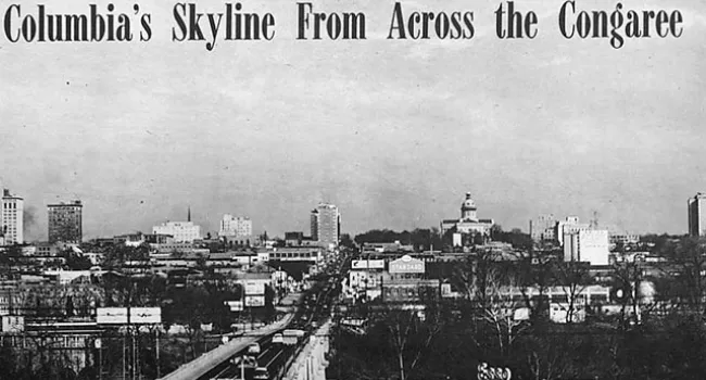
The Congaree River Bridge carries Gervais Street across the river to Lexington County. This panorama of Columbia looking east from the bridge shows the development of the capitol city around 1910.
Courtesy of the Howard G. Woody Postcard Collection.
The Congaree River Bridge carries Gervais Street across the river to Lexington County. This panorama of Columbia looking east from the bridge shows the development of the capitol city around 1910.
Courtesy of the Howard G. Woody Postcard Collection.
Photo
Grades
Photo
Grades
Photo
Grades

Photo
Grades
Photo
Grades
Photo
Grades
Photo
Grades
Photo
Grades
Photo
Grades
Photo
Grades