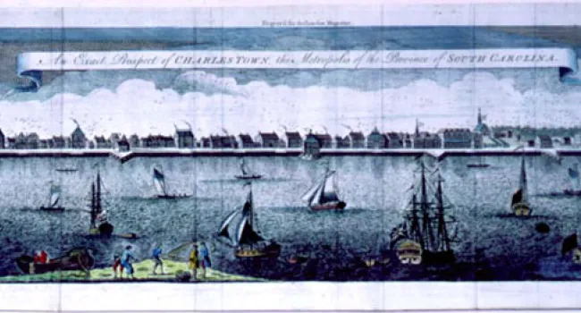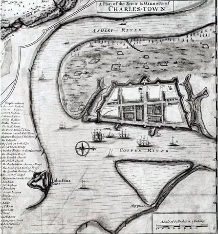
A plan of Charles Town in 1704, drawn by Edward Crisp, and used as an insert map to a larger map of the province of Carolina, published in London in 1711. This copy is a reproduction of the original map.
Courtesy of the South Caroliniana Library.
A plan of Charles Town in 1704, drawn by Edward Crisp, and used as an insert map to a larger map of the province of Carolina, published in London in 1711. This copy is a reproduction of the original map.
Courtesy of the South Caroliniana Library.