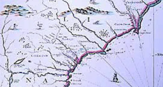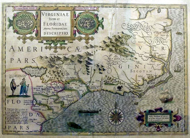
"A Map of Eastern North America: From Florida to Chesapeake Bay" was drawn by John White after his 1585 expedition to the coast of North Carolina. Although White's maps of the Chesapeake, which he observed directly, are fairly accurate, this one including South Carolina is full of distortions. He tried to fill in the coast between the information given in Jacques Le Moyne's map of Florida, published in 1591, and his own observations of the North Carolina Outer Banks. Nevertheless, Port Royal is clearly visible in the bend of the continent. From the British Museum.
Courtesy of the University of North Carolina Press.
Standards
- 1.G.2 Identify and describe the geographic location of South Carolina in relation to the rest of the United States through the use of various maps and geographic tools.
- 3.2.1.ER Recognize and explain how physical features are distributed around the world.
- 3.2.2.ER Identify and analyze the ways people interact with the physical environment in different regions of the state, the country, and the world.