Skyping Through Colonial Settlements
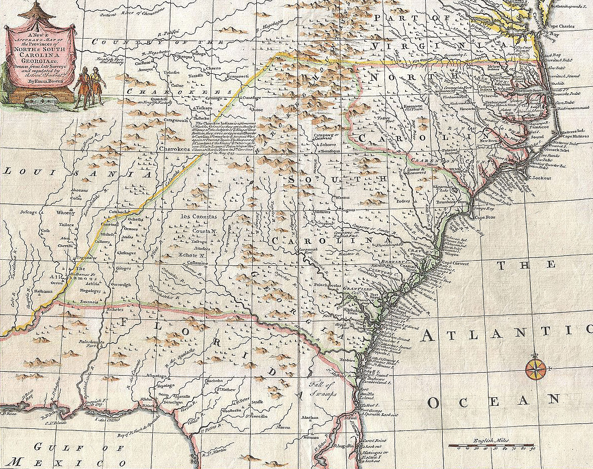
The influences of European nations that settled North America as well as the geographic landscape of each region were two of the most impactful factors that led to how the original thirteen colonies developed both culturally and economically. To learn about the development of these regions and the people who first populated them helps us understand and embrace the similarities and differences of present day people and cultures around the United States today.
Problem: It is the year 2116 and time travel has already been around for decades, however, it is still very costly for a person to travel through time so sending your entire class on a field trip to the past isn’t in your teacher’s budget this year. Knowing how beneficial first-hand accounts can be, your teacher has decided she can send four students to make a trip back in time to learn about the settlement of the American colonies. Fortunately, the visionaries at Skype have developed TIME MACHINE SKYPE (TMS) that will allow you and your team to Skype from the past to your teacher and classmates in the present! To ensure your safety and help your classmates follow you on the trip, you will use the new Google Earth (GE) Follow Me app to plot your course as you travel from place to place and to pinpoint and share important information at each location within the map and through TMS. To do this you, along with three of your classmates must ‘visit’ each of the three geographic areas (New England, Mid-Atlantic and Southern regions) to gather historical information about settlements in each area and answer these questions:
- Where, when and why did European settlers come to the New World? (Puritans in New England, Quakers in the Mid-Atlantic – or Middle – Colonies, and English settlements of Southern colonies, most specifically South Carolina and the rise of slavery)
- What influences of European governments, religions and way of life affected how the colonies were settled?
- How did geography play a role in the development of the way of life and economies of the colonies?
You will add this information to your GE to share with your classmates and as a travel log to keep for years to come! In addition, your team will conduct a TMS session with your classmates from each location (obviously this will all be simulated!) to answer any questions they may have.
Lesson Created By: Christine Horowitz and Kim Buice
Lesson Partners: Spartanburg School District 7
Essential Question
When choosing a settlement location, how important is geography, possible economic opportunities, and past cultural experiences to the success of the colony?
Grade(s):
- 8
Subject(s):
Recommended Technology:
Computers/tablets with internet access
Google Earth Follow Me app
Other Instructional Materials or Notes:
Lesson Progression
Step 1:
Time travel is still a bit unreliable so you and your travel mates must prepare well for your journey. You must first learn how to use the GE Follow Me app (really, you will be using the ‘tour’ feature in Google Earth to record and save a video tour by making KML/KMZ files). If you have never used GE before please visit Rick Castellini’s Youtube video How to Use Google Earth here: https://www.youtube.com/watch?v=bgjMSBXsFZQ&list=PLhZGBxKGqIXD6-v7NFPgml...
Here are other important GE how-to resources that you will need in order to complete the project
How to record a GE Tour and Create KML/KMZ files (your finished project will be a KMZ file)
This resource will have you creating a short tour and KML/KMZ files as practice. Each person in your group should complete the steps so everyone is familiar on how to do this
https://www.google.com/earth/outreach/tutorials/kmltours.html
How to embed a video into a Google Earth tour:
https://www.youtube.com/watch?v=a5zBmPnhjFs (first 2 minutes of video only)
How to add images/photos to Google Earth tour:
https://support.google.com/earth/answer/148126?hl=en
Step 2:
Because time travel is so expensive you will have limited time at each location to gather facts so you will need to do some research to prepare for your journey. You and your travel mates conduct research that answers the essential questions listed in the PROBLEM section about EACH of the three geographic areas prior to your time travel (you will use this information in your TMS ‘session’ and GE tour):
Possible internet resources for research:
PBS Learning Media: Colonizing America: Crash Course US History #2
http://www.pbslearningmedia.org/resource/d377ad71-005f-4bb7-b0a1-e40a5a8...
PBS Learning Media: The Quakers, the Dutch and the Ladies: Crash Course US History #4
http://www.pbslearningmedia.org/resource/1c45ee2c-7835-46bb-9877-48cc038...
The History Channel
http://www.history.com/topics/thirteen-colonies
Land of the Brave
http://www.landofthebrave.info/american-history-of-13-colonies.htm
Social Studies for Kids
http://www.socialstudiesforkids.com/articles/ushistory/13colonies1.htm
America’s Library (sponsored by Library of Congress)
http://www.americaslibrary.gov/jb/colonial/jb_colonial_subj.html
Step 3:
Whenever you travel you always want to first become familiar with your surroundings. Before you go please collect the following geographic resources/files just in case you get lost or the GE app sets you off course! (you will use these resources in your GE tour).
- A map of the three geographic regions of the colonies
- Chart and/or pictograph that shows the economic resources/trades practiced of/in each region
- A map of a major city from each region (i.e. Charleston, Philadelphia, New York, Massachusetts)
- Any other images you feel will help you explain to your classmates what colonial settlement was like
You can find maps at:
University of South Florida Historical Map Collection
http://etc.usf.edu/maps/galleries/us/earlyamerica14001800/index.php?pagenum
Trinity School database of maps, graphs and charts
http://www.trinityhistory.org/AmH/u2maps.htm
Step 4:
You can begin your travel once your research has given you lots of details about what you will experience during your time travel. Make sure to have lots of information and don’t forget your maps, images and charts! Begin your time travel in any of the geographic regions in one of the major cities. In GE add pins to important places that you ‘visit’ and add text and images to explain the details of settlement in each area. Make sure you also TMS your class at every stop to answer important questions (meaning: record yourself giving important details about the location and embed it into your GE).
Step 5:
Once you have pinpointed each of your locations, added significant details and embedded your TMS session then follow the directions listed earlier on how to create a GE tour and save as a KMZ.
Teacher Notes
Possible Extensions
Have groups of students review others’ videos and maps and produce their own videos and maps to explain to the ‘traveling’ students how the settling of the colonies had an impact on the regions today.
How To Use Google Earth for Beginners (Youtube)
This short video introduces new users to basic navigation, searching, layers and other tools found in Google Earth.
View ResourceHow to Embed a Video & Save Your KMZ File (Youtube)
This tutorial will teach you how to use vidoe-embedded placemarks and to save your KMZ file. It will also show you how to upload your saved KMZ file to a Google Site.
View ResourcePBS Learning Media - Colonizing America | Crash Course US History
ohn Green teaches you about the (English) colonies in what is now the United States. He covers the first permanent English colony at Jamestown, Virginia, the various theocracies in Massachusetts, the feudal kingdom in Maryland, and even a bit about the spooky lost colony at Roanoke Island.
View ResourcePBS Learning Media - The Quakers, the Dutch and the Ladies | Crash Course US History #4
John Green teaches you about some of the colonies that were not in Virginia or Massachusetts. Old New York was once New Amsterdam. Before the English got there though, the colony was full of Dutch people who treated women pretty fairly, and allowed free black people to hold jobs. John also discusses Penn's Woods, also known as Pennsylvania. Pennsylvania was (briefly) a haven of religious freedom, and William Penn dealt relatively fairly with the natives his colony displaced. We venture as far south as the Carolina colonies, where the slave labor economy was taking shape. John also takes on the idea of the classless society in America, and the beginning of the idea of the American dream.
View ResourceThe Land of the Brave: The Original 13 Colonies
A comprehensive illustrated guide to the American History of the original 13 Colonies.
View ResourceSocial Studies for Kids
The first colonies in North America were along the eastern coast. Settlers from Spain, France, Sweden, Holland, and England claimed land beginning in the 17th century. The struggle for control of this land would continue for more than a hundred years.
View ResourceAmerica’s Library (sponsored by Library of Congress)
View ResourceUniversity of South Florida Historical Map Collection
View ResourceTrinity School database of maps, graphs and charts
Unit 2--Contact & Colonization - Maps & Pictorial Charts/Graphs
View ResourceStandards
- 8.1.CO Compare the three British North American colonial regions economically, politically, socially, and in regard to labor development.
- This indicator was developed to encourage inquiry into how the three British colonial regions developed in terms of their culture, economies, geography, and labor. The indicator was also developed to encourage inquiry into the unique story of the development of South Carolina.
- 8.1.CC Analyze the changes and continuities of the Native Americans' experiences prior to and as a result of settlement and colonization.
- This indicator was developed to encourage inquiry into Native American civilizations and cultures prior to European contact and their interactions with Europeans during the period of settlement and colonization, including their efforts to preserve their cultures.
- I Inquiry-Based Literacy Standards
- I.3 Construct knowledge, applying disciplinary concepts and tools, to build deeper understanding of the world through exploration, collaboration, and analysis.
- I.3.1 Develop a plan of action by using appropriate discipline-specific strategies.
- I.3.2 Examine historical, social, cultural, or political context to broaden inquiry.
- I.3.3 Gather information from a variety of primary and secondary sources and evaluate sources for perspective, validity, and bias.
- I.3.4 Organize and categorize important information, revise ideas, and report relevant findings.
- I.4 Synthesize integrated information to share learning and/or take action.
- I.3 Construct knowledge, applying disciplinary concepts and tools, to build deeper understanding of the world through exploration, collaboration, and analysis.
- RI.MC.6 Summarize key details and ideas to support analysis of central ideas.
- RI.LCS.11 Analyze and critique how the author uses structures in print and multimedia texts to craft informational and argument writing.
- RI.LCS.11.1 Analyze the impact of text features and structures on authors’ similar ideas or claims about the same topic.
- RI.LCS.11.2 Analyze and evaluate the argument and specific claims in a text, assessing whether the reasoning is sound and the evidence is relevant and sufficient; recognize when irrelevant evidence is introduced.
- RI.LCS.8 Interpret and analyze the author’s use of words, phrases, text features, conventions, and structures, and how their relationships shape meaning and tone in print and multimedia texts.
- C Communication
- C.MC Meaning and Context
- C.MC.1 Interact with others to explore ideas and concepts, communicate meaning, and develop logical interpretations through collaborative conversations; build upon the ideas of others to clearly express one’s own views while respecting diverse pe...
- C.MC.1.1 Prepare for and engage in conversations to explore complex ideas, concepts, and texts; build coherent lines of thinking.
- C.MC.1.4 Engage in a range of collaborative discussions about grade appropriate topics; acknowledge new information expressed by others and when necessary modify personal ideas.
- C.MC.2 Articulate ideas, claims, and perspectives in a logical sequence using information, findings, and credible evidence from sources.
- C.MC.3 Communicate information through strategic use of multiple modalities, visual displays, and multimedia to enrich understanding when presenting ideas and information.
- C.MC.1 Interact with others to explore ideas and concepts, communicate meaning, and develop logical interpretations through collaborative conversations; build upon the ideas of others to clearly express one’s own views while respecting diverse pe...
- C.LCS Language, Craft, and Structure
- C.MC Meaning and Context
Assessments
Evaluation and Assessment
- Assessment of ‘skyping sessions’ (created videos) showing understanding of topic and include accurate information on the geography, culture and economies specific to the location
- Google Earth pins contain pertinent and accurate information about the geography of major cities of the era and include both primary and secondary images.
https://docs.google.com/document/d/1eufhnep2JceHdke9fpMNc-LFYoLPdzwDcNmL...