Show All

Welcome to RiverVenture’s Carrick Creek module!

This mountain stream is nestled in the Blue Ridge Escarpment of South Carolina. Carrick Creek flows within the Saluda watershed, the beginning of a river journey moving water from the mountains to the sea. Explore the module to learn more about this unique waterway and its geology, cove forest habitat, and aquatic ecosystem.

Begin

Rock or Mineral?

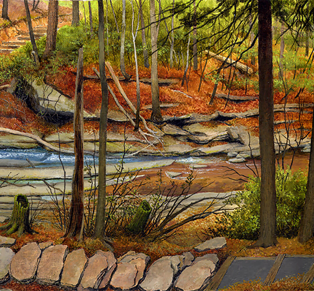
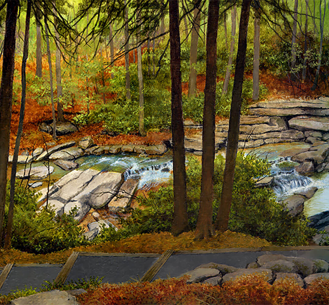
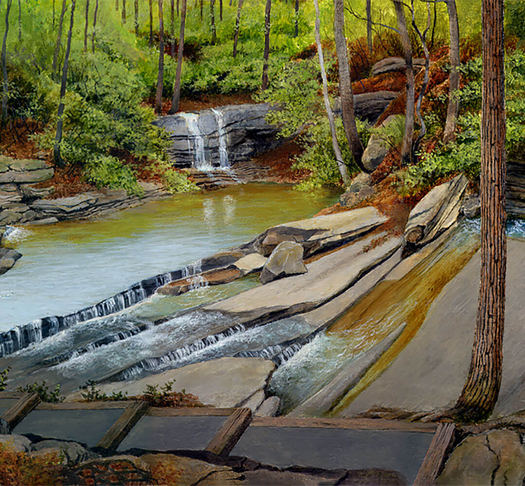
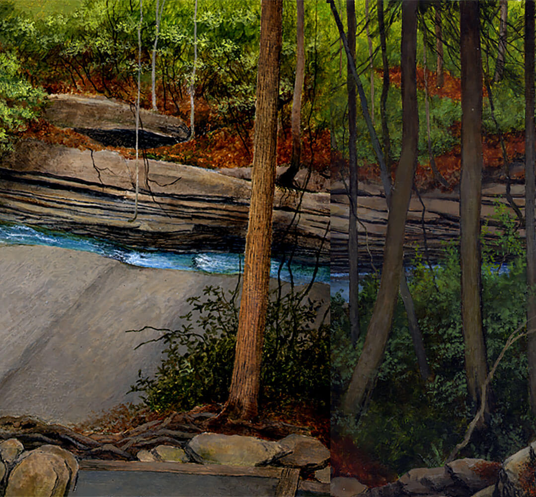
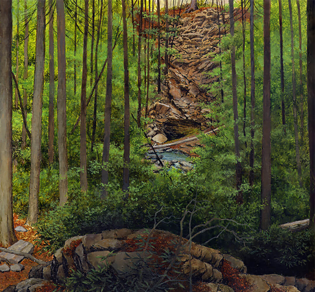
Carrick Creek’s geologic diversity matches its biodiversity of animals and plants. Rocks and minerals are everywhere as rivers and creeks expose what is going on below the earth’s surface.

But first, do you know a rock from a mineral?

Minerals are characterized by their crystal structure, an orderly arrangement of particles in a specific pattern, and defined chemical composition. A visitor can easily find quartz throughout the creek as it is the most common mineral on the earth’s surface.

Rocks are composed of minerals and sometimes other materials that are fused, cemented, or bound together. Unlike minerals, rocks have an inconsistent structure.

Imagine a rock as a chocolate chip cookie, and its ingredients - sugar, flour, chocolate, butter - as minerals that make up that rock.

The rock cycle is an important model for understanding how rocks are formed and change over time. The following are the three major groups of rocks involved in the cycle:

Igneous Rock

Intense heat deep inside the earth melts rocks and minerals to create magma. Hot, liquid magma exits the earth's crust in the form of lava. Igneous rock forms when this magma or lava cools and solidifies. Granite, basalt, and obsidian are examples of common igneous rock types that are all very different based on their texture, grain size, and mineral composition.

Metamorphic Rock

Metamorphism is the physical and chemical change that rock goes through when subjected to heat and pressure. Marble, slate, schist, and gneiss, a widespread rock type at Carrick Creek and Table Rock, are common metamorphic rock types.

Sedimentary Rock

Weathering and erosion continually break down rocks, minerals, and organic materials into fine sediment. Younger layers compress older, lower layers of sediment over time. Chemical and physical processes bond the compacted layers creating sedimentary rock. Sandstone, shale, and limestone are examples of common sedimentary rock types.

Close

SCETV

Carrick Creek is an excellent place to study rocks and minerals.

SCETV

Quartz is a common mineral and easily found in and around the creek.

Clue:

Table Rock's massive exposed dome is primarily granite gneiss, a metamorphosed igneous rock, that formed miles under the earth.

Add clue to notebook

USGS

Feldspar is the most abundant mineral group on earth.

USGS

Gneiss is a common metamorphic rock characterized by bands of minerals.

The Taj Mahal in Agra, India is entirely clad in marble, a common rock type.

USGS

The rock cycle is the process of how rocks are formed.

Next
Prev

Soil Horizons

Erosion along Carrick Creek provides a glimpse into hidden soil layers, or horizons, that can take hundreds to thousands of years to develop. Think of soil as a work in progress and horizons as chapters in its life story. Most soils have three major horizons (A,B,C) and some, including that of Carrick Creek, have an organic (O) horizon.

Horizon O (humus or organic): This layer is formed primarily by decomposing vegetation such as leaves and animal remains or wastes.

Horizon A (topsoil): Decaying organic material, mineral content, and biological activity characterize the topsoil layer. It is the most fertile horizon for supporting plant growth and that of other organisms. Worms, bacteria, tree roots, and fungi in the topsoil contribute to the nitrogen cycle, a process by which nitrogen gas is returned to the air in a form that plants can use.

Horizon B (subsoil): Water leaches downward through the topsoil carrying finely decayed organic materials and minerals to the subsoil. The subsoil contains humus and clays, the finest soil particles. Exposed subsoil makes for poor growing conditions and is often the result of unchecked erosion.

Horizon C: The lowest soil horizon contains mostly inorganic material and weathered rock fragments. Horizon C is the parent material that formed the inorganic make-up of upper horizons.

Bedrock: At the base of the soil horizon is bedrock. Bedrock is a consolidated (solid, dense) stratum of rock that resists water seepage, thus confining water to reachable depths. In some cases, bedrock prevents water from reaching deeper aquifers.

Close

USDA

Soil is a work in progress and soil horizons are chapters in its life story.

USDA

Cross section of soil from the Piedmont landform of North Carolina.

Clue:

Topsoil is the most fertile horizon for supporting plant growth and that of other organisms.

Add clue to notebook
Next
Prev

Red Soil (Iron Oxide)

Many roads and trails in the area have a rusty red color due to iron compounds in the soil. The processes by which iron compounds produce a rusty nail and a rusty trail are similar. Iron compounds corrode when exposed to water and oxygen. During the corrosion process, an iron compound’s surface is oxidized through an electrochemical process that results in a reddish substance, iron oxide or "rust."

Close

Wikimedia/Creative Commons

Red soils and clays at Carrick Creek are "rusting" like a corroded nail.

SCETV

A red trail at Carrick Creek

Clue:

Oxides can weaken or soften rocks, minerals and metals.

Add clue to notebook

Patrick Hayes

A red road in the sandhills landform of South Carolina

Next
Prev

Amphibolite

Amphibolite is a common rock type that once covered the dome of Table Rock Mountain. Over millions of years of uplift and erosion, the weaker and less resistant amphibolite has weathered away to reveal the harder, more resistant granite-gneiss of the dome.

Amphibolite is composed primarily of two mineral families, amphibole and feldspar.

Amphibole contains the elements iron, magnesium, calcium, and aluminum. Minerals weathered from amphibole enhance nutrient-rich soils that support diverse and rare species of plants in the area.

Feldspar, the most abundant mineral group, makes up over 60% of the earth's crust. Feldspar contains aluminum silicates of soda, potassium or lime. The alumina and alkali content of feldspar is utilized to produce glass products, ceramics, and cement. Feldspar weathers into sand and eventually clay materials.

At Carrick Creek, a visitor may recognize amphibolite by its dark color marked with specks of black and white that give it a "salt and pepper" appearance. The mineral hornblende (amphibole) forms the black or dark green bands, and plagioclase (feldspar) forms white bands. It can be distinguished from granite-gneiss by its darker color and tendency to break in angular patterns.

Close

SCETV

Amphibolite in the streambed can be identified by its overall darker color. The red coloration indicates the presence of iron oxidation.

USGS

Amphibolite rock is characterized by its salt and pepper appearance. The darker mineral component is amphibole; feldspar is the lighter.

Wikimedia Commons

Millions of years of erosion and geologic uplift shed amphibolite, a weaker rock, from Table Rock’s harder granite-gneiss dome.

Clue:

Amphibolite, a rock rich in iron compounds, is revealed through red, rust-colored soils in the area.

Add clue to notebook
Next
Prev

Granite-Gneiss

Table Rock Mountain’s striking dome is a massive exposure of granite-gneiss rock that originally formed several miles below the earth’s surface. Approximately 460 million years ago, the ocean floor of the African Continental Plate was slowly colliding into the eastern edge of the North American continent. The event created a subduction zone - a point where one tectonic plate dives under another as it moves toward the mantle. In the process, the ocean plates partially melted and released magma above the subduction zone, yet below the earth's surface. The molten magma crystallized to form Table Rock's breathtaking dome of granite-gneiss. Millions of years of mountain uplift combined with erosional downcutting exposed the dome to the surface to the earth’s surface.

Minerals and granite in Table Rock granite-gneiss are ordered in ribbon-like foliation patterns. Light bands on granite-gneiss in the area are generally composed of quartz and feldspar and dark bands are composed of hornblende and biotite. Granite-gneiss is resistant to erosion and is distinguished from amphibolite, another common rock type in the area, by its lighter gray color.

Close

SCETV

Table Rock’s dome is a massive exposure of granite-gneiss rock.

Wikimedia/Creative Commons

Ribbon-like patterns in Table Rock granite-gneiss are identified by light bands of quartz and feldspar minerals and darker bands of hornblende and biotite minerals.

Clue:

Table Rock’s dome is a pluton.

Add clue to notebook

SCETV

Granite-gneiss in the streambed tends to be lighter in color. Notice banding along rock layers and small tiers indicating exfoliation.

Next
Prev

Plutons and Batholiths

Table Rock's granite-gneiss dome was once molten magma solidified several miles under the earth’s surface during the Ordovician era (495-440 MYA). Hundreds of millions of years of uplift, erosion, and exfoliation eventually exposed it to the surface. Geologists call igneous rock bodies that formed below the surface, but are now exposed, plutons and, if over 40 square miles, batholiths. The name is inspired by “Pluton,” the Roman god of the underworld.

The Table Rock formation was pushed toward the earth’s surface by uplift from the collision of tectonic plates as weathering and erosion removed less resistant rock layers from its top. Wind, rain, and stream erosion continue to carve out coves and streambeds.

Half-Dome, a granite monolith in Yosemite National Park, is perhaps one of the world’s most familiar batholithic structures. Forty Acre Rock, a popular hiking destination in the Piedmont of South Carolina, is a pluton at under 40 square miles.

Close

SCETV

Millions of years ago, the Table Rock pluton was buried miles under the earth’s surface.

Wikimedia Commons

Half-Dome at Yosemite National Park is one of the most recognizable batholiths in the world.

Steven R. Thomas

Forty Acre Rock, a popular hiking destination in South Carolina, is granitic mass known as a pluton.

Clue:

Uplift, weathering, erosional downcutting, and exfoliation shaped Table Rock Mountain over hundreds of millions of years.

Add clue to notebook

SCETV

In this diagram, (1) indicates formation of pluton below earth’s surface and (2) shows how pluton is revealed through uplift, erosion, and exfoliation.

Next
Prev

Quartz

Quartz is a hard, crystalline mineral found in many shapes and forms along the Carrick Creek streambed. It is a valuable mineral resource that is found from South Carolina's mountains to the sea. Crystalline structures of quartz rocks fracture into sharp edges, which made ideal material for early Native American arrowheads. Nineteenth-century miners sought the presence of quartz veins that indicated the presence of gold, a mineral that is sometimes emplaced in quartz during crystallization. Quartz sand mines throughout the state provide the primary material for glass and concrete. Beach sand (of which quartz is the major component) itself is managed as a resource supporting South Carolina's coastal tourism industry.

Sand at the beach was eroded from quartz deposits found upriver, as far up as the mountains. Quartz, or silicon dioxide (Si02), is a common rock-forming mineral, and one can find quartz stones or sediments in nearly every streambed in South Carolina. The crystalline structure of quartz has component ions, atoms, and/or molecules packed in an orderly fashion. Various structures of quartz appear in many varieties and colors; opaque and white (milky); semi-transparent or transparent brown (smoky), purple (amethyst), red (rose), or completely colorless. Quartz crystals have six-sided prism faces that always form a 60-degree angle. The duration at which magma cools determines the size of quartz crystals, with longer cooling periods resulting in larger crystals.

Close

Clemson University

Quartz is a hard crystalline mineral found from South Carolina’s mountains to the sea.

Bill Bristow

Crystalline structures of quartz fracture into sharp edges making it an ideal material for Native American arrowheads.

U.S.A.F., Amber Jacobs

Southeastern beaches are composed of quartz sand that were eroded, transported, and deposited by rivers.

Clue:

Rivers deposit weathered quartz sand at South Carolina beaches.

Add clue to notebook

JJ Harrison

A striking quartz crystal found in Tibet.

Next
Prev

Feldspar

A hiker might notice wart-like formations on stone surfaces along the Carrick Creek streambed and trails. These “warts” may indicate the presence of feldspar, a mineral type that is more resistant to weathering than the rock formation around it. The earth's crust is composed of nearly 60% feldspar, its most common mineral group.

Feldspar is found in igneous, metamorphic and sedimentary rock. The name derives from the German word for "field stone." As it weathers, feldspar releases nutrients such as potassium that are beneficial to vegetation and agriculture. Clay contains a great amount of weathered material from feldspar.

Close

SCETV

In this image, the minerals feldspar and quartz are seen together in a rock formation at Carrick Creek. The whiter, flashier quartz is lower left and more opaque, flat faces of feldspar can be seen upper right.

USGS

As it weathers, feldspar releases nutrients such as potassium that are beneficial to vegetation and agriculture.

Clue:

Feldspar is a mineral type that is found in igneous, metamorphic and sedimentary rock.

Add clue to notebook

James St. John

Kaolin, a clay found in South Carolina, is produced by the chemical weathering of aluminum silicate minerals like feldspar.

Next
Prev

Mica

Abandoned mica mines in Table Rock State Park’s vicinity speak to valuable geologic resources found in the upstate. Large pieces of mica were historically used in windows, roofing materials, stove doors, goggles and jewelry, and continue to be used in electrical and heating insulation, paints, and roofing materials. Its slight transparency and resistance to heat are desirable for many of these products. Mica at Carrick Creek can be found embedded in rock, or as shiny flakes or sediment.

The word "mica" originated from the Latin word "micare," which means "to shine." The mica mineral group (SiO4) has flat, smooth and shiny surfaces due to a near-perfect cleavage. Crystallized minerals break along cleavages, which are parallel, crystallized planes in mica. Cleavage planes result from the orderly make-up of atoms, ions and/or molecules in crystalline minerals. Mica is less resistant than quartz, and mica sediments are flushed out and down the waterway easily.

Close

SCETV

Muscovite is the most common mineral of the mica family.

SCETV

Shiny specks of mica reflect light on this rock near Carrick Creek.

Wikimedia Commons

An antique window made with mica.

Clue:

Shiny metallic looking bits of mica mineral sediments can be found in and around Carrick Creek.

Add clue to notebook
Next
Prev

The Carolina Gold Rush

The Carolina Gold Rush, the first in the United States, originated in 1799 when a 12-year-old boy discovered a fourteen-pound nugget in a North Carolina creekbed. Unaware of its value, his family used the object as a doorstop until a jeweler appraised it in 1802. The rush was on as eager miners explored mountain streambeds and surface quartz veins for the precious metal. In the same year, gold was discovered in Greenville County, South Carolina. In 1827, a large-scale gold mining operation began in Kershaw, where a landowner found a large nugget glittering in a stream bed. The Haile Mine was the richest single mine in the eastern United States, and by 1829, it was shipping to the Philadelphia Mint.

Early prospectors profited from streams that exposed deposits of valuable minerals weathered from mountains and hills. Gold deposits in South Carolina are sometimes found in quartz veins, often located below the earth’s surface. The large nugget had likely eroded from an exposed vein and was deposited downstream.

Close

USGS

Major gold deposits in South Carolina.

SCDHEC

Current Haile gold mining operation in Lancaster County, South Carolina

James St. John

A large gold nugget found in Australia

Clue:

Quartz veins, a sheetlike body of crystallized minerals, can be used to indicate the presence of gold deposits.

Add clue to notebook
Next
Prev

Mechanical Weathering

The geologic landscape of Carrick Creek is in constant motion, a feature that is mostly imperceptible to the human eye. Physical force slowly breaks rock formations, rocks, and minerals down into smaller particles. The abrasion of storms and rushing water, expansion of ice, plant growth, and geologic uplift are all forms of mechanical weathering.

Abrasion: Water and wind scrape sediment and particles across rock, functioning like a piece of sandpaper. The process also removes additional sediments and particles from rocks and minerals. Abrasion is one of the most visible forms of weathering along Carrick Creek.

Frost Wedging: Cracks in rocks often contain water, especially in humid climates such as the Blue Ridge Mountains. Freezing and thawing of water cause ice to expand and contract, wedging and weakening the rock material.

Biomechanical: Tree roots shape the landscape by growing under, in between, and through rock formations. Rocks are fractured and rubbed by the pressure of growing roots.

Pressure Release: Pressure was released when Table Rock's dome reached the earth's surface and shed its overlying rock layers. This reduction in pressure fractures rock layers as they contract. Fractures cause the rock mass to peel away like an onion in a process called exfoliation.

Close

Public Domain

Wind and water abrasion slowly sculpt the unusual formation of sandstone known as “The Wave” in Arizona.

SCETV

Growth of trees and roots act as a wedge in rock cracks, fracturing and eroding it through biomechanical weathering.

Clue:

Mechanical weathering is one of two types of weathering.

Add clue to notebook

UNL.edu

Rock exfoliating in layers as pressure is released on a dome mountain.

Next
Prev

Chemical Weathering

Water is a chief agent in chemical weathering, a form of erosion caused by chemical reactions in contrast to mechanical forces. Chemical weathering causes rocks and minerals to decompose or transform into new substances through changes in chemical structure. There are four primary forms of chemical weathering, all at play in the vicinity of Carrick Creek.

Solution: Mineral materials may detach from a rock in a liquid substance and dissolve into their component ions. Bicarbonates or ionic salts, created by this process, represent the major dissolved load of rivers. Limestone caves and sinkholes are examples of landforms shaped by solution. Calcium carbonate, a major component of limestone, dissolves easily in acidic solvents produced by organic materials.

Hydrolysis: Hydrolysis occurs when mineral substances react and/or decompose when subjected to water’s hydrogen or hydroxyl components. Feldspars break down into clays through the process of hydrolysis.

Oxidation: Minerals may react to oxygen in the air or water and transform into oxides. Oxides can weaken or soften rocks, minerals, and metals. Iron, a common mineral in rocks, is oxidized to become iron oxide or rust.

Biological: Acidic compounds released by plants and animals chemically weather rocks and minerals. Lichens and fungi break down minerals by releasing acidic compounds that slowly "eat" away at the rock. Bacteria also secrete acidic compounds.

Close

USGS

Solution, a form of chemical weathering, was responsible for the massive Winter Park Sinkhole of 1981 in Florida.

Radford University

Granite gneiss converting to clay by hydrolysis

USGS

The red coloration of this piece of limonite, an ore of iron, is due to oxidation.

Clue:

Oxides produced by oxidation can weaken or soften rocks, minerals and metals.

Add clue to notebook

SCETV

Lichens on rocks at Carrick Creek contribute to biological weathering.

Next
Prev

Rain Erosion

In 2018, 123.45 inches of precipitation were recorded over a year at the nearby Walhalla Fish Hatchery in Mountain Rest, breaking a state record in South Carolina. Rainwater is the primary agent of soil erosion, especially in humid areas such as the Blue Ridge Mountains and upper Piedmont. Rainwater creates erosion in many forms, and one can see evidence of it throughout the Table Rock landscape.

Splash Erosion: Like small explosions, the impact of raindrops agitates tiny particles of soil, sediment, and weakly resistant rock.

Sheet Erosion: Rain accumulates on top of surfaces that are unable to absorb its load. Flowing sheets of rainwater remove soil and sediment as they move down-slope toward drains, creeks, and other waterways.

Rill Erosion: Rainwater can cut out small channels called rills as it flows over the soil layer. Rills may become gullies, a more severe form of erosion.

Gully Erosion: Networks of rills sometimes form gullies. Gullies are trenches formed from erosion that widen from successive actions of erosion agents. Heavy rains are capable of removing large loads of soil from gullies.

Close

Publicdomainpictures.net

The impact of raindrops can erode surfaces.

Lynn Wunderlich

Sheet and rill erosion on a dirt road. Rills are the channel networks. Areas of sheet erosion are the smooth textured surface soil surrounding the rills.

Clue:

Erosion is the movement of sediments and soil by wind, water, ice and gravity.

Add clue to notebook
Next
Prev

Stream Erosion

Stream erosion is one of the most powerful and visible forces shaping the landscape of Carrick Creek. The flow of the creek continually transports organic matter, dissolved materials, sediment and stones downstream. Larger flows are capable of moving boulders and trees. Once immersed, the materials scour the area like sandpaper as they flow downstream. The scouring action carves out the streambed, adding even more material to the sediment load of the river. Downward stream erosion, also called downcutting, is a primary factor in shaping channels, valleys and canyons.

Close

SCETV

Stream erosion can transport rocks and boulders downstream at Carrick Creek.

SCETV

Carrick Creek slowly cuts away surrounding areas in the process of stream erosion.

Clue:

Downward stream erosion, also called downcutting, is a primary factor in shaping channels, valleys and canyons.

Add clue to notebook

USGS

Stream erosion from the Colorado River downcut the Grand Canyon over millions of years.

Next
Prev

Wind, Waves, Ice and Gravity

Moving water is one of the more apparent agents of erosion on the landscape, but there are several other forms shaping Table Rock and Carrick Creek.

Wind Erosion: Table Rock's dome is exposed to the effects of wind erosion. Wind scours the landscape’s surface like sandpaper as it carries large loads of sand and sediment from place to place. Wind erosion is most common in dry areas such as deserts and beaches. Dunes are created as wind deposits sand in a single location.

Ice Erosion: Ice scrapes materials off rocks and soil as it moves across their surfaces. Moving glaciers are the most severe form of ice erosion.

Gravity: Hills and mountains with steep gradients such as those around Carrick Creek experience erosion created by gravity. Materials move down-slope in a process called mass movement. Creep, rockslides, and potentially destructive mudslides are all forms of mass movement.

Wave Erosion: The hydraulic action of waves and the abrasive elements in seawater can remove sediment and rock from the coast. Coastlines that experience severe wave erosion generally have bluffs or cliffs. Carrick Creek experiences some wave erosion, mostly in turbulent areas near waterfalls.

Close

USGS

Moving glaciers are the most severe form of ice erosion. Image of Bering Glacier, Alaska

USGS

Gravity caused this massive landslide, or mass movement, in Washington state.

Clue:

Gravity moves materials down-slope in a process called mass movement.

Add clue to notebook

USFWS

Results from wave erosion and tidal surge after major storm on the North Carolina coast

Next
Prev

Sediment Load

Even clear water such as that of Carrick Creek has a certain degree of sediment load. A stream's sediment load is composed of suspended and/or dissolved rock and mineral particles. Scientists study sediment load to determine shapes and drainage patterns of streams, and as a health indicator for aquatic ecosystems.

There are three major forms of sediment load:

The stream's dissolved load is the smallest, invisible component of sediment load. Particles of the dissolved load are taken into solution due to rocks’ chemical weathering and transported as chemical ions.

The suspended load consists of fine sediments such as silt and clay. These materials are usually deposited in still waters such as lakes, floodplains and coastal areas.

The bed load consists of coarse particles that are too heavy to be suspended by the stream current. Sand, pebbles, and gravel slowly slide and skip along the bottom of the stream bed. Increased streamflow may temporarily suspend these materials.

Sediment load can indicate changes in watershed conditions caused by climate, erosion rates, vegetation, topography, and land use. Changes in sediment levels may affect the health of the entire ecosystem. For example, to reproduce effectively, salmon and trout need gravel streambeds for spawning and egg survival. Silt and clay introduced by flooding or excessive erosion can destroy these spawning beds. Stream deposits also represent huge potential sinks for, and sources of, contaminants.

Partially adapted with permission from: http://www.gcrio.org/geo/stream.html

Close

SCETV

A stream's sediment load is composed of suspended and/or dissolved rock and mineral particles.

Wikipedia

Diagram showing dissolved, suspended, and bed loads in waterway

Clue:

Water, wind or ice drop or deposit sediments in a process called deposition.

Add clue to notebook

USFWS

To reproduce effectively, trout and salmon need gravel streambeds and water clear of sediments.

South Carolina Army National Guard

Massive amounts of sediment were introduced into the Saluda, Broad and Congaree watersheds during the 2015 flood in Columbia, S.C.

Next
Prev

Deposition

Deposition is the process by which flowing water transports material from one place and deposits it in another. If you place a handful of sand or silt in a creek and watch it flow downstream, you are witnessing stream deposition in action. Every landform in South Carolina is shaped in some form by this process.

Rocky landscapes of hills and mountains influence deposition in the Blue Ridge landform. Steep elevations have fast-moving waterways that move sediment and dissolved elements quickly downstream. Boulders, rocks, and pebbles move slowly yet steadily down the streambed at different rates. Fast-moving water in creeks and rivers is generally cold, clear and flushed of sediment and silt.

Streams and rivers become slower and broader as they enter the Piedmont’s gently sloping topography. Sediment introduced by rain runoff from clay surfaces of the Blue Ridge and Piedmont landforms may color water brown or reddish-brown.

Sand, clay, and marine fossils characterize the Sandhills landform. Over 100 million years ago, accumulations of quartz sand, eroded from upstream mountains, were deposited at this ancient shoreline where the mouths of waterways entered the sea.

The landscape of the Coastal Plain ranges in elevations from 125 feet to sea level. Streams and rivers occasionally flood out over the flat terrain. Flooding distributes the river’s current across the floodplain, and loads of sediment and silt are deposited in the slower, less turbulent water. Deposition in the Coastal Plain contributes to interesting landforms such as floodplains, meandering rivers, oxbow lakes, sandbars, swamps and wetlands.

Sediments that survive the trip downriver, and are deposited, accumulate at the waterway’s slow-moving mouth, within the beaches and Coast of South Carolina. Uniform size and resistance to weathering are typical of sediment and silt deposited in deltas, marshes, and beaches. Mineral salts weathered from rocks upriver are part of the river's dissolved load and enter the ocean at the river's mouth.

Close

SCETV

Steep, mountainous waterways such as Carrick Creek quickly flush eroded sediments downriver.

Upstate Forever

Sediment filled water traveling downstream on the Upper Saluda River within the Piedmont landform.

Clue:

Sediments deposited in the Coastal Plain landform create interesting landforms.

Add clue to notebook

Steve Thornton

Sand deposited by rivers at an ancient Sandhills beachfront at Peachtree Rock Heritage Preserve near Columbia, S.C.

SCETV

A deposit of sediment along Carrick Creek

Summer’s Corner

This sandbar on the Edisto River is characteristic of deposition in the Coastal Plain landform.

Mary Edna Fraser

The Kiawah River flows into the Atlantic Ocean at the Coast landform of South Carolina.

Next
Prev

Deposition Study

To learn more about the journey and transformation of sediment from the mountains to the sea, a group of students analyzed sediment samples from the Middle Saluda River near Table Rock and Myrtle Beach. The following are the results of their study:

  • Table Rock sample contained many types of minerals and rock fragments. Myrtle Beach sample contained mostly quartz grains with few other minerals.
  • Table Rock sample contained a combination of rounded and angular grains. Myrtle Beach sample contained well-rounded grains.
  • Table Rock sample contained poorly sorted grains. Myrtle Beach sample was well-sorted and all grains were about the same size.

What does this tell us?

  • Minerals that are more resistant (quartz) survive the trip across the landscape.
  • Minerals that are less resistant dissolve easily in water, and may dissolve into their component ions, which include sodium, magnesium and chlorine. The ocean is salty because of these ions, which also help to regulate the pH of streams.
  • Weathering causes sediment pieces to get smaller and more rounded with the distance traveled. Depending on the flow of water, only pieces of a certain size can be transported. Deposition usually sorts minerals by size.

Content adapted with permission from SC Maps: "What Happens to Sediment from the Mountains to the Sea”

Close

SCETV

Rocks and minerals in the form of sediment, sand, stones, and boulders are deposited in Carrick Creek’s streambed

SCETV

The Table Rock sample contained more types of minerals and rock fragments.

USAF

The Myrtle Beach sample contained mostly quartz grains, a resistant mineral that survived the trip downstream.

Clue:

Weathering breaks down rocks and minerals into smaller pieces that are moved in a process called erosion.

Add clue to notebook
Next
Prev

Plate Tectonics

Mountains such as Table Rock are formed by processes occurring many miles below the earth’s surface. The outermost “plates” of the earth shift, collide and divide in a process that mostly goes unnoticed on the surface. Earthquakes and volcanic eruptions are the most dramatic evidence of such activity, while mountain building mostly is imperceptible and occurs over hundreds of millions of years.

Tectonic plates have been shifting since they formed nearly 4.6 billion years ago, at the beginning of geologic time on earth. Plates periodically collide or separate, changing the Earth’s physical geography. Plate tectonics is the theory behind how and why continents stay on the move.

The earth consists of a crust, mantle, and core that get hotter and denser with increasing depth. Oceanic and continental crusts, along with the upper mantle, compose the lithosphere, which is divided into moving slabs of rock called tectonic plates. The greater tectonic plates of the rocky lithosphere hold the Earth's continents and oceans while slowly sliding atop the molten "plastic" of the Earth's outer core, or asthenosphere.

Events such as earthquakes and volcanic eruptions are commonly associated with activity at fault zones between plates. Faults are fractures between two blocks of rock that move relative to each other. Mountains are formed by converging and diverging boundaries of plates, and by uplift caused by magma rising and pushing up against the Earth’s crust.

Close

Wikipedia

Simplified map of Earth's principal tectonic plates, which were mapped in the second half of the 20th century (red arrows indicate direction of movement at plate boundaries)

USGS

An eruption at Kilauea Volcano, Hawaii

USGS

A cutaway of the internal structure of the earth showing its three main layers: the crust, mantel and core

Clue:

Mountains, hills, faults and other land formations are evidence of the earth moving beneath our feet.

Add clue to notebook

USGS

“The Great Earthquake” of 1886, the result of the North American plate in motion, caused massive destruction in Charleston, South Carolina.

Wikipedia Commons

Convergent boundary where two plates collide

Next
Prev

Mountain Building

Volcanic activity and collisions of the earth's crust form mountains over hundreds of millions of years. There are three major types of mountains.

Fold Mountains form as tectonic plates collide, pushing up the earth's surface to create massive "wrinkles" in the landscape. Take a piece of carpet and push it from both ends. What happens? The nearby Appalachian Mountains are an example of fold mountains.

Dome Mountains form from the uplifting of a tectonic plate as magma deep within the earth rises and pushes up the crust without erupting. The magma cools and solidifies to form the basis for the mountain. Table Rock mountain, and nearby Sassafras and Caesar’s Head mountains are examples of dome mountain building.

Fault-Block Mountains: A fault is a place where layers of the earth's crust slip and slide across one another. Plates either dropping below or pushing above the landscape form fault-block mountains. The Teton Range is a dramatic example of fault-block mountain building.

Volcanic Mountains: Ruptures in the earth's crust sometimes occur where tectonic plates converge or diverge. Molten rock, or lava, and gases escape through ruptures during periods of volcanic activity. Accumulations of hardened molten rock in the vicinity of a rupture may form mountains over time. Mount St. Helens is an active volcanic mountain in Washington state. It’s eruption in 1980 was the deadliest and most destructive volcanic event in U.S. history.

Close

Wikimedia Commons

Table Rock Mountain is a dome, or upwarped, mountain.

Ken Thomas/Public Domain

The Appalachian Mountains are fold mountains.

Jon Sullivan/Public Domain

The Teton range in the Rocky Mountains are fault-block mountains.

Clue:

Table rock is a dome mountain formed in part by the uplifting of a tectonic plate.

Add clue to notebook

USGS

1980 eruption of Mount St. Helens, a volcanic mountain, in Washington state.

Next
Prev

Exfoliation

Rock layers are peeling away from the Table Rock's dome in the manner that layers peel away from an onion. This geologic "peeling" is called exfoliation. A visitor can see evidence of the process on a massive scale atop Table Rock's dome, and on a smaller scale on boulders and rock faces near the creek.

Why does this process occur?

Weathering and erosion shed away less resistant rock overlying the more resistant layers of Table Rock’s signature dome of granite-gneiss. Once released from the downward pressure of overlying rock, additional layers of rock underneath are free to expand and fracture. Fractures run in curved sheets and peel in parallel layers, like those of an onion. Freezing and thawing water may upset layers causing them to cleave off the granite mass.

On a smaller scale, rocks along Carrick Creek's streambed show signs of exfoliation. A "hollow" sounding rock is the result of gaps that form between exfoliating layers of rocks. The exfoliation process may also produce small terrace-like ridges seen on boulders.

Table Rock Mountain is considered an "exfoliation dome." Other exfoliation domes include Stone Mountain, Georgia; Looking Glass Mountain, North Carolina; and Half Dome in Yosemite.

Close

Wing-Chi Poon (cc)

Geological exfoliation of granite dome rock in the Enchanted Rock State Natural Area, Texas, U.S.A.

Diagram showing exfoliation process also known as “onion skin” weathering

SCETV

This boulder found in Carrick Creek shows signs of exfoliation.

Clue:

Weathering and erosion are part of the geologic process of exfoliation

Add clue to notebook

Half Dome at Yosemite National Park is an enormous batholith and exfoliation dome.

Next
Prev

Creep (Mass Movement)

The surface of the land - soil, organic debris, and vegetation - around Carrick Creek is sliding down the side of Table Rock’s mountains and hills in a process called "creep." Creep is the slow, nearly imperceptible downhill flow of the soil layer due to gravity. The rate of creep may be affected by environmental factors, including humidity, erosion, vegetation, and soil type. Leaning telephone poles and homes, and curved tree trunks may indicate the process of creep at work on the landscape. Creep also influences the area’s water chemistry by introducing organic debris, soils and clays into the creek.

Creep is the slowest form of mass movement, the general process by which material is transferred downslope due to gravity. More severe rates of mass movement create rockfalls, rockslides and mudflows.

Slope gradient helps geologists determine the rate of mass movement of the soil layer. The steeper the slope, the easier it is for soil to creep down its sides. Gullies, stream erosion, and poor construction practices may cut into the slopes’ sides, causing rapid mass movement in the form of landslides and rockfalls.

Close

USGS

Creep is the slow, nearly imperceptible downhill flow of the soil layer due to gravity.

SCETV

The effects of creep have caused the bend in these trees at Carrick Creek.

Herbythyme Wikipedia (cc)

A rockslide, such as this one at a beach in England, is an example of rapid mass movement.

Clue:

As creep moves trees downhill, they may respond to light stimuli by bending at the trunk.

Add clue to notebook
Next
Prev

Watershed (Drainage Basins)

Citizens of Greenville, South Carolina tap an extremely clean reservoir of water because of protected watersheds around Table Rock. Watersheds, also called drainage basins, are areas where water flows downhill toward a common water body. Watersheds are defined by drainage divides, or high points on the landscape where rain or snow runs down one side or the other.

We all live in a watershed. Smaller watersheds are part of larger watersheds. Watersheds are obvious in areas with mountains and valleys where water flows toward rushing creeks and rivers. Watersheds are less obvious on landscapes with little relief such as plains and flatlands. Water in flat areas usually collects in lakes and wetlands.

Major drainage divides are well known. The Continental Divide is a boundary where water on one side of the divide flows toward the Pacific Ocean, toward the Arctic or Atlantic Oceans. The Eastern Divide is a boundary where water flows toward either the Gulf of Mexico or the Atlantic Ocean.

Rain on the north slope of Table Rock Mountain will flow toward the Table Rock Reservoir. Rain on the south slope may enter Carrick Creek through one of its tributaries. Carrick Creek eventually enters the Middle Saluda River, a part of the largest watershed in South Carolina, the Santee watershed. Waters of the Middle Saluda River flow into the Saluda, Congaree and Santee rivers before finally draining into the Atlantic Ocean over 250 miles downstream (SCDNR).

Adapted partially, with permission, from: http://www.swfwmd.state.fl.us/education/kids/watershed.php

Close

Table Rock Reservoir collects water flowing downhill within the drainage basin.

We all live in a watershed, also known as a drainage basin.

Clue:

Water from Carrick Creek flows into the Middle Saluda River and may eventually end up in the Atlantic ocean over 250 miles downstream.

Add clue to notebook

Karl Musser

Carrick Creek is part of the greater Santee River Basin. Water flowing in Carrick Creek flows into the Saluda River Basin and may end up at the ocean via the Cooper River.

Clemson University

The 8 major drainage basins of South Carolina.

Next
Prev

Confluence

Green Creek enters Carrick Creek at a near right angle along the trail. The point at which two streams or rivers join to form a single waterway is a confluence. A river's confluence represents an increase in a stream's volume as two waterways become one.

Further downstream, Carrick Creek eventually joins the South Saluda, which combines with the Middle and North Saluda Rivers to form the greater Saluda River, a major waterway flowing through the Piedmont of South Carolina. Near Columbia, the Saluda and Broad Rivers combine to form the even larger Congaree River.

Close

Green Creek flows into Carrick Creek at a confluence, a point at which two waterways converge

GISGeography

Major rivers and confluences in South Carolina

Clue:

The Congaree River is formed at the confluence of the Saluda River and Broad River. Downstream, the confluence of the Congaree River and the Wateree River form the Santee River.

Add clue to notebook
Next
Prev

Groundwater

Seepages along Carrick Creek reveal layers of groundwater beneath the soil's surface. Groundwater is water that fills the open spaces and pores of soil and rock material. A well is simply a large hole that reaches below ground into an aquifer, a pocket of groundwater.

Gravity causes water to sink down through layers of soil, sand, rock and gravel. At a certain point, water reaches the saturated zone, a point at which the ground is completely soaked. The top of the saturated zone is called the water table. The water table may be close to the surface of the ground or hundreds of feet down, depending on aspects of an area's geology, gradient, soil type and climate.

Groundwater is revealed in several ways. A well is created by digging down to the water table and into the zone of saturation. Springs and seepages are formed by water moving along the water table or along an impermeable surface, and then released at exposures in the soil.

Close

SCETV

Water trickling out of a seepage near Carrick Creek

Phyllis Newbill

Diagram showing the water table and zone of saturation

Clue:

Gravity causes water to sink down through layers of soil called “horizons.”

Add clue to notebook
Next
Prev

Floods

Flood events may carry heavy debris such as stones, small boulders and downed trees down waterways of the surrounding hills and mountains. Bone dry gullies fill and drain the area of surplus runoff, swelling lower creeks and rivers with the extra surge of water and debris. Evidence of recent flooding can be seen as piles of debris accumulate along creek snags or high water areas.

Flooding across cleared or exposed terrain may increase levels of sediment and runoff pollution into streams and rivers. Changes in water quality caused by floods can be detrimental to aquatic animals, such as trout and salamanders, or as drinking water for humans. Heavy downhill erosion can also scar the landscape by forming deep gullies and landslides.

Close

Queensland Chief Scientist

Factors that contribute to flooding

SCETV

Large stones and boulders at Carrick Creek, as seen in foreground, can move during extreme floods.

Susan Newman

This bridge on the Eastatoe Passage of the Palmetto Trail was damaged by heavy flooding in 2020. Notice the high sediment load introduced by recent flooding.

Clue:

Flooding is a powerful and sometimes destructive agent of erosion.

Add clue to notebook
Next
Prev

Droughts

While a flood can transform Carrick Creek into a raging torrent, a major drought can shrink it to a trickle of its former flow. As creeks become shallow during periods of drought, aquatic animals such as fish may become isolated in puddles, pools and small ponds cut off by the reduced flow.

Water temperatures can rise, as shallow water is more vulnerable to sun and heat. Warm water can kill or sicken aquatic animals, as oxygen levels decrease and body temperatures and water-borne bacteria increase. Standing or slow-moving warm water is conducive to algal growth and decomposition that can further choke the stream of oxygen.

Long periods of drought can kill trees, increasing deadfall while decreasing the cooling shade of the canopy. Animals may starve when the food chain is interrupted by a decrease in edible vegetation. Black bears, a rare sight in Table Rock and Carrick Creek’s more public areas, may be tempted to explore campsites and trash bins as their natural supply of food and water dwindle in more remote drought-ridden areas. In 2016, drought reduced Carrick Creek to a trickle while creating conditions for wildfires that ravaged the area.

Close

Kara Armano, Trout Unlimited

Drought conditions endanger the flow and habitat of this trout stream in Colorado.

Michelle Crowe

A major drought in 2016 led to wildfire on Pinnacle Mountain next to Table Rock Mountain.

Clue:

Black bears may be tempted to enter campsites and trash bins as their natural supply of food dwindles in drought-ridden forests.

Add clue to notebook
Next
Prev

Water Cycle

Water is literally as "old as the hills" - in fact, it is almost as old as the earth itself. Water in Carrick Creek might once have been part of an ancient sea teeming with trilobites, a polar ice cap, a cloud, or the Ganges River. The earth recycles the same limited water supply that has sustained life for hundreds of millions of years. The water cycle is the process that keeps water in continual motion and hard at work.

There are three primary processes involved in the water cycle, also called the hydrologic cycle:

Evaporation is the process by which solar energy transforms liquid water into vapor, water's gaseous state. Water within plants is evaporated into water vapor through a process called transpiration.

Condensation occurs when water vapor cools in the atmosphere and condenses into tiny liquid water droplets, creating clouds and fog.

When tiny droplets of water collect and become too heavy to be supported by the atmosphere, they fall to the earth as precipitation. Rain, sleet, snow, dew and fog are all forms of precipitation.

Precipitated water is set in motion yet again after it hits the surface of the earth. Some water runs off into streams and rivers flowing toward the sea. Water may also soak into porous soils to become groundwater. Plants absorb precipitation and return it to the atmosphere through transpiration. In extremely hot areas precipitation may evaporate immediately back into the atmosphere.

Close

NASA

The water cycle is the process that keeps water in continual motion.

Patrick Hayes

Water evaporates as the sun rises above the Congaree River in South Carolina

Clemson3564 (cc)

Condensation in the form of clouds over Table Rock mountain

USGS

Rain is a form of precipitation.

Clue:

Plants absorb precipitation and return it to the atmosphere in the process of transpiration.

Add clue to notebook
Next
Prev

Carrick Creek

All ecosystems are unified around a need for water, and Carrick Creek plays an integral part of the landscape it passes through. Animals such as raccoons hunt for fish, crayfish and insects in its flow. A diversity of forest dwellers regularly travel to its banks for a drink of water. Hemlock and rhododendron thrive in saturated and acidic soil that collects along the streambed, the product of precipitation eroding area rocks and minerals and running off into the watershed. In contrast, conifers such as loblolly pine that require dry soil are found above and away from the streambed.

As the stream influences the terrestrial environment around Carrick Creek, the surrounding landscape influences its aquatic environment. Insects that fall off trees become part of the aquatic food web where fish or salamanders may consume them. The shade of low-hanging hemlock branches and the thick tree canopy above help to keep the stream cool. These are ideal conditions for trout and colder climate amphibians, and for the macro-invertebrates that amphibians eat - an often overlooked yet crucial part of the food chain.

Aquatic plants and microorganisms need essential nutrients such as nitrogen and phosphorus that wash into the stream from the soil, and from decomposing plants, animals and their waste products. Chemical and mineral matter is also introduced into the stream as rocks and minerals erode, further shaping the stream's water chemistry. Carrick Creek’s fast moving stream is constantly flushed of nutrients and considered nutrient-poor while ponds, slow rivers, and lakes below the creek are generally more nutrient-rich.

Close

SCETV

Ecosystems are unified around a need for water.

Needpix

Forest dwellers utilize the stream for water and food.

Food chain of a wetland area

SCETV

Carrick Creek is both an aquatic and cove forest ecosystem.

Clue:

The wooly adelgid is an invasive insect that has caused harm to Carrick Creek’s natural ecosystem by killing hemlock trees.

Add clue to notebook
Next
Prev

A Rotten Stump

A rotting tree stump near Carrick Creek is a zoo of activity. Take a closer look to see a microcosm at work.

Decaying organisms and organic matter release nitrogen compounds and nutrients that are the "food" of decomposers such as bacteria, bugs, and fungi. Bacteria transform the dead tree's unused energy into carbon monoxide and new forms of nutrients. Special enzymes in fungi help break down more complex tissues and materials in the wood. Mushrooms, a form of fungi, are easily spotted growing on or near rotten stumps.

A rotten stump is also host to various ants, millipedes, and slugs that consume decaying material. Beetles lay eggs on the stump so their larvae may eventually feed on the soft wood. Termites consume the rotting wood. In a symbiotic relationship, protozoa in the termite's hindgut process the cellulose, which feeds their termite host.

The food web further expands around the stump as mammals, reptiles, birds, and amphibians feast on the rotten stump's smaller dinner guests. Nutrients and organic materials in the soil build up as the decomposing vegetation breaks down. Eventually, the stump disappears, completely recycled through the process of decomposition.

Close

SCETV

Rotting trees and stumps are microcosms of activity.

Slugs consume decaying material and, in turn, the slug may be consumed by a higher level predator.

A common millipede can often be sighted on decomposing tree trunks and logs.

Clue:

Decomposing trees and stumps are an integral part of the Carrick Creek ecosystem.

Add clue to notebook
Next
Prev

Carbon Dioxide-Oxygen Cycle

The Carbon Dioxide-Oxygen Cycle is an ecological and chemical engine essential to life on earth. Great forests and oceans of the earth do much of the work so it is easy to see why their conservation is vital.

Your body obtains about 10% of the energy it needs to function through food and water, and about 90% from oxygen transported through the body in your bloodstream. The oxygen in your body, like the water in the creek, constantly cycles through the ecosystem and the organisms it sustains. The carbon dioxide-oxygen cycle is the process by which these gases move continuously through the environment.

In photosynthesis, plants, algae, and some bacteria use carbon dioxide to convert energy from the sun into food they can use. Oxygen is released as the waste product. Photosynthesis carried out by phytoplankton generates about half of the oxygen on our planet. The oxygen produced from photosynthesis is passed on to organisms when they breathe.

Respiration is the process by which organisms breathe in oxygen to help fuel the cells throughout their bodies. Carbon dioxide is the waste product of respiration. People and other organisms release carbon dioxide when they exhale, which continues through the cycle when plants process it during photosynthesis.

In decomposition, fungi and some forms of bacteria derive energy by breaking down dead organisms or wastes, which decay into smaller materials in the process. During decomposition, carbon dioxide is released into the atmosphere. Again, it is used in photosynthesis, thus completing the carbon dioxide-oxygen cycle.

Close

SCETV

The carbon-dioxide oxygen cycle in motion.

Leaves are the primary site of photosynthesis in plants at Carrick Creek.

Clue:

Look for a rotting tree stump to see evidence of decomposition at work.

Add clue to notebook
Next
Prev

Plant "Behavior" (Tropisms)

Many trees near Carrick Creek have an upward bend at their trunks resulting from branches and leaves reaching for maximum exposure to sunlight beaming through the canopy. While soil at the foundation of the trunk creeps downhill, the upper part of the tree realigns itself to maximize the process of photosynthesis.

Plants exhibit behaviors, called tropisms, in response to stimuli. A plant's response to light stimuli is a process called phototropism. Gravitropism is the tendency for plants to grow upward and away from the pull of gravity while their roots grow downward. Thigmotropism is a response some plants have to touch. Peas exhibit this behavior as tendrils on a vine "grab" and pull the plant upward along a trellis or other support. All three plant tropisms are at work as a pea plant positions itself to maximize photosynthesis and stabilize its foundation.

Close

Mathieu Rodriguez (cc)

Unusual curves in trees such as this one are caused by phototropism, a response to light, and gravitropism, a response to gravity.

USDA

Thigmatropism can be observed in vines that “grab” a support to grow upward.

Clue:

Phototropism combined with the downward creep of soil may create bends at the trunks of trees.

Add clue to notebook
Next
Prev

Waterfalls

Beyond undeniable beauty, Carrick Creek’s waterfalls provide a clear example of the erosive power of fast-moving water, as the stream steadily downcuts through rock layers. Once surrounded or encased by weaker sedimentary rock, some harder rocks eventually form into sharp drops or palisades of a waterfall. Water pours over the ledges, wearing down the underlying rocks, as a “plunge pool” gradually deepens and widens at the base of the waterfall.

Carrick Creek Falls is one of the largest and most photographed waterfalls along the trail, and a visitor can easily access its plunge pool from the trail. Plunge pools can serve as distinct ecosystems, hosting various aquatic and semi-aquatic organisms, including salamanders and macroinvertebrates. Waterfalls help sustain life in these stream pools with continuously flowing water, turbulence that constantly diffuses oxygen into the pool. High levels of dissolved oxygen (DO), in addition to clear, cold water conditions, are essential for trout that live and breed in the upstate of South Carolina.

In addition to serving as recreation outlets and life-sustaining agents, rivers with waterfalls can be used as hydroelectric power sources. Niagara Falls is the most powerful in all of North America. Located between the U.S. and Canada, Niagara Falls is exceptionally wide, dumping an average of 4 million cubic feet of water every minute. Compared to the falls, the Niagara River is an otherwise narrow conduit. As its water approaches the broad mouth of the falls, the rushing river increases in velocity. Upstream from the falls, its powerful force can be harnessed to produce hydroelectric power for surrounding areas.

The falls at Carrick Creek are characterized as "cascading" or "tiered,” describing how water flows over separate and distinct steps, each with decreasing elevation in stream flow direction. Some of the falls at Carrick Creek maintain close contact with bedrock and are considered "horsetail" falls because of their long, slender, and feathery appearance.

Close

SCETV

Scenic Carrick Creek Falls and its plunge pool are shaped by stream downcutting and other erosive processes.

Twinkle

Waterfalls are dynamic displays of the power of erosion.

Melticeburg/Earthcaching

Guide to waterfall types

Clue:

Carrick Creek’s waterfalls were created as mountain building, weathering, and erosion shaped the landscape.

Add clue to notebook

SCETV

Waterfalls come in all shapes and sizes at Carrick Creek. Pictured is one showing a tiered formation.

Next
Prev

Tree Canopy - Cove Forests

The tree canopy is the forest’s uppermost layer, between its tallest, or emergent, trees and the understory layer. The canopy serves several functions that ensure the forest ecosystem’s health while functioning as habitat for tree-dwelling creatures. Its shroud of foliage protects the lower forest layers from severe wind or weather, while providing shade that helps maintain cooler temperatures on the ground and in the water below.

Hemlock, White Pine, Red Oak, Hickory, and Sweet Birch, a tree that smells like wintergreen, dominate the canopy in southeastern cove forest ecosystems like Carrick Creek. Different species of trees occupy different forest layers at different heights, and some are more likely to be found near the water than others.

As mature trees in a forest ecosystem fall or die, spaces in the tree canopy open up to growing saplings and smaller species of trees in the understory layer like American Beech and flowering Dogwood. The influx of sun and nutrients allows these saplings to develop and eventually occupy their predecessors’ spaces.

The canopy also influences other forest layers, such as the shrub layer, which lies beneath the understory. Animals that live in the forest canopy may feed on nuts and berries that sometimes fall to the forest floor, where these fruits might propagate new life in the shrub layer. On the ground, animals such as chipmunks, deer, and bear feed on nuts and berries that fall from the canopy as well.

Very little sunlight makes it to the forest’s bottom-most layers: the herbaceous and forest floors. For this reason, plants in these layers normally have relatively short life spans. Here, the decomposition of fallen leaves and organic materials releases nutrients back into the soil and, in some instances, decaying specimens serve as makeshift habitats for other forest plants and animals.

Close

SCETV

The tree canopy high above Carrick Creek is an essential component of a cove forest ecosystem.

Anand Charvin (CC)

Diagram showing layers of the forest

Nicholas Tonelli (CC)

Eastern hemlock and eastern white pine are common in the cove forest canopy layer. Hemlock is identified by its deeply fissured bark.

Clue:

The hemlock tree, an important part of the tree canopy at Carrick Creek, is a conifer with needles instead of leaves.

Add clue to notebook

Eric Hunt (CC)

The flowers of the dogwood tree, an understory layer tree, have striking displays of flowers in the spring.

Next
Prev

Salamanders

Salamanders are elusive creatures that occupy damp, cool crevices in folds along the stream banks, and under logs and rocks near Carrick Creek. Various salamanders have evolved with different behaviors and physical characteristics, although they are all classified as amphibians. Like other amphibians, salamanders are endothermic, as their environments regulate body temperatures. Unlike scaly reptiles, salamanders have smooth skin, wet from secreted mucus that is sometimes poisonous when ingested by predators. Slimy salamander skin affords protection from bacteria and helps in swimming through water or slipping away from predators. As opposed to frogs, salamanders never lose their tails as they develop from tadpoles. In fact, salamanders can regenerate lost limbs and tails.

The variety of characteristics among salamander species is astounding, and habitats can be as diverse as adaptations. In numerous instances, habitats seem to have influenced these adaptations. Some salamanders live in caves or in trees, while several terrestrial species lay their eggs among rocks and damp debris or even underground. Many tree-dwellers have "sticky" fingers to help them climb, while terrestrial, rock-dwelling salamanders have evolved with flatter bodies and tails. The more aquatic species have tails that are more lateral to help them swim.

Most salamanders need damp environments or water to either lay their gelatinous eggs or live out the juvenile stages of their lives. Some species of salamanders experience metamorphosis in their life cycles and might develop gills or lungs or both. Southern Appalachian and dusky salamanders, common to this area, have neither gills nor lungs, instead breathing through their skin. One of the largest salamanders, the mudpuppy, is fully aquatic, living and breeding entirely in water, while retaining gills throughout their lives.

The rare green salamander is the only arboreal, or tree-dwelling, salamander living in South Carolina, though it can also be found in rocks and cliff faces. The green salamander exhibits a range of adaptations, including toe pads similar to those of tree frogs, that help it to climb. It is the only salamander with green coloration in South Carolina, an adaptation resembling lichens and mosses in its habitat. Its critically imperiled status is likely the result of several factors including habitat destruction, climate change, illegal pet trade, and invasive fungi.

Close

Brian Gratwicke (CC)

The rare green salamander is the only tree dwelling salamander in South Carolina.

In its larval stage, the Northern Dusky lives in the water of streams such as Carrick Creek.

A mature Northern Dusky salamander

Clue:

Some salamanders defend against predators through poisonous mucus secreted by their skin.

Add clue to notebook

SCETV

The Black Bellied salamander is the largest salamander found at Table Rock State Park.

Eric Hunt (CC)

Salamanders at Carrick Creek can be found in cracks and other wet rock formations along the creek bed.

Next
Prev

Bullfrog and Gray Tree Frog

A semi-tropical climate and plentiful water make Table Rock State Park the perfect environment for frogs. Although adults have lungs, frogs also extract oxygen from moisture on their skin, thus requiring damp conditions in order to breathe. Two common species that can be found at Table Rock are the American bullfrog and the gray tree frog, both of which need water for breeding grounds to lay eggs, and where tadpoles can metamorphose into frogs.

Still and slow-moving water at Pinnacle Lake is a perfect habitat for bullfrogs in particular. Depending on the region in which they live, bullfrogs typically lay eggs between May and August, from which tadpoles will hatch within five days. The tadpoles remain buried in the mud throughout the winter, emerge in the spring, and transform the following summer.

Frogs are so vulnerable to predation that some species participate in synchronous reproduction, whereby they all reproduce at one time to increase the odds of survival for offspring. Fish, birds, raccoons, and snakes are among some of the predators of frogs. Frogs, in turn, will feed on insects, worms, spiders, centipedes, minnows, fish, crawfish, snakes, and other frogs, whereas tadpoles filter algae and plankton through their gills.

Many species of frogs have developed behavioral and physical adaptations to ward off predators. The gray tree frog, a common local species, can change colors to blend in with its surroundings. It has sticky pads on its toes and fingers that help it grip the vertical surfaces of trees. Other species, like the spotted pickerel frog, excrete toxins through their skin. Wood frogs produce a glucose that allows them to freeze for up to two weeks, while hibernating during harsh, cold conditions.

Close

Jeffrey Pippen

The tiny eggs of Gray treefrogs can be spotted in still water at Table Rock State Park.

Dave Huth (CC)

Gray Treefrog tadpole metamorphosing

Amanda Burton/NRCS

Mature Gray Treefrog

Clue:

Frogs and salamanders are amphibians that live in or near Carrick Creek.

Add clue to notebook

J.D. Wilson/NPS

Bullfrogs can be heard and seen at the Pinnacle Lake area of Table Rock State Park.

Next
Prev

Trout

Trout thrive in clear, cold, oxygen-rich water and are highly vulnerable to pollution and temperature changes. Protected natural areas such as Table Rock State Park safeguard water quality in the watershed. Fast tumbling water like that of Carrick Creek introduces oxygen from the air, thus increasing dissolved oxygen levels conducive to trout populations. The cooling shade of trees draping over streams is vital to maintaining life in the watershed, and deforestation can adversely affect water temperature.

Upper Piedmont and Blue Ridge rivers are known for their trout fishing, and anglers base their tackle on the fish’s food cycle. "Dry" flies are those that resemble insects that land on the water after falling off trees and plants, or emerge from the water after reaching maturity. Grasshoppers, dragonflies, mayflies, stoneflies, and caddisflies are popular dry flies. "Subsurface" flies resemble aquatic prey such as insect larvae, nymphs, and worms. "Wet" flies resemble minnows or leeches.

The South Carolina Department of Natural Resources (SCDNR) stocks public waters to maintain a viable trout fishery. Hatcheries raise brown, brook and rainbow trout cultured to a catchable size of 9-12" before they are released. Fingerling trout are also produced to enhance the trout fishery. The hatchery produces and stocks approximately 500,000 trout a year and keeps very large trout (5-15 pounds) on display for public viewing.

Some text adapted from SCDNR resources by permission.

Close

SCDNR

The Southern Appalachian Trout, or Brook Trout, is South Carolina’s only native species. It prefers small, cool, clear mountain streams with well-oxygenated water.

SCDNR

Brown Trout is a European species that was introduced to the United States.

SCDNR

Rainbow Trout, in addition to Brook and Brown Trout, are stocked by South Carolina Department of Natural Resources fish hatcheries.

Trout flyfishing anglers model their flies on prey such as larvae, nymphs, and minnows.

Clue:

Trout anglers model their bait on the natural food cycle of trout, which includes healthy portions of macroinvertebrates.

Add clue to notebook
Next
Prev

Minnows

Shiners, part of the Cyprinidae or minnow family of fish, are easily spotted in lower sections of Carrick Creek stream, including pools below waterfalls and slower moving water. Shiners are an integral part of the food web and often indicators of cool, high quality and unpolluted water in the stream ecosystem. These small fish eat algae and macroinvertebrates such as insects and their larvae, and in turn are preyed upon by larger fish such as trout, and by birds such as the kingfisher or merganser duck.

The yellowfin shiner, named after the yellow edges on their fins, is a species found at Carrick Creek and are more abundant in streams at higher altitudes in South Carolina. Greenfin shiners are another common species found upstate where they prefer cool, clear pools of water with sandy or rocky bottoms. The greenfin is a crevice spawner that deposits eggs in the crevices of logs and rocks.

Chubs, another Cyprinidae or minnow family of fish, are also small fish one might see at Carrick Creek. The rosyface chub, named for its red forehead, often schools with yellowfin shiners and are found in the Saluda, Savannah, and Altamaha river drainages of South Carolina and Georgia. It inhabits the pools and margins of riffles in small streams and the banks and eddies of larger streams. As habitat, the rosyface chub prefers sandy or rocky bottoms of waterways and requires clean gravel in fast riffles for reproduction.

Close

USGS

Yellowfin shiners are a minnow one might spot in still areas and pools along Carrick Creek.

NANFA.org

Greenfin shiner

NANFA.org

Rosyface chub can be seen swimming with schools of yellowfin shiners.

Clue:

Shiners are an important part of the aquatic food chain.

Add clue to notebook
Next
Prev

Macroinvertebrates

Carrick Creek and its network of waterways, including Pinnacle Lake, are teeming with small aquatic organisms including stoneflies, mayflies, midges, damselflies, crayfish, scuds, clams, caddisflies, leeches, water beetles, and water pennies. These are called macroinvertebrates, "macro" meaning viewable with the naked eye, and "invertebrates" meaning animals with no backbones. Most macroinvertebrates need cold, clear, and oxygen-rich water, all characteristics of Carrick Creek’s water quality. Conditions for habitat and survival drop with warmer, sediment-laden, or oxygen-depleted water.

One may find insect species under rocks in and around the water where they live, reproduce, and carry out their life cycles. Most aquatic insects pass through several life stages as larva, nymphs or pupae, and adults to varying degrees. Dragonflies live in the water as nymphs for up to six years. After they have developed wings, dragonflies may live only two months, during which they reproduce. Some species such as mayflies, stoneflies, and damselflies do not enter a pupal stage and instead emerge as winged adults.

A lack of invertebrates disrupts the food chain and ecosystem. While aquatic insects eat algae, plankton, and diatoms, they are preyed upon by crayfish, salamanders, frogs, fish, turtles, birds, and otters. Scientists consider macroinvertebrates an "indicator species" or "keystone species." Measurements of their health may reveal something about the overall health of the environment in which they live. The presence of macroinvertebrates is usually a sign of good water quality, although some species are more sensitive than others. Caddisflies and mayflies are extremely sensitive indicator species, while dragonflies are a bit more tolerant. Invasive zebra mussels are a macroinvertebrate so tolerant that they prefer pollutants, and are used as an indicator of poor water quality in places like Florida's Okefenokee National Wildlife Refuge. Other indicator species at Carrick Creek besides macroinvertebrates include crayfish, frogs, and salamanders.

Close

EPA

Macroinvertebrates are an integral part of Carrick Creek’s food web. “Macro” meaning viewable with the naked eye, and “invertebrates” meaning animals with no backbones.

Bob Henricks

Stoneflies such as this winter stonefly in nymph stage are intolerant of polluted water.

Bob Henricks

Image of juvenile winter stonefly showing development of wings

Clue:

Macroinvertebrates are an important part of the trout’s food cycle.

Add clue to notebook

Bruce Martin Wikimedia Commons

The common whitetail dragonfly can be found near rivers, lakes, and streams throughout South Carolina.

Next
Prev

Peregrine Falcon

A lucky visitor might get a glimpse of a peregrine falcon, a raptor reintroduced in the 1980s, soaring across the cliffs of Table Rock Mountain. Its high ledges are attractive as nesting spaces for this rare bird of prey. The Peregrine falcon is mainly a predator of other birds that range in size from a hummingbird to a small Canadian goose. The falcon uses its powerful talons to grab birds in flight, though it sometimes captures mammals and reptiles from the ground.

Not long ago, chances of sighting a Peregrine falcon at Table Rock were practically none, after the species was devastated by a history of poor land-use practices. Toxic chemical insecticides such as DDT, once widely used in agriculture, were responsible for the decline of the Peregrine falcon from the 1950s to the mid-1970s.

DDT moved through the food chain in animals that ingested the substance, and birds of prey were particularly vulnerable. DDT caused significant thinning of the bird's eggshells, which often broke prematurely under the incubating egg’s weight. In 1972, a ban on DDT use in the United States began the recovery period for bird populations affected by the toxin. In the mid-1970s, studies estimated that the Peregrine falcon population declined to just 324 nesting pairs in all of North America.

Peregrine falcons and other birds of prey such as the bald eagle and the California condor are making a comeback. Peregrine falcons made a return to Table Rock after the South Carolina Department of Resources re-­introduced a nesting pair in the mid-1980s. Falcons have fledged in the area nearly every year since 1990, likely the first nesting pair’s offspring.

Close

NPS

Peregrine falcons, once in decline, were reintroduced to Table Rock State Park in the 1980s.

USFWS

A peregrine falcon nesting on a cliff with a chick and egg

Public Domain

A peregrine falcon uses its powerful talons to grab prey in flight or on the ground.

Clue:

The Peregrine falcon is a predator that eats other birds and occasionally small reptiles and mammals on the ground.

Add clue to notebook
Next
Prev

Black Bear

At Table Rock State Park, armored trash receptacles have tricky little levers recessed into the handle that baffle black bears searching for an easy meal. Black bear sightings in recreation areas are rare, but some conditions may entice the occasional bear to drop in. Messy picnickers, campers and hikers who leave behind food remnants and garbage increase the likelihood of attracting this visitor. Black bears may detect this potential meal from miles away, as their keen sense of smell is 2,100 times that of humans.

Drought is another condition that may increase bear activity in recreation areas. A prolonged lack of rain stunts or prohibits growth of foods that bears naturally consume. The black bear's diet includes high carbohydrate foods such as grasses, nuts and acorns, herbaceous flowering plants, and fruits such as blackberries or blueberries. Occasionally black bears eat insects and beetles, and most rarely vertebrates, usually in the form of carrion. This low fat, low protein diet makes the fatty foods that humans consume even more of a treat to them, though this treat might be considered the unhealthy "junk food" of the bear diet.

The black bear may also find itself looking for an easy meal at the end of winter and just prior to spring. The forest has not yet yielded its bounty of natural foods during this time of year, and bears are craving a long-overdue meal after hibernation. During hibernation, black bears burn their store of energy obtained from a diet of plentiful berries, nuts and acorns eaten the previous summer and fall.

If you see a black bear, appreciate that you are in its backyard as much as it is in yours. Peoples' desire to approach, and even feed, wild animals overcomes common sense, putting themselves and the animals at risk. Black bears naturally fear humans in the wild, but areas with a history of easy access to human food reduce their fear.

Close

Cephas Wikimedia

The American black bear is a large mammalian resident of Table Rock State Park.

MassWildlife

An American black bear with cub in Massachusetts

NPS

A black bear’s powerful nose can detect a potential meal from miles away.

Clue:

During a prolonged shortage of water or drought, bears may be tempted to look for food sources in areas of human occupation.

Add clue to notebook

SCETV

Trash cans at Table Rock State Park have special handles that prevent bears and other animals from opening them.

Next
Prev

Songbirds

Listen to the chorus of sound around Carrick Creek - frogs, crickets, flowing water, and above all else, the sound of birds. Bird watching, sometimes called "birding," is a hobby and a science that requires keen eyes, an understanding of bird habitat, and a listening ear. Birds hide easily in the dense forest and tree canopy, but their songs and calls, or vocalizations, often reveal their whereabouts.

Bird songs are more musical and complex than bird calls. Male birds generally emit songs in the breeding season, competing with other birds of the same species in a sort of "sing-off" to find a mate and establish territory. Birders often have colorful devices to help them remember the sound of songs. Common songs one might hear near the creek are those of the Carolina Chickadee, a four­note song sounding like "fee-bee-fee-bay." The Chestnut-sided Warbler sounds like "please, please, please to meet 'cha." The Wood Thrush, common in upland deciduous forests, sings, "Ee-a-lay."

Bird calls are shorter, nonmusical vocalizations such as a whistle, grunt or warble. About half the species of birds in the world do not have songs, but most employ calls. Calls are used to communicate with other birds, a flock, or a family, and may indicate warning, flight, identification, hunger or a potential food source. The common raven has one of the broadest "vocabularies," including the ability to imitate human sounds, but its baritone croaking usually identifies it.

Scientists analyze and study bird vocalizations in researching the health, population, identification, and behaviors of birds. Smart bird watchers learn various songs and calls of area species before going birding. There are several phonetic, mnemonic, and audio references for songs and calls available free online, so follow your ears to find the birds!

Close

Neal Lewis/NPS

The vibrant American goldfinch has a song that sounds like, “per-chik’-o-ree, babee.”

Tom Wilson/NPS

The common Carolina Chickadee has a four-note song that sounds like “fee-bee-fee-bay.”

Matt Tillet/USFWS

The Chestnut-sided Warbler has a song that sounds like, “please, please, please to meet ‘cha.”

Clue:

Follow your ears to spot songbirds in Carrick Creek’s cove forest ecosystem.

Add clue to notebook

Gabriel Mapel/NPS

The Wood Thrush, common in upland deciduous forests, sings, "Ee-a-lay."

Next
Prev

Tree Swallows

In spring and fall, tree swallows are frequent visitors to the South Carolina Coastal Plain but relatively new to the state’s Piedmont area. Migrating tree swallows commonly overwinter in South Carolina, but they have only recently begun to nest here. Based on sightings during May between 1996 and 2000 in Oconee and Abbeville counties, nesting behavior was suspected but not confirmed. Another adult male was observed by itself at Table Rock State Park in June of 2000, a sighting unusual for that region and time of year, and well into the breeding season. While the birds nest periodically in northeastern Louisiana, northeastern Mississippi, northern Alabama, northern Georgia, and western North Carolina, these areas were thought to be the limits of the southeastern breeding range. The first verified nesting behavior in South Carolina was reported from Table Rock in April of 2001, when some tree swallows were found nesting near the Visitors Center, and where five nestlings were banded and released.

Tree swallows are cavity nesters requiring either natural or hand-built hollows to build their nests. Woodpeckers or sapsuckers often leave behind hollows, and tree swallows may occupy these, in addition to nest boxes set up for bluebirds and other species. Tree swallows typically construct nests from moss, grass, and aquatic plants placed within tree stumps or branches. Tree swallows also nest in steel drums, holes in the ground, and under eaves of buildings located in open areas near water. Water is vital to tree swallows as its staple diet is flying insects that usually begin their life cycles as aquatic insects. Nesting season begins in tandem with the early spring explosion of insect populations that occurs with warmer weather.

In mid-April of 2001, a few tree swallows were observed landing on a bluebird nesting box about seven feet from the ground, in the middle of an open lawn between Lake Oolenoy and the Visitor Center. Tree swallows typically lay between two and eight eggs at the rate of one egg per day. Between May 4 and May 29, nine eggs were laid at the park. By the middle of June, five nestlings had hatched but were not banded until June 25, just two days before the juvenile young fledged from their nest.

Tree swallows exhibit co-parenting behavior, with both the male and the female remaining active in foraging for and feeding young nestlings until at least three days after fledging. The parents of the young tree swallows at Table Rock were believed to have been feeding their fledglings when the nestlings were spotted, days after they had left their nest box and were seen perching in the branches of an old oak tree found between the lake and the parking area. The following year, in 2002, at least three fledglings were hatched in the same nest box, after a pair of tree swallows built a nest there.

Bird banding is common for research of tree swallows and other species, such as ruby-throated hummingbirds. A tag is attached to a bird's leg to monitor its movement, migration, and behavior. Studies show that tree swallow nesting and migration patterns are occurring much earlier in the year than even twenty years ago, and that this trend may be related to global warming.

Close

Gordon Dietzman/NPS

Tree swallows are relatively new to Table Rock State Park.

iStock

Tree swallows are cavity nesters requiring either natural or hand-built hollows to build their nests.

Matt Tillet/USFWS

The Chestnut-sided Warbler has a song that sounds like, “please, please, please to meet ‘cha.”

Clue:

Another cavity nesting bird, the wood duck, can be found at the lake below Carrick Creek.

Add clue to notebook
Next
Prev

White-Tailed Deer

White-tailed deer are widespread east of the Rocky Mountains, especially in South Carolina, where the variety is found in every part of the state. For this reason, the white-tailed deer is the state animal of South Carolina, along with ten other states. Named for the white undersides of their tails, which are seen pointing upward as the animals take flight, white-tailed deer use their tails to signal danger to one another. They also communicate danger, reproductive readiness and their mere presence through bleating, snorting, grunting or wheezing sounds, as well as through the release of pheromones from scent glands, and the territorial marking of trees.

At between 130 and 300 pounds, mature male white-tailed deer are some of the largest wild mammals in South Carolina. Deer are mainly herbivores, feeding on grasses, twigs, fruits, and flowers. Deer are highly adaptable to various habitats, and when resources are scarce, they will migrate to forests near residential or business communities. Natural predators of deer include bears, coyotes, foxes, cougars, wolves and bobcats, although their leading predator is humans.

It may be surprising to find that deer, a frequent sight at Table Rock State Park, were virtually eliminated from the region as of 1900. White-tailed deer were common to much of the continent before European settlement, but populations dwindled with increased hunting and habitat loss due to agriculture. In the 1950s, proactive natural resource management, re-introduction of the animal, and strict hunting regulations began to revitalize deer populations in the state.

Close

NPS

The white-tailed deer is a common large mammal that a visitor might see at Table Rock State Park. Pictured is a male deer.

WJ Berg USFWS

Mothers leave their fawns well-hidden as they go to feed for hours at a time.

Jesse Achtenberg/USFWS

White-tailed deer are herbivores, or plant eaters.

Clue:

White-tailed deer are herbivores that eat plants.

Add clue to notebook

Brett Billings/USFWS

A female white-tailed deer, or doe

Next
Prev

Bobcat

The bobcat is named for its stubby tail and a noticeable bobbing gait caused by relatively long hind legs. A bobcat is the most predominant type of wild cat found in the United States, ranging from southern Canada to northern Mexico, and the only wild cat you will find in South Carolina. Their reclusive nature and nocturnal hunting habits make them an extremely rare sight at Carrick Creek.

Bobcats are very territorial, and individuals usually occupy a radius of between .02 to126 square miles, although females usually roam less than males to find prey or to mate. Bobcats prefer surroundings that afford small enclosures or dens in which to rest, escape from predators or inclement weather, and bear young. They are highly adaptable to different habitats, and can be found in swamps, mountains, deserts or urban edges, but prefer woodland areas. The forest at Carrick Creek provides an abundance of dense vegetation in which bobcats can hide and stalk their prey.

Bobcats are fierce hunters at the top of the food chain, and are crucial to controlling their prey populations. Bobcats normally become active hunters a few hours before sundown and continue until the middle of the night. Protected by their spotted, camouflaged coats, they lie and wait for prey to wander near and then pounce with sharp, retractable claws, seizing and biting their prey through the neck, chest or at the base of the skull. In the southeastern United States, cottontail rabbits are a major food source for bobcats, although they are known to eat just about anything, including rodents, fish, insects, birds, squirrels, opossums, raccoons, beavers, skunks, minks, dogs, cats and even deer. They will also scavenge on food sources killed by other predators when prey is scarce, or bury leftovers of larger animals under leaves, so that they can return to feed at a later time.

Although bobcats and their cubs face natural predators such as coyotes, eagles, and owls, the primary threat to bobcats has been humans who have decimated natural habitat and over hunted them for sport and fur. In South Carolina, the bobcat has been designated a protected species, and can only be hunted during a specific season between Thanksgiving and May.

Close

Neal Herbert/NPS

The reclusive nature of the bobcat makes it a rare sight at Table Rock State Park.

NPS

A bobcat kitten

Linda Tanner/CC by 2.0

Rabbits are common prey animals for bobcats.

Clue:

Bobcats may eat small deer, which eat plants that need sunlight to grow.

Add clue to notebook
Next
Prev

Wood Duck

At the base of Carrick Creek, a visitor might spot a wood duck at Pinnacle Lake. This duck species is one of the few that nests in South Carolina, and it can be found throughout the state year-round. For these reasons, it has been designated the official state duck.

Wood ducks are considered to be “perching” ducks, meaning that they perch in trees, and on top of logs or stumps near water. They prefer shallow lakes, ponds, marshes, and forested wetlands as nesting sites. Wood ducks lay eggs in tree cavities left by squirrels and woodpeckers, or inside thick brush. They often use handmade nesting boxes, carefully constructed above water on poles with shields to protect from climbing predators like raccoons or snakes.

A brood of hatchlings remains in the nest from eight to ten weeks, when they jump to the ground or water down below and feed on aquatic insects. Adult wood ducks will also eat insects in addition to berries, seeds, and grains. The mother protects hatchlings for another eight to ten weeks until they can fly, but must be careful of predators such as snapping turtles, bullfrogs and snakes.

Close

NPS

Wood ducks can be spotted below Carrick Creek at Pinnacle Lake in Table Rock State Park.

USFWS

A female (left) and male pair of wood ducks

Danielle Brigida/USFWS

A male wood duck sits on top of a hand built nest.

Clue:

Tree swallows are cavity nesters that live in Table Rock State Park.

Add clue to notebook

NPS

A mother duck tends to her ducklings.

Next
Prev

Hemlock

Eastern Hemlocks are one of the most common trees at Table Rock. Among other species like yellow poplar, hemlock branches dominate the canopy, and trees are easily identified along the water at Carrick Creek where their roots help to control erosion.

Eastern Hemlock trees are conifers, evergreens that have needles instead of leaves. They are often found at relatively high elevations, between 2000 and 6000 feet above sea level and tend to grow near water in cool, moist climates and in rocky, well-draining soils, often on hillsides. They are a canopy tree with large, draping boughs that are crucial to providing cooling shade to plants and animals down below.

An impending crisis facing hemlocks in Table Rock State Park is the wooly adelgid beetle infestation. Adelgid beetles are an invasive species thought to have come from Asia by way of Virginia, hitch-hiking on birds, hikers and other visitors. Their egg cases look like cotton underneath the branches of the hemlock trees. Around South Carolina, they have been found on the Chattooga River, at Caesar's Head, and at Table Rock.

From observation of other areas with this particular problem, it is likely that red maple will fill in the spaces where hemlocks get wiped out. If hemlocks are decimated, they will not be easily replaced. While a mature hemlock can be as tall as 173 feet, it can take 10 years for a red maple to reach just 20 feet. The absence of hemlocks could leave gaping holes in the tree canopy, allowing in dangerous amounts of sunlight that could pose a threat to the entire ecosystem at Carrick Creek.

The two methods presently used to fend off the adelgid beetles involve biological or chemical deterrents. Scientists have found success in the introduction of predatory beetles to affected areas, but this biological method may not be a quick enough fix to combat the problem.

Some chemical "injections" and sprays on trees have been effective, but these methods require thorough application, and are not always practical for large stands of Hemlocks. As a last resort, blighted trees are cut down to prevent further infestation.

Close

NPS

Eastern Hemlocks are conifers that have needles instead of leaves.

Nicholas Tonelli (CC)

Eastern hemlock and eastern white pine are common in the cove forest canopy layer. Hemlock is identified by its deeply fissured bark.

Clue:

Hemlocks are an important part of the forest layer known as the canopy.

Add clue to notebook

Thomas Paradis/NPS

The white fuzz of the destructive hemlock wooly adelgid on a hemlock branch

Next
Prev

Rhododendron and Mountain Laurel

Trails around Carrick Creek are lined with Rhododendron and Mountain Laurel trees, both species belonging to the heath family of plants. Heaths are common in the Appalachians and surrounding areas where the alpine environment consists of acidic soils and cooler climates. Heaths do not fare well in soils with lime content, a characteristic of soils found in the state’s lower elevations. Blueberries are also part of the heath family, and are usually found in the higher elevations of South Carolina.

Mountain Laurel and Rhododendron share many traits, and because they often grow next to one another, are somewhat difficult to differentiate. Both have long dark green leaves that emerge in star-shape clusters. Both are shrubs that may grow to tree size in some conditions, and both are poisonous to many animals, including cattle, horses, and deer. Mountain Laurel is sometimes called "Calf-kill" or "Lamb-kill" for the potential to harm such animals if ingested.

Rhododendron can be distinguished from Mountain Laurel by its slightly larger leaves. Another way to distinguish the plants is to examine the bark. Rhododendron has smoother bark lacking the vertical fissures of Mountain Laurel bark. Rhododendron flowers tend to have more defined petals while Mountain Laurel has more of a bell or saucer shaped flower. Mountain Laurel and Rhododendron begin to bloom in the upstate in late spring and mid-June in higher elevations.

Close

USFWS

Rhododendron blooming in the Appalachian mountains

Angelyn Whitmeyer

Rhododendron (left) often grows side-by-side next to mountain laurel (right). Rhododendron leaves are slightly larger.

Clue:

Rhododendrons and Mountain Laurels are some of the many wildflowers a visitor can see at Carrick Creek.

Add clue to notebook

Angelyn Whitmeyer

Undersides of rhododendron leaves (left) are paler green than topsides, slightly fuzzy and bend downward. Undersides of mountain laurel (right) are paler green than topsides, smoother than rhododendron, and bend upward.

Jim Robbins/NCSU, USFWS

The blooms of rhododendron (left) are generally clusters of 10-20 bell shaped flowers and larger than those of mountain laurel. Blooms of mountain laurel (right)l have petals that are fused together and are cup-like in appearance.

Next
Prev

American Chestnut

Stumps found in the surrounding forests are ghostly remnants of one of the most dearly loved and missed trees of the Appalachian forest, the American chestnut. The American chestnut now lives mostly in memory, the victim of an exotic blight that killed trees across the Midwest and eastern United States. Scientists believe the chestnut blight began in the early 1900s with the introduction of a non-native Asian species of chestnut. First identified in trees of the New York Zoological Garden, by the 1960s the blight had devastated the majority of American chestnuts in the eastern United States.

The loss of the American chestnut altered the nature of eastern hardwood forests forever. Its abundant nuts were a primary seasonal food for many animals, including deer, black bears, and wild turkey. The loss of its large and bountiful foliage and shed leaves altered the forest floor’s character and the chemistry of the soil beneath. The loss of shade provided by the tree, which could grow up to 100 feet in areas such as the Appalachians, changed the nature of the understory, as weeds and bushes populated bare sunlit spaces. These factors impact species habitat and diversity while providing an important example of how non-native or invasive species can create an imbalance in an ecosystem.

As part of the ecosystem, humans were also negatively impacted by the loss of this important resource. American chestnuts were an important commodity as food, timber and tannin. Tannins derived from the trees were a primary tanning agent of the leather industry, with large tracts owned by companies for that purpose. Appalachian people once stockpiled the delicious, easy-to-preserve nuts for long winters, and sold them in markets by the wagon load. The wood was greatly desired for its scale, durability, and rot resistance, making the tree’s decimation also the ruin of a large timber industry built around them. A number of historic structures at Table Rock are still in use, thanks to the resilience of American chestnut lumber.

Today efforts to restore the tree are promising yet slow. American Forests described the tree as being in a "coma," as root sprouts and small trees may grow in the vicinity of American chestnut stumps but fail to reach maturity because of the ongoing blight. Attempts at repopulating the American chestnut by creating blight resistant hybrids provide hope but will take several generations of cultivation to establish.

Close

American Chestnut Foundation

Once a resident of upland forests, the American chestnut lives mostly in memory. Pictured is an engraving, “Gathering Chestnuts,” that appeared in the Art Journal, 1878.

Town of Pelham, NY

This American chestnut, photographed in 1900, shows the species’ enormous size.

Clue:

In the 1930s, the Civilian Conservation Corps (CCC) built many structures at Table Rock State Park out of American chestnut trees.

Add clue to notebook

Wikimedia Commons

Chestnuts were an important food source for Native Americans and European settlers of the region.

NPS

The wood of the American chestnut, the “redwood of the east,” was valued for its scale, durability, and rot resistance. Pictured: Loggers in the Great Smoky Mountains.

Next
Prev

Ferns and Mosses

Assorted ferns and mosses line the forest floor and herbaceous layer at Carrick Creek. Ferns and mosses were some of the earliest flora to evolve on land, and considered to be among the more "primitive" plants. Both are spore-bearing plants, meaning that they reproduce through spores rather than flowers or seeds. Ferns have a vascular system that transports water and nutrients throughout the plant. Nonvascular mosses, with the exception of club mosses, filter water and minerals between cells. For this reason, ferns are considered to be more advanced.

Most ferns and mosses prefer a lot of shade and moisture making Carrick Creek an ideal environment with suitable growing conditions. They will readily grow on porous surfaces that stay moist, including wood, brick, and rocky outcrops where even the tiniest amount of soil has been trapped. Velvety mats of mosses die and decompose, enriching and adding to the soil depth of the forest. Ferns are often among the first to grow in their spongy soil beds.

There are about 500 species of ferns and mosses in the southern Appalachians. At Table Rock this includes running pine moss, a rare groundcover club moss, also referred to as foxtail club moss. Ferns that cover much of the landscape around Carrick Creek can easily be identified by their "fiddleheads" and emergent leafy fronds. Entire fronds and parts of fronds on a single plant often alternate between being sterile and fertile, and species can be evergreen or deciduous. The variety of ferns at Table Rock is staggering, and most of them are named after a resemblance to something. Examples include the deciduous rattlesnake fern, named for its fertile frond's likeness to the rattlesnake's rattle and the northern maidenhair fern, which secrete water without being wet. The Christmas fern is commonly used for holiday decorations, and the evergreen cut-leaved grape fern has saw-tooth fronds and spore cases that resemble bunches of grapes.

Close

SCETV

Ferns and mosses are plentiful on the landscape surrounding Carrick Creek.

John Zuke/NPS

Ferns cover a shady forest floor at Catoctin Mountain National Park in Maryland.

NPS

The emerging young shoots of Christmas ferns are called “fiddleheads” for their resemblance to the head of a violin.

Smithsonian Institution

The Rare club moss, or “pine moss,” can be identified by its resemblance to a small pine tree.

Next
Prev

Flowering Plants of Table Rock

Wildflowers at Table Rock are seasonal attractions, with the upstate area home to the greatest diversity of wildflowers in the state.

By mid-spring, one might spot the delicate white petals and yellow stamens of bloodroot blooming in the moist environs of the creek. Extracts of this herbaceous plant were once used as a folk remedy for warts and skin ailments but are deemed toxic in modern medicine.

Dogwood trees exhibit their white blooms by late spring and are easily spotted amongst tree stands lining the highway near Table Rock. The term dogwood is derived from "dagwood," a term related to hard wood ideal for making daggers, arrows, and other sturdy tools.

Early summer begins with pink and white clusters of rhododendron and mountain laurel lining Carrick Creek. Into midsummer, Queen Anne's lace makes its debut in fields surrounding Table Rock State Park. One theory behind the nonnative flower's name is inspired by a contest that Queen Anne of Denmark (1574-1619), an avid lace maker, conducted to produce a lace pattern as beautiful as the plant's flowering cluster.

During midsummer, scan the floor of hemlock and rhododendron forests for white-veined, bluish-green leaves and vertical white flower clusters of the downy rattlesnake plantain. Its name is derived from soft hairs that cover its petals and leaves, and it is used as a folk remedy for snakebites. The flower's patterned leaf surfaces resembling snakeskin may have inspired the connection between the remedy and the plant.

Late summer through early fall ushers in blooms of our official "State Wildflower," the tall goldenrod. This important, heat and drought-resistant native plant can be easily seen in fields and meadows, or along roadsides and ditches. The tall goldenrod's abundant yellow flowers are a bounty of nectar for bees, butterflies, wasps, and other flying insects. They are also a hunting ground for such predatory insects as the praying mantis. Goldenrod has a history of folk remedy applications, including use as a medicine for cramps and boils. Additionally, dyes derived from the flowers have been used on wool, silk and other fabrics.

The preceding plants are a tiny sample of the wildflowers one might spot in Table Rock State Park. Make sure to drop by the Visitor's Center for lists of area flowers.

And remember don't pick the flowers!

Close

NPS

Bloodroot, an herbaceous plant once used as a folk remedy, can be found on the forest floor of Table Rock State Park’s cove forests.

Missouri Dept. of Conservation

The blooms of dogwood trees can be seen in late spring at the park.

NPS

Late spring and early summer are a good time to view blooms of rhododendron along the creek and in the surrounding mountains.

Clue:

Please don’t pick the flowers!

Add clue to notebook

Wikimedia Commons CC by 2.0

Rattlesnake plantains have vertical white flower clusters and leaves resembling the pattern of a snake skin.

Barbara Smith/Clemson Extension

South Carolina’s state wildflower, the goldenrod, has abundant yellow flowers that provide nectar for bees, butterflies, wasps, and other flying insects.

Next
Prev

Fruit of the Land

Living off the land was necessary for the Cherokee and early settlers of the geographically isolated Appalachian Mountains. Rough terrain and flooding made farming difficult in many coves, hills and "hollers," and often trading posts and other conveniences were not available in the backcountry. Poverty in mountain areas also contributed to a need to cultivate wild foods. The Appalachians are one of the most biodiverse areas in the Southeast, and nature provided early settlers with abundant game animals, medicinal herbs and edible wild plants.

For backcountry settlers, hunting was a way of life and not a pastime. Deer, bear, wild turkey and squirrel were abundant game that provided food and fur. Fishing for brook trout, turtles and other aquatic animals also provided people with a source of meat and protein. The abundance of game was matched by an abundance of wild edible foods, many of which the European colonists learned to identify from Native Americans. Common edible plants in the upstate include blackberry, elderberry, blueberry, and black cherry. These fruits were eaten raw, dried and preserved, and eventually used in jams, jellies, and wine. Acorns and nuts were also abundant in hardwood forests. Before the chestnut blight devastated the American chestnut in the mid-20th century, the tree was greatly relied upon for its bountiful yield of large, sweet chestnuts.

Living off the land also meant one's medicine cabinet was derived from nature. Medicinal plants, sometimes called “folk remedies,” were widely used by Native Americans who passed on this information to early European settlers. Yellow root, toxic in large doses, was used in tea to treat mouth sores and ulcers and skin ailments. Cough medicines were made from coltsfoot and black cherry. Jewelweed provided relief from poison ivy, and goldenseal, now endangered, was used for minor aches and pains. Many of these wild, edible and medicinal plants are still consumed or used by people who live in the Appalachians.

Do not eat any wild plant without additional supervision or identification provided through a knowledgeable source. There are as many poisonous wild plants as there are safe ones to ingest, and some are difficult to distinguish. Many parks do not allow cultivation of wild plants.

Close

Bill Bristow

Arrowheads such as these made from quartz, a mineral resource, were traditionally used for hunting by Native Americans.

Jay Fleming/NPS

Brook trout, the only native trout species to South Carolina, was a source of food for those who lived off the land.

Joey WIlliamson, Clemson Extension

Blueberries are abundant in the Piedmont and Blue Ridge areas of South Carolina.

Clue:

Wild food sources such as deer, blackberries, nuts and acorns were once a major part of the food chain of humans who lived in the area.

Add clue to notebook

Wikimedia Commons

American chestnuts, now virtually extinct, were an important food source for Native Americans and European settlers of the region.

James Steakly CC by SA 3.0

Goldenseal, now endangered, was a folk remedy used for minor aches and pains.

Next
Prev

Butterflies

Due to an abundance of rocks, minerals, and flowering plants, Carrick Creek is an excellent source of nutrients for mature butterflies, while the forest ecosystem affords plentiful vegetation for egg-laying and caterpillar feeding. Some species that occupy Carrick Creek include our state butterfly, the eastern tiger swallowtail, as well as the cloudless sulphur, falcate orangetip, Diana fritillary, hackberry emperor, and monarch, which are known for their annual, long­distance migration between Canada and Mexico. All butterflies are classified among winged insects that experience metamorphosis. They are perhaps best known for their life cycles.

Butterfly life cycles consist of stages including egg, larva, pupa and adult. Eggs are normally found on leaves of plants, and many species require specific types of plants on which to lay their eggs. Monarch butterflies, for example, require milkweed, which is somewhat toxic. Eggs are often disguised as bird droppings to deter predation. Their hard outer shells are lined with a waxy material that prevents the developing larva from drying out. During cold months, the eggs of some species are capable of dormancy, allowing metamorphosis to continue in warmer weather.

Larval stages are entered into as caterpillars, which spend the majority of their time eating leaves of host plants. If these plants are toxic, as in the case of monarchs eating milkweed, caterpillars themselves assume these toxins as an added defense mechanism against predators. Caterpillars have evolved to advertise their toxicity through bold coloration, and even into adulthood, they will often have "eyespot" patterns, which distract predators from their most sensitive parts. Some also have hairs or bristles to protect themselves.

A fully mature larva will normally anchor itself to a leaf’s underside to produce a hormone that helps it develop into a pupa, characterized by the butterfly's cocoon or chrysalis. This is where butterflies develop their four distinctive wings, which are covered in tiny, colorful scales. From the chrysalis, butterflies emerge as fully mature adults, which feed on flower nectar. In fact, butterflies are very important to the pollination of flowering plants. Their long mouthparts called proboscis, result from the co-evolution of this mutually beneficial relationship.

Close

NPS

The Eastern Tiger Swallowtail is South Carolina’s state butterfly and common to the Carrick Creek area.

Jim Hudgins/USFWS

The monarch butterfly is a visitor to Table Rock that migrates between Canada and Mexico.

Public Domain

The Falcate Orangetip frequents wet woods along waterways such as Carrick Creek.

Clue:

Rocks and minerals are an important part of a butterfly habitat.

Add clue to notebook

NPS

The life cycle of a monarch butterfly includes (1) egg phase, (2) caterpillar phase, (3) chrysalis phase, and (4) adult phase.

Next
Prev

Turtles

Somewhere on the forest floor of Carrick Creek, an eastern box turtle, an omnivore, slowly hunts for worms, insects, berries, vegetable matter and mushrooms. Many of us have encountered this species found from the mountains to the sea of South Carolina, the most common terrestrial turtle in the Southeast. Although the box turtle resembles a tortoise, a land-dwelling animal in the same family, it is more closely related to aquatic turtles.

Down the creek in Pinnacle Lake, one might spot familiar aquatic turtles such as the yellow-bellied slider and the common snapping turtle in the still, deeper and warmer water. Here turtles feed on fish, insects, crayfish, aquatic plants, and in the case of the snapping turtle, the occasional duckling. The small and agile musk turtle, or "stinkpot," is primarily aquatic but occasionally spotted on land, sometimes basking in overhanging branches. The stinkpot gets its name for a pungent musk it secretes from its glands when disturbed.

A newcomer to the area, the red-eared slider is a non-native aquatic turtle that spread in population beyond its native home of Mississippi, Kentucky and Cumberland Valley with the pet trade. Interestingly, the red-eared slider's popularity as a pet increased significantly as the cartoon series Teenage Mutant Ninja Turtles became a hit in the 1980s and early 1990s. Many of these highly adaptable turtles were released into the wild by their owners, and have since appeared in a wide range of states including Maine, Florida and Hawaii, and worldwide in places such as the U.K., Thailand, and South Africa. As an invasive species, this aggressive eater competes with native populations of turtles for food, upsetting the balance of the ecosystem.

Close

Alicia Lafever/NPS

The eastern box turtle, the most common terrestrial turtle in the Southeast, hunts for worms, berries, vegetable matter, and mushrooms on the forest floor of Carrick Creek.

Chelsi Burns/USFWS

A visitor might see a common snapping turtle in or near the stiller, warmer water of Pinnacle Lake.

Wikimedia Commons CC by SA 3.0

The musk turtle, or “stinkpot,” is primarily aquatic and secretes a pungent smell when disturbed. Musk turtles may be sighted in the Pinnacle Lake area below Carrick Creek.

Clue:

Reptiles such as turtles, snakes and lizards are ectotherms.

Add clue to notebook

WIkimedia Commons

The red-eared slider is a nonnative invasive species of aquatic turtle that can upset the balance of the ecosystem.

Next
Prev

Snakes

Few forest animals generate more alarm and excitement than the snake. The chance of sighting a poisonous snake is slim, as venomous snakes are less common and more fearful of humans than the more widespread non-venomous snakes. Hikers injured by snakes often make a careless choice to disturb, or even handle, the animal. Precautions can be taken by keeping an eye on the trail, and hands out of cracks and crevices, of logs or rocks.

The harmless eastern garter snake is the most frequently identified non­venomous snake in the Southeast and found in a range of habitats from the mountains to the sea. Like many snakes, it is semi-aquatic and sometimes spotted around wetlands, streams and ponds where it hunts for small fish and other semi-aquatic animals. The eastern garter snake also plays an important role in the food web as a predator of insects, earthworms, amphibians, and small rodents, and as prey for snapping turtles, hawks, foxes, skunks and raccoons.

The black rat snake is a much larger non-venomous snake common in the Piedmont and Blue Ridge landforms of South Carolina. Growing up to six feet long, this impressive snake is a frequent predator of mice, rodents, birds and bird eggs. Black rat snakes are notorious for consuming entire clutches of wood duck eggs.

One might spot the northern water snake, a common non-venomous water snake of the southern Appalachians, swimming in Pinnacle Lake downstream. Northern water snakes are often mistaken for the venomous cottonmouth, also known as water moccasin. The snakes are both dark brown in color, have relatively wide girths, and feed on amphibians and fish. Cottonmouths, however, live in warmer lowland areas of the state, and can be distinguished by their triangular-shaped heads, a common characteristic trait of venomous snakes.

Copperheads are the most common venomous snake of the upstate. The snake's tan, copper and brown colored skin is well camouflaged against the brown leaf litter of the forest floor.

One is most likely to see a snake in the spring and early summer after the cold­blooded reptile emerges from hibernation to seek food and a mate. Snakes are most active in temperatures between 70 and 90 degrees. During extreme heat, snakes may seek shade in rock crevices, stumps, old logs, stumps and leaf debris. During cooler temperatures snakes are sometimes seen sunning on rocks and roads that absorb and retain the heat of the day.

Close

Alicia Lafever/NPS

The common garter snake is a harmless non-venomous species found throughout South Carolina.

NPS

The black rat snake is a non-venomous species that can grow up to six feet long. It is common to the Piedmont and Blueridge areas of South Carolina.

NPS

A visitor might see a northern water snake swimming in Pinnacle Lake below Carrick Creek.

Clue:

To avoid snakes, keep an eye on the trail and hands out of cracks and crevices of logs or rocks, especially in warmer months.

Add clue to notebook

NPS

Copperheads are the most common venomous snakes in South Carolina.

Next
Prev

Lizards

Lizards are the most abundant reptile with over 3,000 species spread across every continent except Antarctica. As spring temperatures warm up, a visitor is likely to spot a lizard basking on the nature center’s deck or a rock along Carrick Creek. This behavior is essential, as lizards, like the other reptiles, bask in the sun to raise their core body temperature. Warm blooded (endothermic) animals, such as birds and mammals, generate their own body heat, and maintain it at an optimal level under normal conditions. Reptiles are ectothermic, or "cold-blooded," animals that cannot generate their own heat. A reptile's body temperature changes with the outside temperature. Cooler temperatures disable its ability to move, transport oxygen, and digest food.

During the winter, lizards and other reptiles enter a period of dormancy, securing shelter and protection from the cold in leaf debris, decaying logs and stumps, or deep holes, cracks and crevices in earth and stone. Reptiles are adapted to warm environments, and are most active in temperatures between 65° to 85° degrees Fahrenheit. The cooler climate of the Blue Ridge area limits the diversity and population of reptile species at Carrick Creek, with lizards being the most abundant and frequently spotted of the reptiles.

The common eastern fence lizard is a diurnal reptile, or reptile that is active during the daytime. It is the only lizard native to South Carolina that has rough scales, and is most often spotted on trees where its camouflaged scales and climbing ability render it safe from predators. Like a squirrel, the eastern fence lizard will continually move to the backside of the tree to avoid being spotted by an observer. It lives primarily on a diet of insects and spiders, and is sometimes preyed upon by red fire ants, which can easily kill the lizard with a few poisonous stings. Scientists believe red fire ants, native to South America, were introduced by trade ships in the early 1900s. A recent study suggests that fence lizards are adapting to the invasive predator by evolving longer legs and defensive behaviors that allow the animal to shake off the predator.

The five-lined skink is a common lizard found throughout the eastern United States, and one of the few found in the more mountainous areas of South Carolina. The lizard is easily identified by its five yellowish stripes and blue tail, both of which tend to fade to brown as the animal ages. The habitats of five-lined skinks are moist forest areas where they frequent old stumps, logs, ground debris, trees, crevices, wooden structures, and fences. The five-lined skink and the eastern fence lizard both can detach their tails if a predator grabs onto them, thus distracting the predator to free themselves. The tails eventually regenerate.

Close

NPS

An eastern fence lizard is a cold-blooded reptile that may be seen basking on a sunny rock as temperatures warm up at Carrick Creek.

Jarek Tuszynski CC by SA 3

The eastern fence lizard has camouflaged scales that make it hard to see when resting on trees.

Brad Glorioso/USGS

The five-lined skink is one of the few lizards found in the more mountainous areas of South Carolina.

Clue:

During colder months lizards enter a period of dormancy and secure shelter and protection from the cold in leaf debris, holes and cracks in the earth and rocks, and decaying logs.

Add clue to notebook

Five-lined skinks and eastern fence lizards can detach their tails if attacked by a predator.

Next
Prev

History of Table Rock

The original inhabitants, the Cherokee, called this place “Sah-ka-na-g,” meaning “The Great Hills of God.” The physical environment helped to shape their spiritual beliefs that featured an enormous spirit who loomed over this mountain range. His shadow formed a bluish haze from which the mountain range derived the name “Blue Ridge.” The names of the two dominant landforms, Table Rock Mountain and Stool Mountain, also remind us of how their belief system included their physical surroundings. They believed that the spirit sat on the lower Stool Mountain and ate from the higher, flatter Table Rock Mountain.

In 1785, the treaty of Hopewell laid out a boundary of American settlement ceding land in the region from the Cherokee to the federal government. Like many treaties between the federal government and native people, this one was broken by white settlers squatting on the Cherokee side of the land, expansion beyond the boundary, and eventual displacement and devastation of indigenous inhabitants. The Cherokee phrase “talking leaves'' originates from the Hopewell Treaty as such promises would blow away like leaves in the wind when conditions no longer suited white settlers.

In 1935, Pickens and Greenville counties donated approximately 2,860 acres of land to the federal government, laying the foundation for a park. It was the Great Depression (1929-1939) and many people were desperate for work. Under President Franklin Delano Roosevelt, a federal relief project called the Civilian Conservation Corps (CCC) was formed to employ people in building parks and preserves across the country. The CCC developed many landmark structures at Table Rock State Park including roads, trails, shelters, cabins, fish hatcheries, ponds and lakes. Many of these structures are still in use and are included on the National Register of Historic Places.

Today Table Rock Park is one of the most popular attractions in the South Carolina State Park system setting new records for visitation in 2020 and 2021.

Close

L. Lucane

The origin of Table Rock Mountain’s (left) and Stool Mountain’s (right) names come from the Cherokee.

This map shows approximate locations of historic South Carolina tribal lands with Cherokee located on top left. Notice how many rivers derive names from various tribes.

SCDAH

Original park sign at Table Rock.

Clue:

The Civilian Conservation Corps (CCC) built many of the structures at Table Rock State Park in the 1930s. The original inhabitants of the area were the Cherokee.

Add clue to notebook

SCDAH

CCC construction of dam at Table Rock State Park

SCDAH

Hewn timber log cabin under construction at Table Rock State Park

A log cabin constructed by the CCC that is open for overnight stays

Next
Prev

Walk Softly

National and State Parks, refuges and preserves are established because of the tremendous foresight of those who wanted to see nature's beauty preserved for future generations. We show our appreciation for this idea after visiting these areas when we "leave only footprints and take only memories." And pictures of course!

Here are some guidelines for low-impact and "Leave No Trace" recreation in the park:

  • Follow marked trails only. Who knows what forest dweller's home you might step on if you get off trail? And when in groups, hike in a single-file line to prevent erosion of the surrounding landscape. It will be easier to find your way home on a trail that is kept clearly marked!
  • Obviously, put all trash in proper receptacles to prevent pollution of the environment and to preserve its natural beauty. A piece of trash will easily interrupt a hiker's exploration of a wild, and seemingly uncharted territory. Help keep the mystery alive for the next person.
  • Take only photos. Table Rock has hundreds of thousands of visitors a year. If everyone picked a flower or took home a stone, we'd put quite a dent into the sensitive ecosystem of Table Rock. Who knows if that rock is home to a critter, or if that flower is endangered? And what if it were the only flower left of its kind? Photograph the evidence instead, and you might become famous!
  • Camp only in designated campsites. Although some parks allow backcountry camping, Table Rock does not. Camping, even with the greatest care, leaves a noticeable footprint on the land.
  • Fires in many parks are prohibited, or only allowed in designated fire pits. A poorly tended fire at Jones Gap, a state park up the road from Table Rock, recently destroyed 300 acres of woodlands.
  • Do not feed wild animals. They are cute, but you won't be saying that when they steal your picnic, or even worse, show you who's boss. Animals that are fed learn to stay near humans, a situation potentially harmful to both.
  • Don't use soap or detergent in creeks, lakes, rivers or streams. How would you like it if someone put soap in your mouth? Animals, plants and microscopic organisms need their water to stay clean of contaminants just like you do!

These are only a few guidelines for low-impact enjoyment of the park. For a more detailed list of guidelines, visit the Leave No Trace website.

Close

Public Domain

Your footsteps can disturb the habitat for animals and plants. Follow marked trails when possible to prevent damage to the environment.

NPS

Pack it in, pack it out.

Pixabay

Take only photos, leave only footprints.

Clue:

Responsible hikers and campers leave no trace of their time in the forest.

Add clue to notebook

USFS

Only you can prevent wildfires.

Next
Prev

Working at the Park

Both national and state parks offer numerous opportunities for employment. Park rangers play a significant role in preserving these wild, historic, cultural, and scenic areas and come from numerous backgrounds. Some rangers specialize in interpretive roles that inform the public with stories behind the environment both natural and cultural. These rangers often work with teachers and students to broaden classroom work with field trips to the “outdoor laboratory.” Staff in these positions may have education in environmental science, ecology, biology, forestry or history. Other rangers maintain the safety of park resources and visitors as law enforcement, firefighters, and emergency responders.

National and state parks are extremely popular destinations for travellers and vacationers. Staff with hospitality management backgrounds ensure that visitors have a comfortable and safe stay, are directed to areas of interest, and help manage restaurants, stores, and overnight facilities such as campgrounds, cabins and RV parks. Maintenance staff specialize in a range of areas including house cleaning, road and trail maintenance, and groundskeepers.

Research opportunities abound at parks where natural and cultural landmarks are preserved and maintained for the public. Scientists such as biologists, zoologists, arboriculturalists, ornithologists, dendrologists, and geologists study these wilderness landscapes and, in turn, further interpretation for the public. In addition, archaeologists and historians study human history and play a critical part in research and interpretation. Parks often support university research studies as a means to protect fragile ecosystems and cultural resources.

Close

SC State Parks

Ranger Robert Dinkins, Park Manager at Lake Hartwell State Park, studied Recreation Leisure Services Management and Biology at Coastal Carolina University.

SC State Parks

Rangers help the public understand the natural, historic, and cultural landscapes of parks throughout the state.

Clue:

Parks offer numerous employment opportunities for people who wish to work in preserving and maintaining natural and cultural resources for the public.

Add clue to notebook

SC State Parks

Parks have a range of overnight facilities from camping to cabins. Hospitality staff ensure visitors have a comfortable and safe stay.

SC State Parks

Americorps volunteers assist with trail building at Table Rock State Park.

SC State Parks

Archaeologists at Rose Hill Plantation State Historic site are studying material culture of generations of African Americans who once lived at the location.

Next
Prev

Table Rock Legend (Folklore)

Table Rock Mountain and its landscape of waterfalls, hidden springs, rich flora and fauna have captured the imaginations of humans for thousands of years. The following Native American legend imagines the creation of Table Rock's inspiring dome:

“In the days of extreme witchcraft, the witches had planned a convention and needed a place to meet. They chose the flat top of our mountain. The morning session had ended and it was time for lunch, but they had no table on which to spread their lunch. They bewitched the wind and commanded it to blow the rock clean. The wind blew - and it blew and blew, until there was nothing left on the rock. So, they spread their lunch on it. But, there were no chairs and they knew their mighty Wizard, The Old Man of the Mountain, must be provided a place to sit. So the witches made ready the little hill into a stool for their ruler. He sat on this stool and ate from the table of rock. So, this welded the name Table Rock to the mountain and The Stool to the nearby hill, and the wind is still keeping the rock clean.”

Content adapted with permission from SC Maps: "What Happens to Sediment from the Mountains to the Sea”

Close

Next
Prev

Trail Building

Hiking trails are an essential part of providing access to Table Rock's natural beauty. Official park trails are built and maintained by a crew, often a combination of park staff and volunteers. Modern trail builders ask and answer a lot of questions before creating a route.

Examining the soil type and gradient of an area informs the builder of what to expect during times of high precipitation. The potential for erosion and pollution are important factors. Is this trail sustainable after it is created? Will runoff from the trail contaminate a nearby stream or wetland? Trail builders also route trails to avoid the habitat of animals and plants vulnerable to human intrusion. The projected number of visitors also adds to the mix: what is their goal - to get to the top of a mountain, an overlook, or the edge of a stream?

Eventually the process of trail building begins. The site is surveyed, the trail mapped, and the labor of clearing the path follows. Some trails are eventually rerouted if foot traffic creates too much impact on an area. Table Rock's steep elevations, wet climate, proneness to erosion, dense forests, and high visitation increase the amount of work it takes to ease your trip into the wilderness.

The well-traveled Carrick Creek trail incorporates several different materials and techniques. Asphalt is used nearest the nature center where foot traffic is more extreme, creating the highest potential for erosion damage. One ascends the Carrick Creek streambed on natural stone "steps" shaped by a trail crew for safety and convenience. Wooden platforms and stone pavers elevate a hiker above boggy areas where water seepages soak the trail. Finally, a bridge across Stair Step Falls ensures a hiker's view and safety across the slippery streambed. Most of these trail components are "organic" in that they shift, as gravity and erosion alter the lay of the land.

Beyond the falls at Carrick Creek, hikers begin a steep climb toward the dome of Table Rock. Trails traversing steep terrain are often designed as a series of "switchbacks" that zigzag their way upward, following the contours of the land. Hiking uphill "as the crow flies" is not only physically challenging, but eventually carves out gullies that erode quickly during heavy rain events. Trail crews design switchbacks to provide a less taxing and less erosive way to ascend the mountain.

Close

SCETV

Trails ascending Carrick Creek and Table Rock Mountain adapt to various conditions such as steep, wet, and environmentally sensitive areas.

Laura Smith

Stone pavers decrease wear and tear on the trail to Table Rock’s peak while keeping hikers' feet dry in muddy areas.

Clue:

Trail builders use various techniques to prevent erosion along forest pathways that are frequented by park-goers.

Add clue to notebook

NPS

Crews such as this one in Grand Canyon National Park build and maintain trails essential to wildlife viewing experiences.

TrailMarmont

Switchbacks provide less strenuous, and less erosion-prone, trips up steep mountains.

Laura Smith

If you make it to the top of Table Rock’s 3,124 foot peak, thank a trail crew!

Next
Prev

River Wrap

Ready to file a River Wrap?

Use what you've learned to answer the following twelve questions.

If you need help, use your notebook of continue to explore the area.

You can leave and return to the River Wrap at any time during your visit.

Click begin when you're ready!

Begin

Question 7.

Plants exhibit behaviors, called tropisms, in response to stimuli. Which of the following best describes phototropism?

  1. The tendency for plants to grow upward
  2. A plant's response to light stimuli
  3. A response some plants have to touch
  4. The process in which a plant creates food

That's correct!

Continue

Question 9.

A food chain is a linear sequence of plants and animals in which each organism is a source of food (energy) for the next in the sequence. Which of the following is a correct food chain for the Carrick Creek/Table Rock ecosystem?

  1. Plant -> sun -> bobcat -> deer
  2. Sun -> bobcat -> deer -> plant
  3. Bobcat -> deer -> plant -> sun
  4. Sun -> plant -> deer -> bobcat

Very good!

Continue

Question 12.

Table Rock State Park was created during the Great Depression by one of the federal relief projects created by President Franklin Delano Roosevelt. Which New Deal project created Table Rock State Park?

  1. Works Progress Administration (WPA)
  2. Civilian Conservation Corps (CCC)
  3. Creedence Clearwater Revival (CCR)
  4. National Youth Administration (NYA)

Way to go!

Continue

Congratulations!

You've successfully completed the River Wrap!

Sorry, that isn't the right answer.

Check your notebook or explore Table Rock again.

Try again
Close

Notebook - My Clues

Your Notebook is empty.

Find clues hidden in the map. They will be recorded here for future reference.

Close
abdominal
hindmost body region
abrasion
the process of scraping or wearing something away
abundant
having large amounts of something
accumulation
the process of gathering something over time
acidic
describes substances that reacts with some metals to give off a gas and tastes sour with sticky texture
adaptation
the ability for an organism to change to its environment to better survive and reproduce
adversely
acting in an opposite way
agriculture
the science or practice of farming
algae
a simple, nonflowering, and typically aquatic plant
alkali
a basic salt that contains earth-like materials
alumina
a white solid aluminum oxide
aluminum
common metal element with the symbol Al
amphibians
animals that live both on land and in water; have moist skins and no scales; most lay eggs in water, and the young breathe with gills before developing lungs and breathing air as adults
amphibole
any of a group of complex silicate minerals with like crystal structures that contain calcium, sodium, magnesium, aluminum, or iron ions or a combination of them
amphibolite
dark-colored metamorphic rock containing lots of iron-rich amphibole
anglers
one who fishes with a hook
angular
forming an angle
Appalachian Mountains
mountain system of eastern North America from Labrador and New Brunswick in Canada southwest to northern Alabama
appraised
to set a value on (from Merriam-Webster)
aquatic
fresh- or salt- water-based
aquatic ecosystems
water-based ecosystems and may be fresh water (lakes and ponds) or saltwater (oceans, estuaries and saltwater marshes)
aquifer
underground source used to pump water for growing plants
arboreal
refers to organisms that live in trees
architecturally
in a way that relates to the design and construction of buildings
asphalt
a mixture of sand and gravel
asthenosphere
the top portion of the mantle
atmosphere
a layer of gases that surrounds the Earth that supports life
atoms
small particles that make up all matter
bacteria
one-celled organisms found almost everywhere that can be both helpful and harmful
baritone
second lowest in musical pitch
barium
a silver-white element of the alkaline earth metal group with atomic number 56
basalt
igneous rock that has a uniform color with few visible crystal grains
batholiths
a type of igneous rock that forms when magma rises into the earth's crust, but does not erupt onto the surface
bed load
particles in a flowing fluid that are transported along the stream bed
bedrock
base of the soil horizon when weathered creates the sand, silt, and clay portion of soil
behavior
a response to a change in the environment
bewitched
to have casted a spell over
bicarbonates
acid carbonates
biodiverse
the variety of organisms at all levels in an ecosystem
biodiversity
the variety of organisms at all levels in an ecosystem
biological
of or related to biology
biology
a branch of science that deals with living organisms
biomechanical
of or related to the study of the motion and forces of biology
biotite
the black variety of mica
bird banding
when a tag is attached to a bird's leg to monitor its movement, migration, and behavior for research
birds
animals that are warm-blooded, breathe with lungs, lay eggs, have feathers, and have a beak, two wings, and two feet
blight
a plant disease
Blue Ridge Mountains
the eastern range of the Appalachian Mountains extending from South Mountain, southern Pennsylvania, into northern Georgia
bough
main branch of a tree
boulder
a large rock
bounty
yield especially of a crop
brood
the young of an animal
calcium carbonate
scientific term for chalk
camouflage
a color or pattern that allows an animal to blend into its environment and protects it from being seen by its enemies or allows it to sneak up more easily on its food
canopy
the top layer of the forest
canyon
A deep valley with very steep sides; often carved from the Earth by a river
carbohydrate
molecules composed of carbon, hydrogen, and oxygen
carbon dioxide
gas produced by animals that plants need in order to make food
carbon dioxide-oxygen cycle
a process by which carbon is cycled through the atmosphere, land, water, and organisms
carbon monoxide
a colorless odorless very toxic gas
Carolina Chickadee
a chickadee of the southeastern U.S.
Carolina Gold Rush
started in 1799 when a 12-year-old boy discovered a fourteen-pound nugget of gold in a North Carolina creekbed then eager miners explored mountain streambeds and surface quartz veins for the precious metal
carrion
the decaying flesh of dead animals
cascading
to fall, pour, or rush in
cell
the most basic unit of any living organism
cellulose
a protective framework for the cell
channels
the places where stream systems form as water flows and collects
chemical weathering
a change in the chemical composition of the rock
chemistry
a science that deals with the composition, structure, and properties of substances
Chestnut-sided Warbler
a common warbler of eastern North America
chrysalis
the hardened outer protective layer of a pupa
clay
soil that has very small grains, much smaller than sand or silt, and holds water easily
cleavage
the way a mineral breaks
cleavage planes
a flat surface among which a mineral breaks
climate
the range of an area’s typical weather conditions and the extent to which those conditions vary over long periods of time
Coastal Plain
a large, relatively flat region of southern South Carolina characterized by rivers, swamps, agriculture, and pine forests; the area between the Coastal Zone and the Sandhills
cocoon
an envelope, often largely of silk, which an insect larva forms about itself and in which it passes the pupa stage
co-evolution
when two or more species living close to each other change in response to each other
coloration
the arrangement of colors on an organism
commodity
something useful or valuable
compound
substances composed of two or more elements
condensation
the water droplets that form during the change in state from a gas to a liquid
confluence
a coming or flowing together, meeting, or gathering at one point
conifers
types of trees and shrubs such as pine trees and fir trees
conservation
the wise use of natural resources
contaminant
something that soils, stains, corrupts, or infects by contact
continental crust
Earth’s outermost layer made up of granite
continental divide
a boundary that separates a continent's river systems
converging
to come together
co-parenting behavior
when both parents take care of their offspring by finding food and feeding them
corrosion
the wearing away due to chemical reactions
creek
water from streams that flows downward and meets with other water flows, gaining enough volume and eventually flow to ponds, lakes, or the ocean
creekbed
bottom of the creek
creep
the process of slow downhill movement of particles due to gravity
crevice
a narrow opening, especially in a rock or wall
crust
Earth’s outermost layer that is the least dense of all the layers
crystal
grainy or glassy particles found in rocks and minerals
cultivation
the act or process of preparing the soil for the raising of crops
cyprinella
a type of fish that contains carps and minnows
DDT
an odorless, colorless compound that is used to kill insects
deciduous forests
forests made up of trees that lose their leaves in the winter when it is cold and often dry
decimation
the act of causing great destruction or harm to
decompose
to break down dead plants and animals
decomposition
the breaking down of dead plants and animals
deforestation
the cutting down of trees by excessive logging
delta
the end of a river where material is deposited by the water
deposition
the process in which Earth materials are eroded and put in a new location
deposits
the earth materials that have been eroded and put in a new location
detrimental
obviously harmful
differentiate
to recognize the difference between two things
diffuses
to move from one area with a high amount of something to an area with a lower amount
dissolved load
the portion of a stream's total sediment load that is carried by the water
dissolved oxygen
the amount of oxygen that is present in water
diverging
to move or extend in different directions from a common point
dome mountains
mountains that form from the uplifting of a tectonic plate as magma deep within the earth rises and pushes up the crust without erupting
dormancy
a period of time when the growth or activity of a plant or seed stops due to changes in temperature or amount of water
down-cutting
to cut down as if by erosion
drainage basins
all of the land that water flows over or through before reaching a lake or river; watershed
drainage divide
the highland area that separates one watershed from another
drought
natural occurrence that creates a lack of water in an environment
earthquake
the natural occurrence when the surface of the ground shakes and rolls causing damage to the Earth’s surface, like cracks and other openings, and damage to roads and buildings
ecological
the role of an organism in its environment including type of food it eats, how it obtains its food and how it interacts with other organisms
ecosystems
complex, interactive systems that include both the living components and physical components of the environment
ectothermic
describes animals, including fish, amphibians, and reptiles, which have an internal body temperature that changes with the temperature of the environment
electrochemical process
the process that creates a chemical change by adding electric current
elevation
height above a given level, especially sea level
emplaced
to have put into position
endothermic
describes animals, including birds and mammals, that maintain a nearly constant internal temperature and do not change with the temperature of the environment
enzymes
proteins that serve as catalysts (something causes a reaction) in a living organism
erosion
the process in which Earth materials like rock, sand, and soil are being carried away from their original location usually caused by water and wind
evaporation
a change in state from a liquid to a gas
evergreens
trees with thin, waxy needles that protect them from freezing and from losing water
exfoliation
the process in which rock layers are peeled away from a mountain
expansion
the act of increasing the volume of something
extracts
products prepared by withdrawing by a physical or chemical process
fault zones
areas where plate boundaries and tectonic forces result in the buildup of pressure
fault-block mountains
mountains that form when a normal fault uplifts a block of rock
fauna
the animals characteristic of a region, period, or special environment
feldspar
a common pink or white mineral that is dull or pearly and can scratch glass
fishery
a place for catching fish
fissures
a narrow opening or crack of considerable length and depth usually occurring from some breaking or parting
fledge
to leave the nest as a young bird
fledglings
a young bird that has just left the next
flora
plant, bacterial, or fungal life characteristic of a region, period, or special environment
flood
a natural occurrence when a lot of water causes rivers and streams to overflow their banks over the surrounding land around them; usually caused by heavy rainfall in the area
floodplains
an area of low-lying ground next to a river
flowering plants
plants that make seeds within their flowers
fluctuation
to shift back and forth uncertainly
fold mountains
mountains that form when pressure from earth is applied slowly
foliage
plant leaves collectively
foliation
the process of creating layers or bands of minerals in metamorphic rocks
food chain
a model used when scientists describe the way energy is passed from one organism to another
food web
interconnected food chains
fracture
the act or process of breaking
fronds
the leaves or leaflike parts of a palm, fern, or similar plant
frost wedging
the process in which water freezes and thaws in the cracks of rocks causing ice to expand and contract
fungus (plural – fungi)
mostly multicellular organisms that do not move to get food, but do need to absorb nutrients from other organisms (either living or dead)
gait
a person's manner of walking
gelatinous
resembling jelly
geography
the study of the physical features of the earth and its atmosphere and its human activity
geologic
describing landforms
geologists
people who study geology
geology
the study of the Earth, the materials of which it is made, the structure of those materials, and the processes acting upon them
girths
the measurements around the middle of something
glaciers
huge sheets of ice that cover land; found where temperatures are very cold
global warming
the increase in Earth’s average surface temperature
glucose
a simple sugar produced by plants during photosynthesis that the plant uses for food
gneiss
common metamorphic rock often granite-like in composition/comparison
gradient
an inclined part of a road or railway
granite
igneous rock containing crystals of different types of minerals
gravitropism
the process in which many species grow away from gravity
gravity
a pull that makes objects fall to the ground
groundwater
water that seeps into Earth’s surface
gullies
a small valley or trench
gully erosion
erosion caused by the widening of gullies
habitat
the natural home or environment of an animal, plant, or other organism
hatcheries
places for hatching eggs (as of fish)
hatchlings
young animals that have recently emerged from their eggs
headwaters
the source of a stream
hemlock
a common species of tree that has needles instead of leaves; often at relatively high elevations
herbaceous
of, relating to, or having the characteristics of an herb
hibernating
reducing body activity in order to conserve food stored in the body
hormone
protein that coordinates body
hornblende
an amphibole mineral that forms black or dark green bands
humidity
a measure of the amount of water vapor in the air
humus
dark, soft, and very crumbly soil that is made up of decayed parts of once-living organisms
hybrids
the offspring has one copy of the dominant trait and one copy of the recessive trait; also called heterozygous
hydrogen
common element with the symbol H with an atomic number
hydraulic
operated, moved, or affected by means of water
hydrochloride
a chemical substance that is a combination of a metal or base with hydrochloric acid
hydrochloric acid
a colorless, strong acid containing hydrogen and chlorine
hydroelectric power
a form of energy that utilizes the power of flowing water to generate electricity
hydrologic cycle
the process by which water changes states through the processes of evaporation, condensation, and precipitation between Earth’s surface and atmosphere; also known as the water cycle
hydrolysis
the chemical breakdown of a compound due to reaction with water
ice erosion
the process in which ice scrapes materials off rocks and soil as it moves across their surfaces
igneous
rock that was once melted from magma or lava that has cooled and hardened; may be glassy or grainy with crystals of different types of minerals in them, such as granite; may be a uniform color with few visible crystal grains, such as basalt; have holes in them from gas bubbles that were trapped when lava cooled, such as scoria or pumice; and typically do not have layers
imperceptible
extremely slight
impermeable
not allowing fluid to pass through
incubating
sitting on (eggs) in order to keep them warm and bring them to hatching by a bird
infestation
the presence of an unusually large number of insects or animals in a place, typically so as to cause damage or disease
insecticides
substances used for killing insects
insulation
material that is used to stop the passage of electricity, heat, or sound from one conductor to another
intrusion
the act or process of thrusting oneself in without invitation, permission, or welcome
invasive
tending to spread especially in a quick manner
ion
compound created by the transfer of electrons (positively charged atomic particle)
iron
common metal and element with symbol Fe that turns reddish-brown when rusted due to chemical change
iron oxide
iron rust that turns reddish-brown when rusted due to chemical change
juvenile
undeveloped
landform
a natural feature of the earth's surface
landscape
all the visible features of an area of land
larva
the active immature form of an insect
lava
molten rock (magma) that reaches Earth’s surface
lichens
simple slow-growing plants that typically form a low crusty or leaflike growth on rocks, walls, and trees
limestone
common sedimentary rock that is likely to change through the process of chemical weathering
lithosphere
the crust and top layer of Earth’s mantle
loblolly pine
a pine tree of the southern U.S. that has very long slender needles and is an important source of timber
macro-invertebrates
any animal lacking a backbone and large enough to see without the aid of a microscope
magma
molten rock found beneath the Earth’s surface
mammals
animals that grow fur or hair, usually give birth to live young, and can nurse their young with milk
mantle
the middle and thickest layer of Earth’s crust that is dense, hot and semi-solid
marble
common metamorphic rock often used to make blocks for homes and office buildings
mass movement
when rocks and soils on a slope are no longer able to stay in place and begin to move down the hill or mountain side as a result of gravity
meandering
following a winding course
mechanical weathering
the physical processes that break down rocks at or near the surface of the earth
medicinal plants
plants used in the making of medicine
metamorphic
rocks that were once another type of rock deep inside Earth, but heat and pressure caused the minerals to change and form a new type of rock; could have been sedimentary rocks, igneous rocks, and even other metamorphic rocks; have minerals that line up in layers; some have bands or stripes of alternating light and dark mineral colors; sometimes the heat just changes the size of the mineral crystals; they do not always have layers or bands if formed mainly from heat
metamorphism
process that changes rocks that were once another type of rock deep inside Earth, but heat and pressure caused the mineral to change and form a new type of rock
metamorphosis
the process of changes (may be in appearance, color, shape, or growth of new structures) in form that some animals undergo in their life cycle
mica
a shiny mineral with a layered structure sometimes found in granite or other rocks, or as crystals
microcosm
a little world
microorganisms
living things that are too small to be seen without magnification (seen through a microscope or magnifying lens); can be single-celled or multi-celled
microscopic
describes something that is very small and only able to be seen with a microscope
migration
the movement of animals over the same route in the same season each year; allows animals to take advantage of resources (like food and water) in one location when they run low in another location
minerals
solid materials formed in nature that have never been alive and have properties by which they can be identified
molecules
a group of atoms bonded together
monolith
a large single upright block of stone
Mount St. Helens
volcanic mountain now 8,363 feet (2,549 meters) high in the Cascade Range of southwestern Washington
mountain
a place on Earth’s surface where the land is much higher than the land that surrounds it
mucus
a slippery liquid released from the body of an animal in order to moisten or protect
mudslides
when rocks and soils on a slope are no longer able to stay in place and begin to move down the hill or mountain side very fast as a result of gravity
mutually beneficial relationship
a relationship in which two organisms benefit because the two organisms work closely together to help each other survive
nectar
a sweet liquid produced by flowers and collected by bees and other insects
Niagara Falls
waterfalls in the Niagara River (36 miles or 58 kilometers long) on the border between the U.S. (New York state) and Canada
nitrogen
common gas that comprises 78 percent of the Earth’s atmosphere; atomic symbol - N
nitrogen cycle
process by which nitrogen gas is returned to the air in a form that plants can use
nocturnal
done, occurring, or active at night
nonvascular
plants that do not have a well-developed system for transporting water and food; therefore, do not have true roots, stems, or leaves; must obtain nutrients directly from the environment and distribute it from cell to cell throughout the plant; usually small in size and grow close to the ground
non-venomous
not poisonous
nymph
an immature form of an insect that does not change greatly as it grows
obsidian
hard, dark, glasslike igneous rock
oceanic crusts
outermost layer of the Earth’s surface which underlies the ocean basin; thinner than continental crust; more dense than continental crust
offspring
an animal’s young
omnivore
animals that eat both producers (animals that make their own food) and consumers (animals that cannot make their own food)
opaque
not able to be seen through
Ordovician era
occurred about 440 million years ago, involved massive glaciations that locked up much of the world's water as ice
organism
something that is alive
oxbow
a U-shaped bend in the course of a river or lake
oxidation
the reaction of oxygen in air or water that causes breakdown to occur in rocks, minerals, or metals; in the case of iron, oxidation causes the formation of rust
palisades
a line of bold cliffs
perching
to be resting on something usually high above the ground
Peregrine falcon
a type of falcon that is very swift
pheromones
a chemical substance produced and released into the environment by an animal
phosphorus
the chemical element of atomic number 15 that is a nonmetal
photosynthesis
the process by which plants make their own food, a simple sugar, for survival
phototropism
the process in which many species like plants and fungi will grow in response to light
phytoplankton
plankton (the small and microscopic organisms drifting or floating in the sea or fresh water) consisting of microscopic plants
plains
a flat region of lowlands that occurs at the bottoms of valleys
plagioclase
feldspar mineral that forms white bands
plate tectonics
the unifying theory that explains the past and current crustal movements at the Earth’s surface
plutons
bodies of intrusive igneous rock
pollination
the spreading of pollen from flower to flower
pollution
anything that harms the natural environment
population
all members of one kind of organism that live in a particular area
potassium
a common chemical element with the symbol K and the atomic number 19 found often in nature
porous
having minute spaces or holes through which liquid or air may pass
precaution
care taken in advance
precipitation
the type of water falling from the clouds is rain, snow, sleet, or hail
predation
the preying of one animal on others
predators
animals that hunt and kill other animals for food
predecessors
the object or machine that came before it in a process of development
predominant
present as the strongest or main element
preserves
areas restricted for the protection of natural resources
prey
animals that are hunted and killed as food for other animals
primitive
original
proboscis
the nose of a mammal, especially when it is long and mobile
propagate
to pass along to offspring
prospector
a person who searches for mineral deposits
protected species
a species of animal or plant forbidden by law to harm or destroy
protein
molecules composed of chains of amino acids (molecules that are composed of carbon, hydrogen, oxygen, nitrogen, and sometimes sulfur)
protozoa
a common group of single-celled organism
pungent
having a sharply strong taste or smell
pupa
an insect in its inactive immature form between larva and adult; also known as chrysalis
pupal
relating to the pupa
quartz
common glassy mineral that can scratch glass
radius
a straight line from the center to the circumference of a circle or sphere
rain erosion
the process in which Earth materials like rock, sand, and soil are being carried away from their original location by rain
receptacles
objects or spaces used to contain something
reclusive
avoiding the company of other people
recreation
activity done for enjoyment when one is not working
refuges
places that provides shelter or protection
regenerate
regrow to replace lost or injured body part
reptiles
animals that are ectothermic (cold-blooded), breathe with lungs, most lay eggs, although in some the eggs hatch inside the female, and have scales or plates
reservoirs
a large natural or artificial lake used as a source of water supply
resilience
the ability to recover quickly from difficulties
respiration
the process in which energy is released from food in most organisms
retractable
able to be drawn back or back in
rhododendron
a common type of shrub or tree with showy flowers and evergreen leaves
rill erosion
the process of Earth materials like rock, sand, and soil being carried away from their original location by rills (small channels) being cut out by rainwater and then becoming gullies
river
water that flows toward the ocean and is a freshwater habitat
rock
hard, solid, non-living materials that make up Earth
rock cycle
the ongoing natural process that can change rocks from one form to another
rockslides
when rocks on a slope are no longer able to stay in place and begin to move down the hill or mountain side very fast as a result of gravity
runoff
water from precipitation that does not evaporate or enter the ground
salmon
a common type of fish that is found in North America
Sandhills
the hilly, central area of South Carolina that was a prehistoric beachfront (55-100 million years ago) and is marked by deposits of sand and sedimentary rock
sandstone
common sedimentary rock often used to make blocks for homes and office buildings
sapling
a young tree
saturated zone
a point at which the ground is completely soaked
schist
common metamorphic rock that has a tendency to split into layers
secrete
produce and discharge (a substance)
sediment load
composed of suspended and/or dissolved rock and mineral particles from a stream
sedimentary
rocks usually made up of pieces of rock that have been pressed and cemented together; can be recognized by being made of sediments of various sizes, including pebbles, sand grains, silt, and clay/mud; and may contain fossils
sediments
pieces of older rocks that have been broken down by the process of weathering
seepage
the slow escape of a liquid or gas through small holes
seizing
taking control of
shale
common sedimentary rock containing silt- and clay- size particles
sheet erosion
the process of Earth materials like rock, sand, and soil being carried away from their original location by flowing sheets of rainwater
shiners
type of fish that is part of the minnow family found in creeks and small rivers
silicate
a salt that contains the element silicone and oxygen
silicon dioxide
a hard, unreactive, colorless compound which occurs as the mineral quartz
silt
soil that contains pieces that are smaller than sand and feels like powder
sinkholes
holes caused by erosion in rocks formed, depending on the rock present, the way water is moving, and the minerals in the water
slate
common metamorphic rock that splits easily into thin slabs
slope gradient
the action of particles (gradients) in higher elevations causes the water to move faster and much erosion takes place
sodium
salt
soil
the loose, top layer of Earth’s surface made up of pieces of rock, sand, water, air, and pieces of dead organisms
soil horizons
the layers of soil
soil profile
all of the layers, or horizons, of the soil; consist of three layers - topsoil, subsoil, and parent material above bedrock
solution
a special type of mixture in which one substance is dissolved evenly into another substance
solvents
the substances in a solution that have the greatest amount
spawning
releasing or depositing eggs of a fish
splash erosion
the process of Earth materials like rock, sand, and soil being carried away from their original location from the impact of raindrops
spore-bearing plants
non-flowering plants that produce spores instead of seeds
stamen
the male organ of a flower
sterile
unable to reproduce
stratum
a layer or a series of layers of rock in the ground
stream
small, flowing body of fresh water that flows into rivers
stream deposition
the process of Earth materials that have been eroded and put in a new location by a small, flowing body of fresh water that flows into rivers
stream erosion
the process of Earth materials like rock, sand, and soil being carried away from their original location from the impact of streams
streambed
the bottom of a small, flowing body of fresh water that flows into rivers
subduction zone
the area in which the process of an oceanic crust converging with another oceanic crust, in which one of the two plates is denser (and usually older) and descends beneath the other
subsoil
second layer, or horizon, of the soil profile; contains humus and clay
substrates
underlying substances or layers
suspended load
fine sediments such as silt and clay that are usually deposited in still waters such as lakes, floodplains, and coastal areas
sustainable
able to be maintained at a certain rate or level
symbiotic
a relationship that exists between organisms of two different species that live together in direct contact
synchronous reproduction
the process by which all reproduce at one time to increase the odds of survival for offspring
tannin
a yellowish or brownish bitter-tasting organic substance present in some parts of trees used in leather production
tectonic plate
large sections of the Earth’s crust and upper mantle that move in different directions and rates
tendrils
thin, stem-like parts of a climbing plant that holds on to walls or other plants for support
terrace
a flat area of ground
territorial
relating to the ownership of an area of land or sea
Teton Range
mountain range in northwestern Wyoming extending from Yellowstone National Park in the north to Grand Teton National Park in the south
terrain
a stretch of land
terrestrial environment
Land-based environments and ecosystems
thigmotropism
the ability for a plant to close its leaves when touched
tiered
having a series of rows or levels placed one above the other
tissues
a group of specialized cells that work together to perform a specific function
topography
the shape of the land
topsoil
top soil layer, or horizon; most suitable for plant growth when nutrient rich, containing a mixture of humus, clay, and minerals; most animals live on this layer
torrent
a strong and fast-moving stream of water or other liquid
transparency
the ability for a material to allow light to pass through so that objects behind can be distinctly seen
transpiration
the process in which plants store water inside of their cells then lose water through the leaves
traverses
to travel across or through
treaty
a formal agreement
tree cavities
hollow areas of trees
tree swallows
a common type of bird that nests in hollow areas of trees
trellis
a framework of light wooden or metal bars, chiefly used as a support for fruit trees or climbing plants
tributaries
bodies of waters that form when streams flow into each other
trout
common type of fish that are smaller than salmon and are restricted to cool fresh water
turbulent
moving unsteadily or violently
uncharted
something that is not recorded or plotted on a map
understory
a layer of vegetation beneath the main canopy of a forest
uplift
to raise the level of; a raised level
valleys
a lowland area between higher areas such as mountains
vapor
water’s gaseous state
vascular system
a well-developed system used for transporting nutrients throughout an organism’s body
veins
fingerlike bands in rocks in which hot mineral solutions may spread through small cracks in rock and harden
vegetation
plant life of an ecosystem
velocity
the speed and direction of an object
venomous
poisonous
vertebrates
animals with backbones
vocalizations
sounds or noises
volcanic eruptions
the natural occurrence when Earth material called lava comes out of the volcano, and flows down the side of the mountain (or is sent up into the air and lands nearby) where it hardens
warble
the soft song of a bird
water cycle
the process by which water changes states through the processes of evaporation, condensation, and precipitation between Earth’s surface and atmosphere; also known as the hydrologic cycle
water table
the top of the point in which the ground is soaked
waterfalls
bodies of water, especially from a river or stream, dropping from a higher to a lower point
watershed
all of the land that water flows over or through before reaching a lake or river
wave erosion
the process of Earth materials like rock, sand, and soil being carried away from their original location from the impact of waves
weathering
the process in which Earth materials like rocks are being broken apart; can change the shape of the Earth’s surface by breaking down the rocks and soils that make up landforms
wetlands
an area of land that at least part of the year is under water wind erosion: the process of Earth materials like rock, sand, and soil being carried away from their original location from the impact of moving air
witchcraft
the practice of magic and the use of spells
Wood Thrush
a type of bird that is found in eastern North America that is rusty brown on the head and back, has white underparts marked with large black spots, and is noted for its loud clear song
Yosemite National Park
famous national park located in the Sierra Nevada Mountains of California
Close
Loading 0%